Buck Mountain Topo Map Montana
To zoom in, hover over the map of Buck Mountain
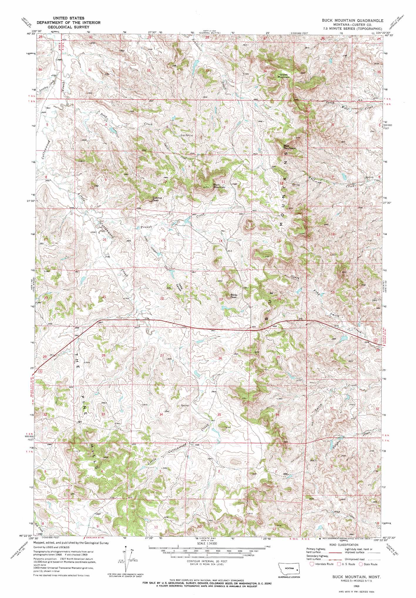
USGS Topo Quad 46105d4 - 1:24,000 scale
| Topo Map Name: | Buck Mountain |
| USGS Topo Quad ID: | 46105d4 |
| Print Size: | ca. 21 1/4" wide x 27" high |
| Southeast Coordinates: | 46.375° N latitude / 105.375° W longitude |
| Map Center Coordinates: | 46.4375° N latitude / 105.4375° W longitude |
| U.S. State: | MT |
| Filename: | o46105d4.jpg |
| Download Map JPG Image: | Buck Mountain topo map 1:24,000 scale |
| Map Type: | Topographic |
| Topo Series: | 7.5´ |
| Map Scale: | 1:24,000 |
| Source of Map Images: | United States Geological Survey (USGS) |
| Alternate Map Versions: |
Buck Mountain MT 1969, updated 1973 Download PDF Buy paper map Buck Mountain MT 2011 Download PDF Buy paper map Buck Mountain MT 2014 Download PDF Buy paper map |
1:24,000 Topo Quads surrounding Buck Mountain
Kinsey Nw |
Kinsey Ne |
Zero |
Zero Ne |
Flat Top Butte |
Kinsey |
Shirley |
Corral Butte |
Spring Draw |
Flat Top Butte Sw |
Government Hill |
The Knob |
Buck Mountain |
Locate |
Hogan Creek |
Whitney Creek |
Government Hill Se |
Locate Sw |
Locate Se |
Red Knob |
Horse Creek |
First Creek |
Loaf Of Bread Butte |
Mizpah |
Pennock Creek |
> Back to 46105a1 at 1:100,000 scale
> Back to 46104a1 at 1:250,000 scale
> Back to U.S. Topo Maps home
Buck Mountain topo map: Gazetteer
Buck Mountain: Dams
Ogdahl Number 3 Dam elevation 859m 2818′Buck Mountain: Springs
Log Spring elevation 868m 2847′Buck Mountain: Streams
Cabin Creek elevation 844m 2769′Cedar Canyon Creek elevation 840m 2755′
Deep Creek elevation 796m 2611′
Levalley Creek elevation 790m 2591′
Little Cottonwood Creek elevation 806m 2644′
Trough Creek elevation 823m 2700′
Buck Mountain: Summits
Baldy Peak elevation 982m 3221′Blue Mountain elevation 1005m 3297′
Blue Mountains elevation 930m 3051′
Buck Mountain elevation 1014m 3326′
Green Mountain elevation 1013m 3323′
Sunrise Peak elevation 924m 3031′
Buck Mountain: Valleys
Cedar Canyon elevation 841m 2759′Buck Mountain: Wells
07N50E02BBBB01 Well elevation 905m 2969′08N50E05BDAA01 Well elevation 797m 2614′
Buck Mountain digital topo map on disk
Buy this Buck Mountain topo map showing relief, roads, GPS coordinates and other geographical features, as a high-resolution digital map file on DVD:
Eastern Montana & Western North Dakota
Buy digital topo maps: Eastern Montana & Western North Dakota