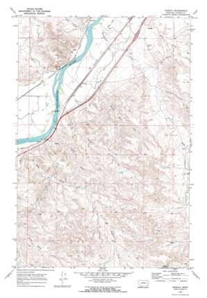
Shirley Topo Map Montana
To zoom in, hover over the map of Shirley
USGS Topo Quad 46105e5 - 1:24,000 scale
| Topo Map Name: | Shirley |
| USGS Topo Quad ID: | 46105e5 |
| Print Size: | ca. 21 1/4" wide x 27" high |
| Southeast Coordinates: | 46.5° N latitude / 105.5° W longitude |
| Map Center Coordinates: | 46.5625° N latitude / 105.5625° W longitude |
| U.S. State: | MT |
| Filename: | o46105e5.jpg |
| Download Map JPG Image: | Shirley topo map 1:24,000 scale |
| Map Type: | Topographic |
| Topo Series: | 7.5´ |
| Map Scale: | 1:24,000 |
| Source of Map Images: | United States Geological Survey (USGS) |
| Alternate Map Versions: |
Shirley MT 1969, updated 1973 Download PDF Buy paper map Shirley MT 2011 Download PDF Buy paper map Shirley MT 2014 Download PDF Buy paper map |
1:24,000 Topo Quads surrounding Shirley
> Back to 46105e1 at 1:100,000 scale
> Back to 46104a1 at 1:250,000 scale
> Back to U.S. Topo Maps home
Shirley topo map: Gazetteer
Shirley: Canals
Kinsey Main Canal elevation 710m 2329′Shirley: Crossings
Interchange 159 elevation 711m 2332′Shirley: Populated Places
Shirley elevation 697m 2286′Shirley: Post Offices
Ainslie Post Office (historical) elevation 697m 2286′Shirley Post Office (historical) elevation 697m 2286′
Shirley: Streams
Cabin Creek elevation 689m 2260′Charlie Creek elevation 719m 2358′
Cottonwood Creek elevation 687m 2253′
Dead Horse Creek elevation 701m 2299′
Deep Creek elevation 690m 2263′
E-2 Creek elevation 753m 2470′
Harris Creek elevation 695m 2280′
Hay Creek elevation 686m 2250′
Miles Creek elevation 692m 2270′
Prairie Creek elevation 738m 2421′
Short Creek elevation 690m 2263′
Shirley: Wells
09N49E05CBC_01 Well elevation 725m 2378′09N49E06BBBA01 Well elevation 703m 2306′
09N49E07DDBC01 Well elevation 724m 2375′
09N49E13BDAA01 Well elevation 756m 2480′
10N48E24ACAC01 Well elevation 710m 2329′
10N48E36DAAD01 Well elevation 702m 2303′
10N49E14DDDD01 Well elevation 730m 2395′
10N49E17DBDA01 Well elevation 700m 2296′
10N49E30ABCD01 Well elevation 699m 2293′
10N49E30DBBC01 Well elevation 703m 2306′
10N49E31BAAA01 Well elevation 699m 2293′
10N49E31BBBB01 Well elevation 702m 2303′
10N49E31CCAC01 Well elevation 704m 2309′
10N49E33ADD_01 Well elevation 728m 2388′
10N49E35DACD01 Well elevation 727m 2385′
Shirley digital topo map on disk
Buy this Shirley topo map showing relief, roads, GPS coordinates and other geographical features, as a high-resolution digital map file on DVD:
Eastern Montana & Western North Dakota
Buy digital topo maps: Eastern Montana & Western North Dakota


