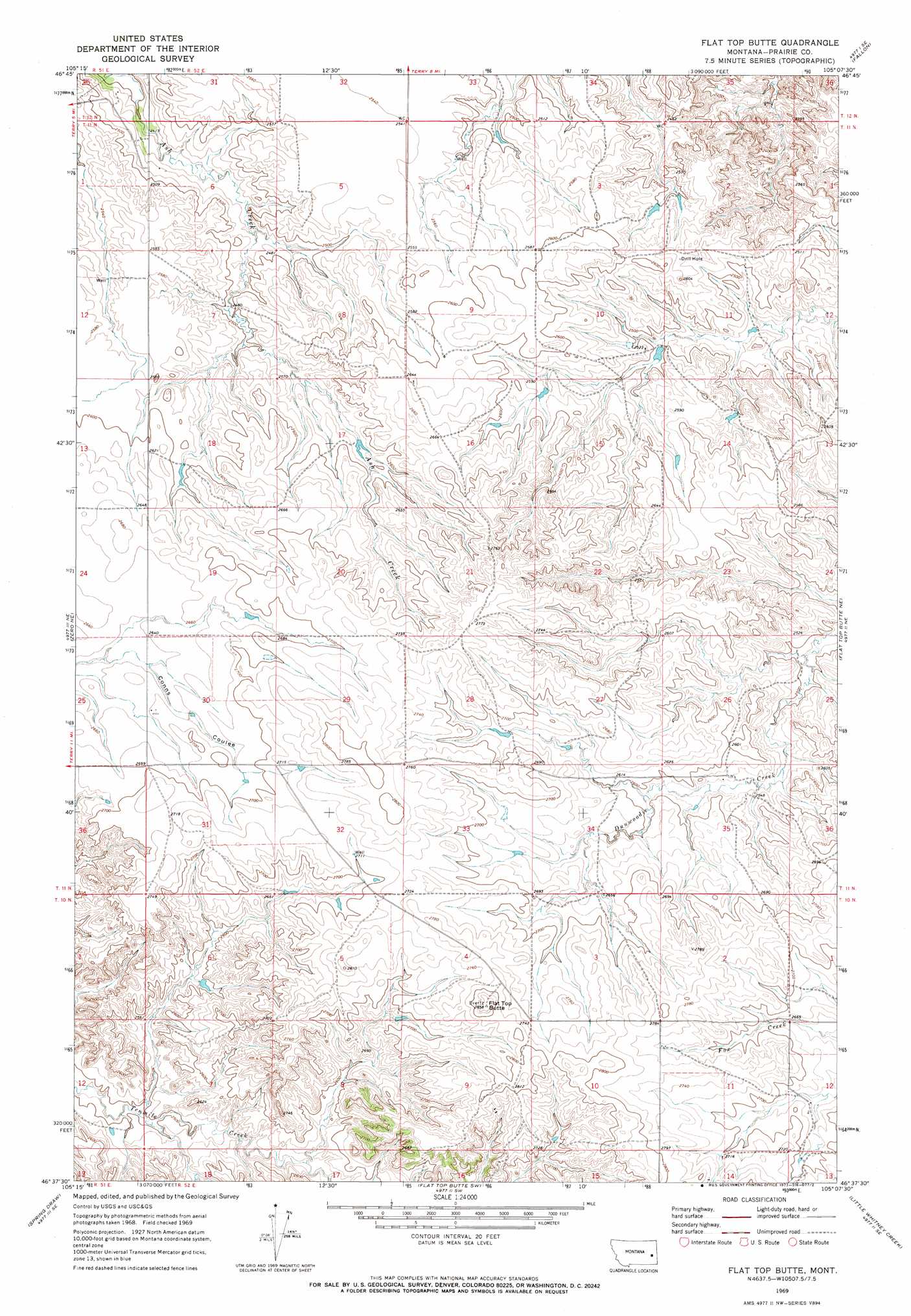
Flat Top Butte Topo Map Montana
To zoom in, hover over the map of Flat Top Butte
USGS Topo Quad 46105f2 - 1:24,000 scale
| Topo Map Name: | Flat Top Butte |
| USGS Topo Quad ID: | 46105f2 |
| Print Size: | ca. 21 1/4" wide x 27" high |
| Southeast Coordinates: | 46.625° N latitude / 105.125° W longitude |
| Map Center Coordinates: | 46.6875° N latitude / 105.1875° W longitude |
| U.S. State: | MT |
| Filename: | o46105f2.jpg |
| Download Map JPG Image: | Flat Top Butte topo map 1:24,000 scale |
| Map Type: | Topographic |
| Topo Series: | 7.5´ |
| Map Scale: | 1:24,000 |
| Source of Map Images: | United States Geological Survey (USGS) |
| Alternate Map Versions: |
Flat Top Butte MT 1969, updated 1973 Download PDF Buy paper map Flat Top Butte MT 2011 Download PDF Buy paper map Flat Top Butte MT 2014 Download PDF Buy paper map |
1:24,000 Topo Quads surrounding Flat Top Butte
Papps Reservoir |
Diamond G Creek |
Hendrickson Coulee |
Fallon Ne |
Marsh |
Calypso |
Terry |
Fallon Sw |
Fallon |
Marsh Sw |
Zero |
Zero Ne |
Flat Top Butte |
Flat Top Butte Ne |
Mildred |
Corral Butte |
Spring Draw |
Flat Top Butte Sw |
Little Whitney Creek |
Loony Hollow |
Buck Mountain |
Locate |
Hogan Creek |
Montague Butte |
Bracket Butte |
> Back to 46105e1 at 1:100,000 scale
> Back to 46104a1 at 1:250,000 scale
> Back to U.S. Topo Maps home
Flat Top Butte topo map: Gazetteer
Flat Top Butte: Summits
Flat Top Butte elevation 862m 2828′Flat Top Butte: Wells
10N52E14BAAA01 Well elevation 835m 2739′11N52E04BCDD01 Well elevation 767m 2516′
11N52E10DDBA01 Well elevation 770m 2526′
11N52E15DBBD01 Well elevation 770m 2526′
11N52E17BB__01 Well elevation 777m 2549′
11N52E32DBCD01 Well elevation 816m 2677′
11N52E35ABBC01 Well elevation 781m 2562′
Flat Top Butte digital topo map on disk
Buy this Flat Top Butte topo map showing relief, roads, GPS coordinates and other geographical features, as a high-resolution digital map file on DVD:
Eastern Montana & Western North Dakota
Buy digital topo maps: Eastern Montana & Western North Dakota