Papps Reservoir Topo Map Montana
To zoom in, hover over the map of Papps Reservoir
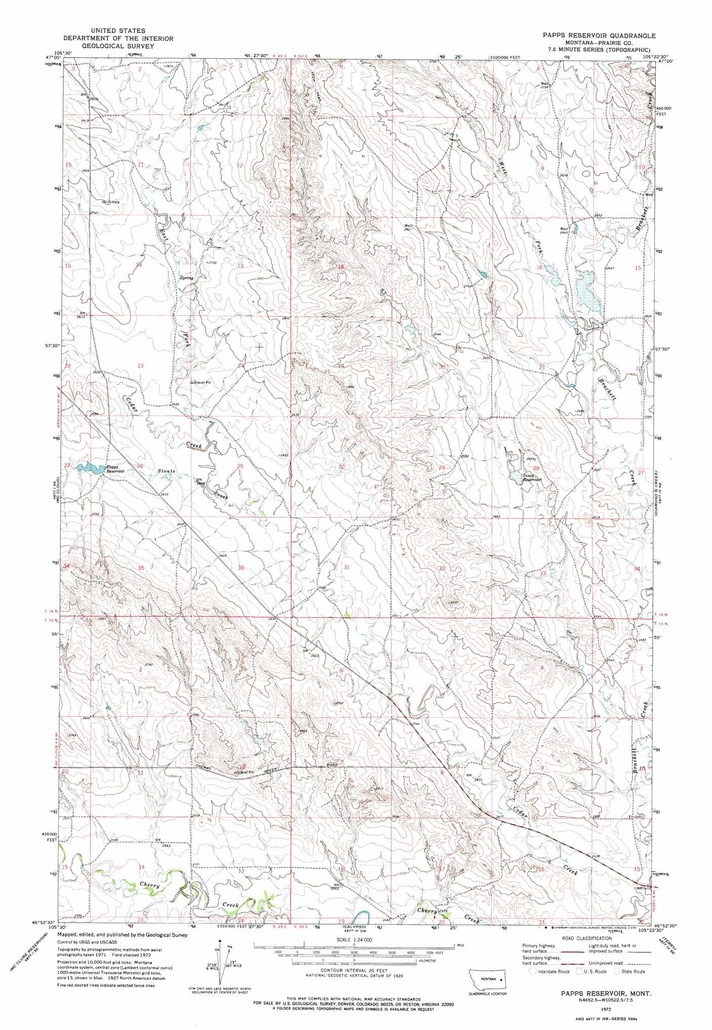
USGS Topo Quad 46105h4 - 1:24,000 scale
| Topo Map Name: | Papps Reservoir |
| USGS Topo Quad ID: | 46105h4 |
| Print Size: | ca. 21 1/4" wide x 27" high |
| Southeast Coordinates: | 46.875° N latitude / 105.375° W longitude |
| Map Center Coordinates: | 46.9375° N latitude / 105.4375° W longitude |
| U.S. State: | MT |
| Filename: | o46105h4.jpg |
| Download Map JPG Image: | Papps Reservoir topo map 1:24,000 scale |
| Map Type: | Topographic |
| Topo Series: | 7.5´ |
| Map Scale: | 1:24,000 |
| Source of Map Images: | United States Geological Survey (USGS) |
| Alternate Map Versions: |
Papps Reservoir MT 1972, updated 1975 Download PDF Buy paper map Papps Reservoir MT 2011 Download PDF Buy paper map Papps Reservoir MT 2014 Download PDF Buy paper map |
1:24,000 Topo Quads surrounding Papps Reservoir
Big Sheep Mountain Nw |
Bearshack Creek |
Diamond G Butte Nw |
Union School |
Lindsay |
Big Sheep Mountain |
Becker Dam |
North Coulee |
Diamond G Butte |
Lindsay Sw |
South Fork Reservoir |
Mccloud |
Papps Reservoir |
Diamond G Creek |
Hendrickson Coulee |
Physic Creek |
Mcclure Reservoir |
Calypso |
Terry |
Fallon Sw |
Kinsey Nw |
Kinsey Ne |
Zero |
Zero Ne |
Flat Top Butte |
> Back to 46105e1 at 1:100,000 scale
> Back to 46104a1 at 1:250,000 scale
> Back to U.S. Topo Maps home
Papps Reservoir topo map: Gazetteer
Papps Reservoir: Dams
Innes Reservoir Dam elevation 786m 2578′Nefsy Number 2 Dam elevation 801m 2627′
Nefsy Number 3 Dam elevation 797m 2614′
Papps Reservoir: Reservoirs
Innes Reservoir elevation 786m 2578′Papps Reservoir elevation 803m 2634′
Papps Reservoir: Streams
East Fork Cedar Creek elevation 806m 2644′Stouts Creek elevation 779m 2555′
West Fork Brackett Creek elevation 785m 2575′
Papps Reservoir: Wells
13N49E02CCDB01 Well elevation 802m 2631′13N50E09CCAA01 Well elevation 751m 2463′
13N50E10CDDC01 Well elevation 746m 2447′
14N50E29DCBA01 Well elevation 825m 2706′
Papps Reservoir digital topo map on disk
Buy this Papps Reservoir topo map showing relief, roads, GPS coordinates and other geographical features, as a high-resolution digital map file on DVD:
Eastern Montana & Western North Dakota
Buy digital topo maps: Eastern Montana & Western North Dakota