Combs Ranch Topo Map Montana
To zoom in, hover over the map of Combs Ranch
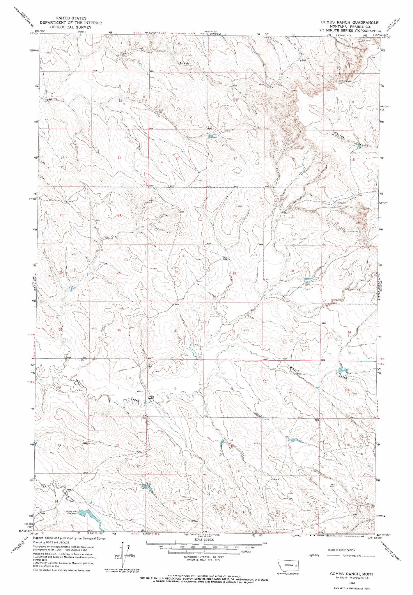
USGS Topo Quad 46105h8 - 1:24,000 scale
| Topo Map Name: | Combs Ranch |
| USGS Topo Quad ID: | 46105h8 |
| Print Size: | ca. 21 1/4" wide x 27" high |
| Southeast Coordinates: | 46.875° N latitude / 105.875° W longitude |
| Map Center Coordinates: | 46.9375° N latitude / 105.9375° W longitude |
| U.S. State: | MT |
| Filename: | o46105h8.jpg |
| Download Map JPG Image: | Combs Ranch topo map 1:24,000 scale |
| Map Type: | Topographic |
| Topo Series: | 7.5´ |
| Map Scale: | 1:24,000 |
| Source of Map Images: | United States Geological Survey (USGS) |
| Alternate Map Versions: |
Combs Ranch MT 1965, updated 1968 Download PDF Buy paper map Combs Ranch MT 2011 Download PDF Buy paper map Combs Ranch MT 2014 Download PDF Buy paper map |
1:24,000 Topo Quads surrounding Combs Ranch
Hedstrom Lake Nw |
Hedstrom Lake |
Berry School |
Watkins |
Big Sheep Mountain Nw |
Tree Coulee School |
Hedstrom Lake Se |
Heitz School |
Watkins Se |
Big Sheep Mountain |
Little Chalk Butte |
Crow Rock |
Combs Ranch |
Little Sheep Mountain |
South Fork Reservoir |
Rock Springs School |
Crow Rock Se |
Twin Buttes School |
Morehouse Creek |
Physic Creek |
Angela |
Angela Ne |
Horse Creek Hill |
Coal Bank Spring |
Kinsey Nw |
> Back to 46105e1 at 1:100,000 scale
> Back to 46104a1 at 1:250,000 scale
> Back to U.S. Topo Maps home
Combs Ranch topo map: Gazetteer
Combs Ranch: Dams
Janitell Number 1 Dam elevation 876m 2874′McDevlin Number 1 Dam elevation 894m 2933′
McMullin Dam elevation 900m 2952′
Pfaff Irrigation Dam elevation 859m 2818′
Pfaft Number 1 Dam elevation 923m 3028′
Combs Ranch: Wells
13N45E14ACCA01 Well elevation 849m 2785′13N45E14ACCB01 Well elevation 854m 2801′
13N46E10ADAA01 Well elevation 913m 2995′
13N46E10CBCA01 Well elevation 915m 3001′
13N46E10CBCD01 Well elevation 918m 3011′
14N45E24CBBD01 Well elevation 886m 2906′
14N46E29BACC01 Well elevation 898m 2946′
14N46E30DCCA01 Well elevation 908m 2979′
Combs Ranch digital topo map on disk
Buy this Combs Ranch topo map showing relief, roads, GPS coordinates and other geographical features, as a high-resolution digital map file on DVD:
Eastern Montana & Western North Dakota
Buy digital topo maps: Eastern Montana & Western North Dakota