Smith Creek Ne Topo Map Montana
To zoom in, hover over the map of Smith Creek Ne
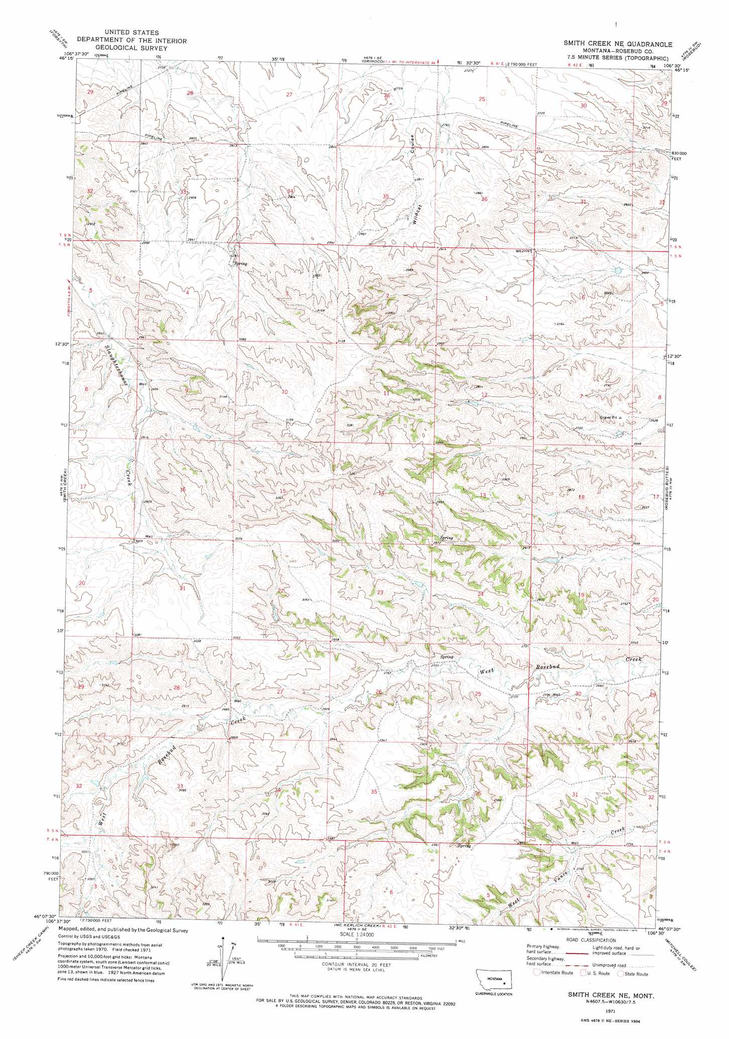
USGS Topo Quad 46106b5 - 1:24,000 scale
| Topo Map Name: | Smith Creek Ne |
| USGS Topo Quad ID: | 46106b5 |
| Print Size: | ca. 21 1/4" wide x 27" high |
| Southeast Coordinates: | 46.125° N latitude / 106.5° W longitude |
| Map Center Coordinates: | 46.1875° N latitude / 106.5625° W longitude |
| U.S. State: | MT |
| Filename: | o46106b5.jpg |
| Download Map JPG Image: | Smith Creek Ne topo map 1:24,000 scale |
| Map Type: | Topographic |
| Topo Series: | 7.5´ |
| Map Scale: | 1:24,000 |
| Source of Map Images: | United States Geological Survey (USGS) |
| Alternate Map Versions: |
Smith Creek NE MT 1971, updated 1974 Download PDF Buy paper map Smith Creek NE MT 2011 Download PDF Buy paper map Smith Creek NE MT 2014 Download PDF Buy paper map |
1:24,000 Topo Quads surrounding Smith Creek Ne
Finch Ne |
Black Coulee |
Schultz Coulee |
Box Canyon Coulee |
Sand Buttes |
Nichols |
Forsyth |
Orinoco |
Rosebud |
Thurlow |
Griffin Coulee Ne |
Smith Creek |
Smith Creek Ne |
Rosebud Buttes |
Indian Creek |
Griffin Coulee |
Sheep Creek Camp |
Mckerlich Creek |
Mitchell Coulee |
Crain Place |
Trail Creek School |
Colstrip West |
Colstrip East |
Hammond Draw Nw |
John Hen Creek |
> Back to 46106a1 at 1:100,000 scale
> Back to 46106a1 at 1:250,000 scale
> Back to U.S. Topo Maps home
Smith Creek Ne topo map: Gazetteer
Smith Creek Ne: Wells
05N41E12CABA01 Well elevation 845m 2772′05N41E16CCCD01 Well elevation 916m 3005′
05N41E16CCCD02 Well elevation 922m 3024′
05N41E27CBBC01 Well elevation 879m 2883′
05N41E28DA__01 Well elevation 895m 2936′
05N42E08C___01 Well elevation 803m 2634′
05N42E19CABC01 Well elevation 822m 2696′
06N41E35ADBC01 Well elevation 858m 2814′
Smith Creek Ne digital topo map on disk
Buy this Smith Creek Ne topo map showing relief, roads, GPS coordinates and other geographical features, as a high-resolution digital map file on DVD:
Eastern Montana & Western North Dakota
Buy digital topo maps: Eastern Montana & Western North Dakota