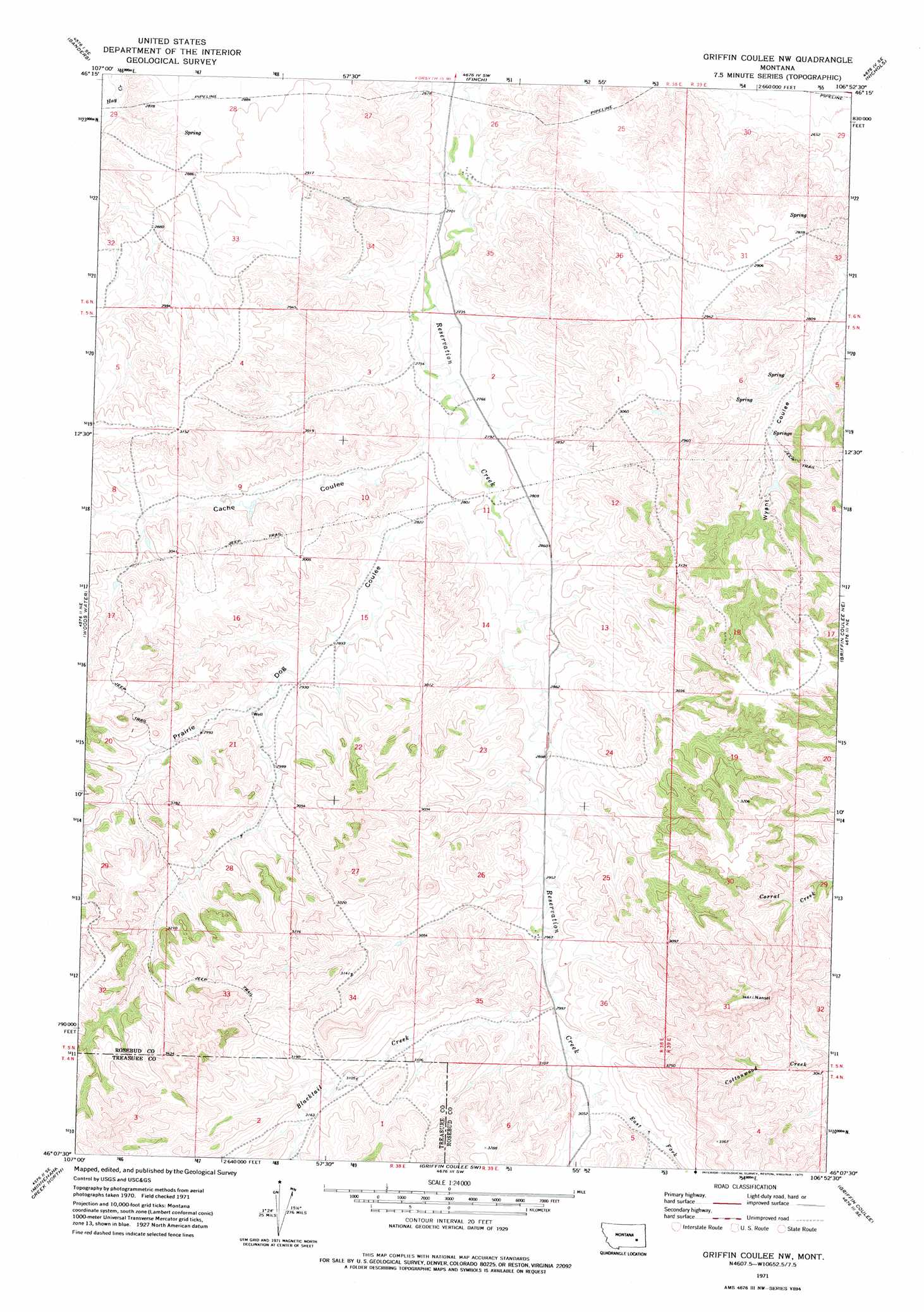
Griffin Coulee Nw Topo Map Montana
To zoom in, hover over the map of Griffin Coulee Nw
USGS Topo Quad 46106b8 - 1:24,000 scale
| Topo Map Name: | Griffin Coulee Nw |
| USGS Topo Quad ID: | 46106b8 |
| Print Size: | ca. 21 1/4" wide x 27" high |
| Southeast Coordinates: | 46.125° N latitude / 106.875° W longitude |
| Map Center Coordinates: | 46.1875° N latitude / 106.9375° W longitude |
| U.S. State: | MT |
| Filename: | o46106b8.jpg |
| Download Map JPG Image: | Griffin Coulee Nw topo map 1:24,000 scale |
| Map Type: | Topographic |
| Topo Series: | 7.5´ |
| Map Scale: | 1:24,000 |
| Source of Map Images: | United States Geological Survey (USGS) |
| Alternate Map Versions: |
Griffin Coulee NW MT 1971, updated 1975 Download PDF Buy paper map Griffin Coulee NW MT 2011 Download PDF Buy paper map Griffin Coulee NW MT 2014 Download PDF Buy paper map |
1:24,000 Topo Quads surrounding Griffin Coulee Nw
Ahles |
Vananda |
Donleys Reservoir |
Finch Ne |
Black Coulee |
Hysham |
Sanders |
Finch |
Nichols |
Forsyth |
Scraper Coulee |
Woods Water |
Griffin Coulee Nw |
Griffin Coulee Ne |
Smith Creek |
South Bear Creek |
Minnehaha Creek North |
Griffin Coulee Sw |
Griffin Coulee |
Sheep Creek Camp |
Iron Spring |
Minnehaha Creek South |
Mcclure Creek |
Trail Creek School |
Colstrip West |
> Back to 46106a1 at 1:100,000 scale
> Back to 46106a1 at 1:250,000 scale
> Back to U.S. Topo Maps home
Griffin Coulee Nw topo map: Gazetteer
Griffin Coulee Nw: Streams
Blacktail Creek elevation 912m 2992′East Fork Reservation Creek elevation 927m 3041′
Griffin Coulee Nw: Valleys
Cache Coulee elevation 850m 2788′Prairie Dog Coulee elevation 855m 2805′
Griffin Coulee Nw: Wells
05N38E14B___01 Well elevation 885m 2903′05N38E26DDDD01 Well elevation 903m 2962′
05N46E15CBDD01 Well elevation 885m 2903′
Griffin Coulee Nw digital topo map on disk
Buy this Griffin Coulee Nw topo map showing relief, roads, GPS coordinates and other geographical features, as a high-resolution digital map file on DVD:
Eastern Montana & Western North Dakota
Buy digital topo maps: Eastern Montana & Western North Dakota