Rosebud Topo Map Montana
To zoom in, hover over the map of Rosebud
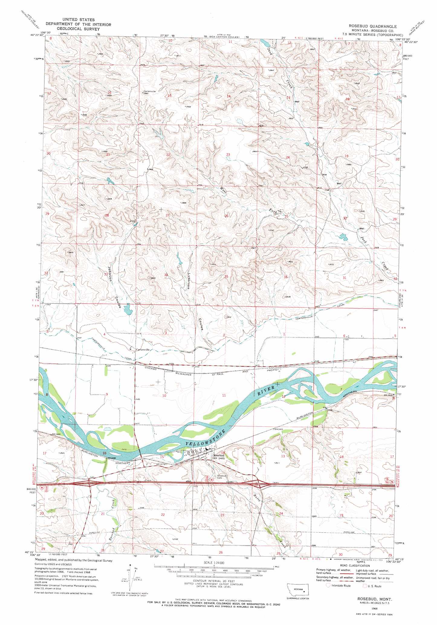
USGS Topo Quad 46106c4 - 1:24,000 scale
| Topo Map Name: | Rosebud |
| USGS Topo Quad ID: | 46106c4 |
| Print Size: | ca. 21 1/4" wide x 27" high |
| Southeast Coordinates: | 46.25° N latitude / 106.375° W longitude |
| Map Center Coordinates: | 46.3125° N latitude / 106.4375° W longitude |
| U.S. State: | MT |
| Filename: | o46106c4.jpg |
| Download Map JPG Image: | Rosebud topo map 1:24,000 scale |
| Map Type: | Topographic |
| Topo Series: | 7.5´ |
| Map Scale: | 1:24,000 |
| Source of Map Images: | United States Geological Survey (USGS) |
| Alternate Map Versions: |
Rosebud MT 1968, updated 1972 Download PDF Buy paper map Rosebud MT 2011 Download PDF Buy paper map Rosebud MT 2014 Download PDF Buy paper map |
1:24,000 Topo Quads surrounding Rosebud
Rough Creek Sw |
Rough Creek Se |
Wild Horse Pass |
Wild Horse Pass Se |
Hobo Coulee |
Black Coulee |
Schultz Coulee |
Box Canyon Coulee |
Sand Buttes |
Hathaway Nw |
Forsyth |
Orinoco |
Rosebud |
Thurlow |
Hathaway |
Smith Creek |
Smith Creek Ne |
Rosebud Buttes |
Indian Creek |
Miller Creek Nw |
Sheep Creek Camp |
Mckerlich Creek |
Mitchell Coulee |
Crain Place |
Miller Creek Sw |
> Back to 46106a1 at 1:100,000 scale
> Back to 46106a1 at 1:250,000 scale
> Back to U.S. Topo Maps home
Rosebud topo map: Gazetteer
Rosebud: Canals
Cartersville Canal elevation 757m 2483′Rosebud: Crossings
Interchange 102 elevation 764m 2506′Interchange 105 elevation 797m 2614′
Rosebud: Dams
Hook Number 61 Dam elevation 775m 2542′Rosebud: Parks
Rosebud River Historical Marker elevation 756m 2480′Rosebud: Populated Places
Albright (historical) elevation 757m 2483′Cartersville elevation 764m 2506′
Rosebud elevation 756m 2480′
Rosebud: Post Offices
Albright Post Office (historical) elevation 757m 2483′Cartersville Post Office (historical) elevation 762m 2500′
Rosebud Post Office elevation 755m 2477′
Rosebud: Streams
Butte Creek elevation 753m 2470′Rosebud Creek elevation 757m 2483′
West Fork Jack Creek elevation 770m 2526′
Rosebud: Valleys
Johnson Coulee elevation 760m 2493′Luterson Coulee elevation 759m 2490′
Rosebud: Wells
06N42E02D___01 Well elevation 755m 2477′06N42E09A___01 Well elevation 759m 2490′
06N42E12AA__01 Well elevation 751m 2463′
06N42E14C___01 Well elevation 779m 2555′
06N42E16DA__01 Well elevation 757m 2483′
06N42E20DDDD01 Well elevation 785m 2575′
06N42E22ACBB01 Well elevation 808m 2650′
06N43E06D___01 Well elevation 751m 2463′
07N42E35DDCC01 Well elevation 779m 2555′
08N46E15BCD_01 Well elevation 763m 2503′
Rosebud digital topo map on disk
Buy this Rosebud topo map showing relief, roads, GPS coordinates and other geographical features, as a high-resolution digital map file on DVD:
Eastern Montana & Western North Dakota
Buy digital topo maps: Eastern Montana & Western North Dakota