Finch Ne Topo Map Montana
To zoom in, hover over the map of Finch Ne
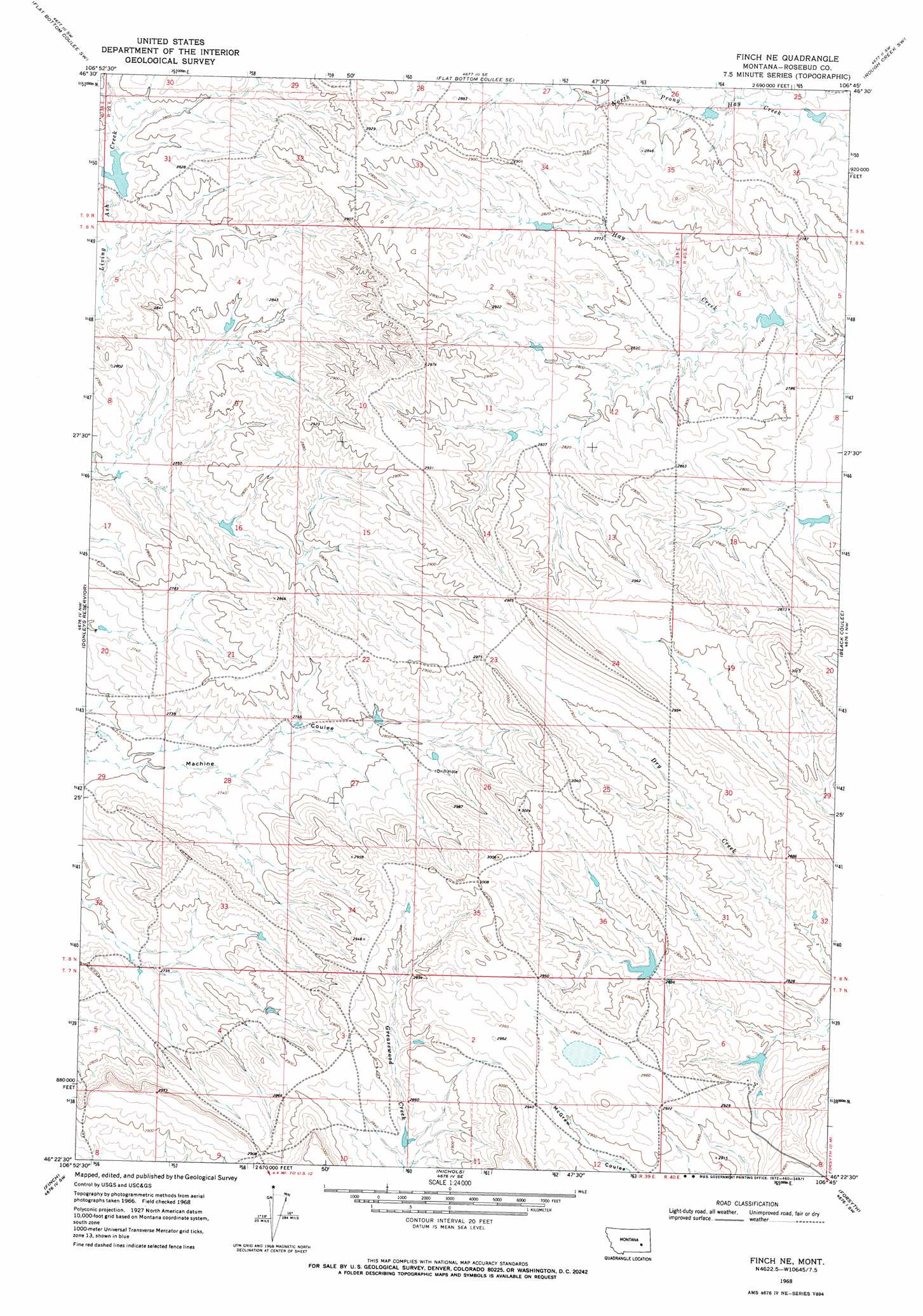
USGS Topo Quad 46106d7 - 1:24,000 scale
| Topo Map Name: | Finch Ne |
| USGS Topo Quad ID: | 46106d7 |
| Print Size: | ca. 21 1/4" wide x 27" high |
| Southeast Coordinates: | 46.375° N latitude / 106.75° W longitude |
| Map Center Coordinates: | 46.4375° N latitude / 106.8125° W longitude |
| U.S. State: | MT |
| Filename: | o46106d7.jpg |
| Download Map JPG Image: | Finch Ne topo map 1:24,000 scale |
| Map Type: | Topographic |
| Topo Series: | 7.5´ |
| Map Scale: | 1:24,000 |
| Source of Map Images: | United States Geological Survey (USGS) |
| Alternate Map Versions: |
Finch NE MT 1968, updated 1972 Download PDF Buy paper map Finch NE MT 2011 Download PDF Buy paper map Finch NE MT 2014 Download PDF Buy paper map |
1:24,000 Topo Quads surrounding Finch Ne
Brown Coulee |
Flat Bottom Coulee Nw |
Flat Bottom Coulee Ne |
Rudie Coulee |
Rough Creek Ne |
Zempel Lake |
Flat Bottom Coulee Sw |
Flat Bottom Coulee Se |
Rough Creek Sw |
Rough Creek Se |
Vananda |
Donleys Reservoir |
Finch Ne |
Black Coulee |
Schultz Coulee |
Sanders |
Finch |
Nichols |
Forsyth |
Orinoco |
Woods Water |
Griffin Coulee Nw |
Griffin Coulee Ne |
Smith Creek |
Smith Creek Ne |
> Back to 46106a1 at 1:100,000 scale
> Back to 46106a1 at 1:250,000 scale
> Back to U.S. Topo Maps home
Finch Ne topo map: Gazetteer
Finch Ne: Dams
Erickson Number 2 Dam elevation 860m 2821′Gearhart Number 11 Dam elevation 830m 2723′
Gearhart Number 13 Dam elevation 857m 2811′
Harstad Number 1 Dam elevation 829m 2719′
Johnson Number 1 Dam elevation 848m 2782′
Montana Number 6 Dam elevation 871m 2857′
Watson Number 1 Dam elevation 836m 2742′
Finch Ne: Summits
Castle Butte elevation 938m 3077′Finch Ne digital topo map on disk
Buy this Finch Ne topo map showing relief, roads, GPS coordinates and other geographical features, as a high-resolution digital map file on DVD:
Eastern Montana & Western North Dakota
Buy digital topo maps: Eastern Montana & Western North Dakota