Van Burton Creek Topo Map Montana
To zoom in, hover over the map of Van Burton Creek
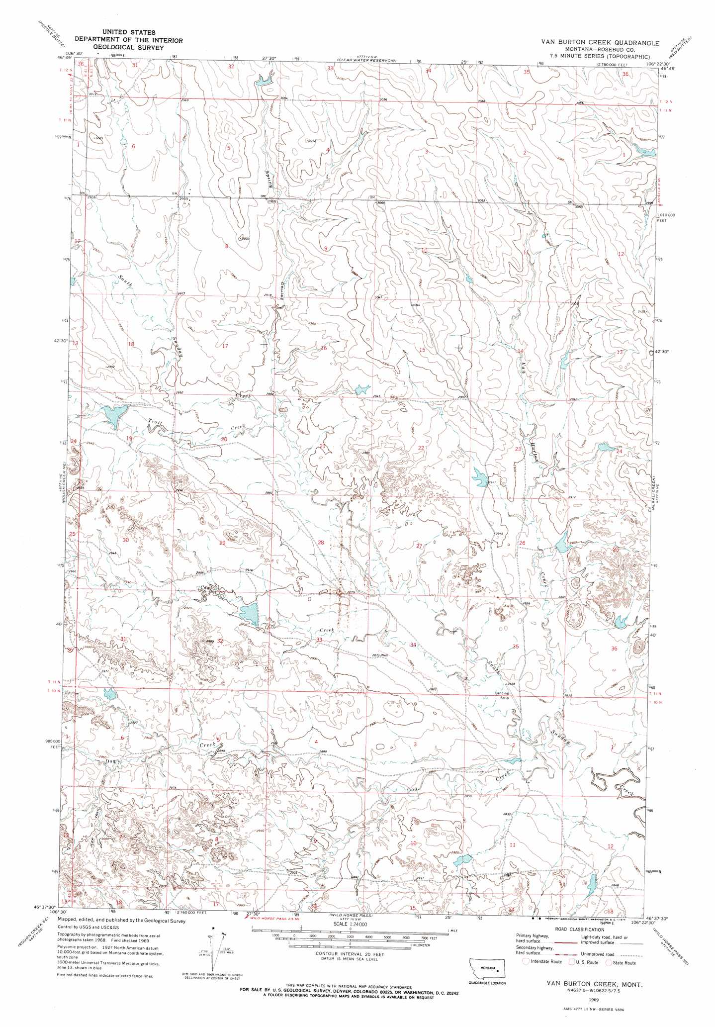
USGS Topo Quad 46106f4 - 1:24,000 scale
| Topo Map Name: | Van Burton Creek |
| USGS Topo Quad ID: | 46106f4 |
| Print Size: | ca. 21 1/4" wide x 27" high |
| Southeast Coordinates: | 46.625° N latitude / 106.375° W longitude |
| Map Center Coordinates: | 46.6875° N latitude / 106.4375° W longitude |
| U.S. State: | MT |
| Filename: | o46106f4.jpg |
| Download Map JPG Image: | Van Burton Creek topo map 1:24,000 scale |
| Map Type: | Topographic |
| Topo Series: | 7.5´ |
| Map Scale: | 1:24,000 |
| Source of Map Images: | United States Geological Survey (USGS) |
| Alternate Map Versions: |
Van Burton Creek MT 1969, updated 1973 Download PDF Buy paper map Van Burton Creek MT 2011 Download PDF Buy paper map Van Burton Creek MT 2014 Download PDF Buy paper map |
1:24,000 Topo Quads surrounding Van Burton Creek
Black Hills |
Christenson Reservoir |
Hillside |
Coleman Coulee |
Little Chalk Butte |
Needle Butte Reservoir |
Needle Butte |
Clear Water Reservoir |
Red Buttes |
Rock Springs School |
Rudie Coulee |
Rough Creek Ne |
Van Burton Creek |
Alkali Creek |
Angela |
Rough Creek Sw |
Rough Creek Se |
Wild Horse Pass |
Wild Horse Pass Se |
Hobo Coulee |
Black Coulee |
Schultz Coulee |
Box Canyon Coulee |
Sand Buttes |
Hathaway Nw |
> Back to 46106e1 at 1:100,000 scale
> Back to 46106a1 at 1:250,000 scale
> Back to U.S. Topo Maps home
Van Burton Creek topo map: Gazetteer
Van Burton Creek: Dams
Hook Number 10 Dam elevation 889m 2916′Hook Number 12 Dam elevation 898m 2946′
Hook Number 15 Dam elevation 898m 2946′
Hook Number 17 Dam elevation 903m 2962′
Hook Number 18 Dam elevation 877m 2877′
Hook Number 19 Dam elevation 870m 2854′
Hook Number 64 Dam elevation 886m 2906′
Killen Number 3 Dam elevation 914m 2998′
Killen Number 4 Dam elevation 900m 2952′
Killen Number 5 Dam elevation 907m 2975′
Montana Number 3 Dam elevation 884m 2900′
Van Burton Creek: Streams
Coal Creek elevation 866m 2841′Dog Creek elevation 860m 2821′
Trail Creek elevation 879m 2883′
Van Burton Creek elevation 861m 2824′
Van Burton Creek: Valleys
Spring Coulee elevation 879m 2883′Van Burton Creek digital topo map on disk
Buy this Van Burton Creek topo map showing relief, roads, GPS coordinates and other geographical features, as a high-resolution digital map file on DVD:
Eastern Montana & Western North Dakota
Buy digital topo maps: Eastern Montana & Western North Dakota