Hillside Topo Map Montana
To zoom in, hover over the map of Hillside
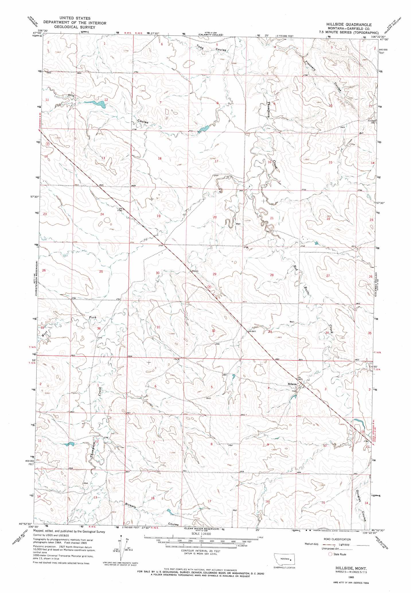
USGS Topo Quad 46106h4 - 1:24,000 scale
| Topo Map Name: | Hillside |
| USGS Topo Quad ID: | 46106h4 |
| Print Size: | ca. 21 1/4" wide x 27" high |
| Southeast Coordinates: | 46.875° N latitude / 106.375° W longitude |
| Map Center Coordinates: | 46.9375° N latitude / 106.4375° W longitude |
| U.S. State: | MT |
| Filename: | o46106h4.jpg |
| Download Map JPG Image: | Hillside topo map 1:24,000 scale |
| Map Type: | Topographic |
| Topo Series: | 7.5´ |
| Map Scale: | 1:24,000 |
| Source of Map Images: | United States Geological Survey (USGS) |
| Alternate Map Versions: |
Hillside MT 1965, updated 1969 Download PDF Buy paper map Hillside MT 2011 Download PDF Buy paper map Hillside MT 2014 Download PDF Buy paper map |
1:24,000 Topo Quads surrounding Hillside
York Reservoir |
Cohagen Ne |
Hafla School |
Whiteside Ranch |
Hedstrom Lake Nw |
Cohagen Sw |
Cohagen |
Calamity Coulee |
Sleepy Hollow |
Tree Coulee School |
Black Hills |
Christenson Reservoir |
Hillside |
Coleman Coulee |
Little Chalk Butte |
Needle Butte Reservoir |
Needle Butte |
Clear Water Reservoir |
Red Buttes |
Rock Springs School |
Rudie Coulee |
Rough Creek Ne |
Van Burton Creek |
Alkali Creek |
Angela |
> Back to 46106e1 at 1:100,000 scale
> Back to 46106a1 at 1:250,000 scale
> Back to U.S. Topo Maps home
Hillside topo map: Gazetteer
Hillside: Dams
Artz Number 1 Dam elevation 827m 2713′McWilliams Reservoir Dam elevation 823m 2700′
Newman Number 1 Dam elevation 861m 2824′
Swayne Number 1 Dam elevation 850m 2788′
Hillside: Populated Places
Hillside elevation 856m 2808′Hillside: Post Offices
Hillside Post Office (historical) elevation 856m 2808′Hillside: Reservoirs
McWilliams Reservoir elevation 823m 2700′Hillside: Streams
Red Butte Creek elevation 821m 2693′West Fork Thompson Creek elevation 839m 2752′
Hillside: Valleys
Artz Coulee elevation 820m 2690′Bickels Coulee elevation 857m 2811′
Todd Coulee elevation 805m 2641′
Hillside: Wells
13N41E12DBDA01 Well elevation 860m 2821′14N41E26ABCA01 Well elevation 855m 2805′
Hillside digital topo map on disk
Buy this Hillside topo map showing relief, roads, GPS coordinates and other geographical features, as a high-resolution digital map file on DVD:
Eastern Montana & Western North Dakota
Buy digital topo maps: Eastern Montana & Western North Dakota