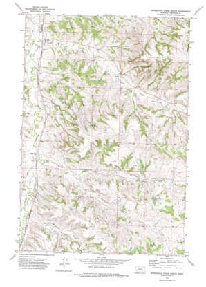
Minnehaha Creek North Topo Map Montana
To zoom in, hover over the map of Minnehaha Creek North
USGS Topo Quad 46107a1 - 1:24,000 scale
| Topo Map Name: | Minnehaha Creek North |
| USGS Topo Quad ID: | 46107a1 |
| Print Size: | ca. 21 1/4" wide x 27" high |
| Southeast Coordinates: | 46° N latitude / 107° W longitude |
| Map Center Coordinates: | 46.0625° N latitude / 107.0625° W longitude |
| U.S. State: | MT |
| Filename: | o46107a1.jpg |
| Download Map JPG Image: | Minnehaha Creek North topo map 1:24,000 scale |
| Map Type: | Topographic |
| Topo Series: | 7.5´ |
| Map Scale: | 1:24,000 |
| Source of Map Images: | United States Geological Survey (USGS) |
| Alternate Map Versions: |
Minnehaha Creek North MT 1972, updated 1975 Download PDF Buy paper map Minnehaha Creek North MT 2011 Download PDF Buy paper map Minnehaha Creek North MT 2014 Download PDF Buy paper map |
1:24,000 Topo Quads surrounding Minnehaha Creek North
> Back to 46107a1 at 1:100,000 scale
> Back to 46106a1 at 1:250,000 scale
> Back to U.S. Topo Maps home
Minnehaha Creek North topo map: Gazetteer
Minnehaha Creek North: Post Offices
Dick Post Office (historical) elevation 1002m 3287′Rumsey Post Office (historical) elevation 914m 2998′
Minnehaha Creek North: Springs
03N37E09ACCB01 Spring elevation 910m 2985′Outlaw Spring elevation 987m 3238′
Minnehaha Creek North: Streams
Bear Creek elevation 873m 2864′Beaver Creek elevation 897m 2942′
Crystal Creek elevation 902m 2959′
Minnehaha Creek elevation 908m 2979′
South Bear Creek elevation 889m 2916′
South Fork Beaver Creek elevation 921m 3021′
West Bear Creek elevation 875m 2870′
Minnehaha Creek North: Valleys
Outlaw Coulee elevation 884m 2900′Sawmill Coulee elevation 956m 3136′
Minnehaha Creek North: Wells
03N37E02DDAB01 Well elevation 997m 3270′03N37E03CBBD01 Well elevation 971m 3185′
03N37E09A___01 Well elevation 906m 2972′
03N37E09DDDD01 Well elevation 929m 3047′
03N37E10ACCB01 Well elevation 945m 3100′
04N37E22BAAD01 Well elevation 924m 3031′
04N37E27CACA01 Well elevation 910m 2985′
04N38E20BDCC01 Well elevation 963m 3159′
Minnehaha Creek North digital topo map on disk
Buy this Minnehaha Creek North topo map showing relief, roads, GPS coordinates and other geographical features, as a high-resolution digital map file on DVD:
Eastern Montana & Western North Dakota
Buy digital topo maps: Eastern Montana & Western North Dakota


