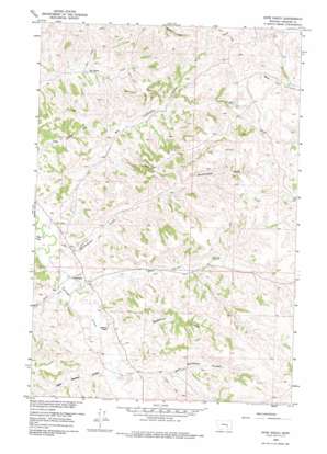
Hope Ranch Topo Map Montana
To zoom in, hover over the map of Hope Ranch
USGS Topo Quad 46107a3 - 1:24,000 scale
| Topo Map Name: | Hope Ranch |
| USGS Topo Quad ID: | 46107a3 |
| Print Size: | ca. 21 1/4" wide x 27" high |
| Southeast Coordinates: | 46° N latitude / 107.25° W longitude |
| Map Center Coordinates: | 46.0625° N latitude / 107.3125° W longitude |
| U.S. State: | MT |
| Filename: | o46107a3.jpg |
| Download Map JPG Image: | Hope Ranch topo map 1:24,000 scale |
| Map Type: | Topographic |
| Topo Series: | 7.5´ |
| Map Scale: | 1:24,000 |
| Source of Map Images: | United States Geological Survey (USGS) |
| Alternate Map Versions: |
Hope Ranch MT 1960, updated 1962 Download PDF Buy paper map Hope Ranch MT 1960, updated 1975 Download PDF Buy paper map Hope Ranch MT 2011 Download PDF Buy paper map Hope Ranch MT 2014 Download PDF Buy paper map |
1:24,000 Topo Quads surrounding Hope Ranch
> Back to 46107a1 at 1:100,000 scale
> Back to 46106a1 at 1:250,000 scale
> Back to U.S. Topo Maps home
Hope Ranch topo map: Gazetteer
Hope Ranch: Dams
Hope et al Number 1 Dam elevation 1022m 3353′Hope Ranch: Streams
Big Lightning Creek elevation 861m 2824′East Burnt Creek elevation 873m 2864′
Hutchinson Creek elevation 868m 2847′
West Burnt Creek elevation 871m 2857′
Hope Ranch: Valleys
Anderson Coulee elevation 879m 2883′East Bosshart Coulee elevation 884m 2900′
Haystack Coulee elevation 883m 2896′
Hollister Coulee elevation 935m 3067′
Jasper Coulee elevation 862m 2828′
West Bosshart Coulee elevation 879m 2883′
Hope Ranch: Wells
03N35E01BBAC01 Well elevation 968m 3175′03N35E11D___01 Well elevation 910m 2985′
03N35E14ACCC01 Well elevation 892m 2926′
04N35E22DBCA01 Well elevation 903m 2962′
04N35E25ABCC01 Well elevation 937m 3074′
04N35E33A___01 Well elevation 862m 2828′
04N36E09DBAA01 Well elevation 1026m 3366′
Hope Ranch digital topo map on disk
Buy this Hope Ranch topo map showing relief, roads, GPS coordinates and other geographical features, as a high-resolution digital map file on DVD:
Eastern Montana & Western North Dakota
Buy digital topo maps: Eastern Montana & Western North Dakota


