Marsh Coulee Topo Map Montana
To zoom in, hover over the map of Marsh Coulee
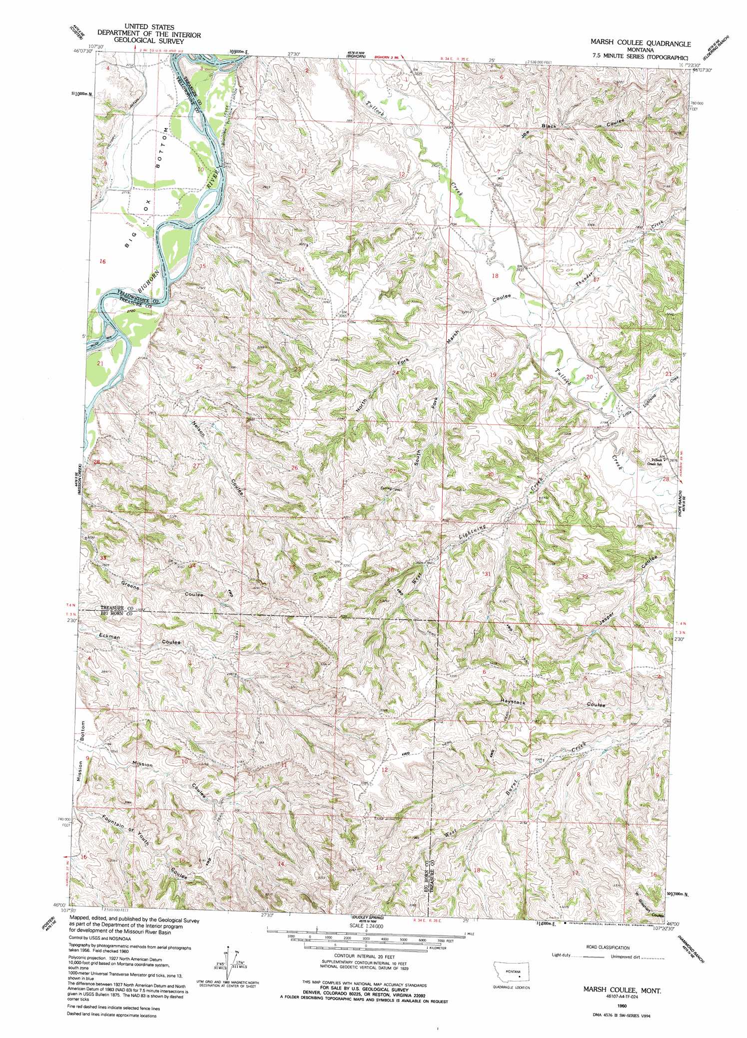
USGS Topo Quad 46107a4 - 1:24,000 scale
| Topo Map Name: | Marsh Coulee |
| USGS Topo Quad ID: | 46107a4 |
| Print Size: | ca. 21 1/4" wide x 27" high |
| Southeast Coordinates: | 46° N latitude / 107.375° W longitude |
| Map Center Coordinates: | 46.0625° N latitude / 107.4375° W longitude |
| U.S. State: | MT |
| Filename: | o46107a4.jpg |
| Download Map JPG Image: | Marsh Coulee topo map 1:24,000 scale |
| Map Type: | Topographic |
| Topo Series: | 7.5´ |
| Map Scale: | 1:24,000 |
| Source of Map Images: | United States Geological Survey (USGS) |
| Alternate Map Versions: |
Marsh Coulee MT 1960, updated 1962 Download PDF Buy paper map Marsh Coulee MT 1960, updated 1992 Download PDF Buy paper map Marsh Coulee MT 2011 Download PDF Buy paper map Marsh Coulee MT 2014 Download PDF Buy paper map |
1:24,000 Topo Quads surrounding Marsh Coulee
Mexican Buttes |
Devils Kitchen |
Rancher Cemetery |
Myers |
Hysham |
Coal Bank Creek |
Custer |
Bighorn |
Eldering Ranch |
Scraper Coulee |
Waco |
Mission Creek |
Marsh Coulee |
Hope Ranch |
South Bear Creek |
Lemon Ranch |
Foster |
Dudley Spring |
Hammond Ranch |
Iron Spring |
Chimney Creek |
Ninemile Point |
The Dugout |
Padlock Ranch |
Iron Spring Sw |
> Back to 46107a1 at 1:100,000 scale
> Back to 46106a1 at 1:250,000 scale
> Back to U.S. Topo Maps home
Marsh Coulee topo map: Gazetteer
Marsh Coulee: Bends
Big Ox Bottom elevation 828m 2716′Marsh Coulee: Canals
Victory Ditch elevation 834m 2736′Marsh Coulee: Streams
Little Joe Creek elevation 839m 2752′Little Lightning Creek elevation 854m 2801′
Thunder Creek elevation 847m 2778′
West Lightning Creek elevation 855m 2805′
Marsh Coulee: Valleys
Fountain of Youth Coulee elevation 847m 2778′Joe Black Coulee elevation 846m 2775′
Marsh Coulee elevation 847m 2778′
Mission Coulee elevation 843m 2765′
Nelson Coulee elevation 835m 2739′
North Fork Marsh Coulee elevation 860m 2821′
South Fork Marsh Coulee elevation 860m 2821′
Marsh Coulee digital topo map on disk
Buy this Marsh Coulee topo map showing relief, roads, GPS coordinates and other geographical features, as a high-resolution digital map file on DVD:
Eastern Montana & Western North Dakota
Buy digital topo maps: Eastern Montana & Western North Dakota