Eldering Ranch Topo Map Montana
To zoom in, hover over the map of Eldering Ranch
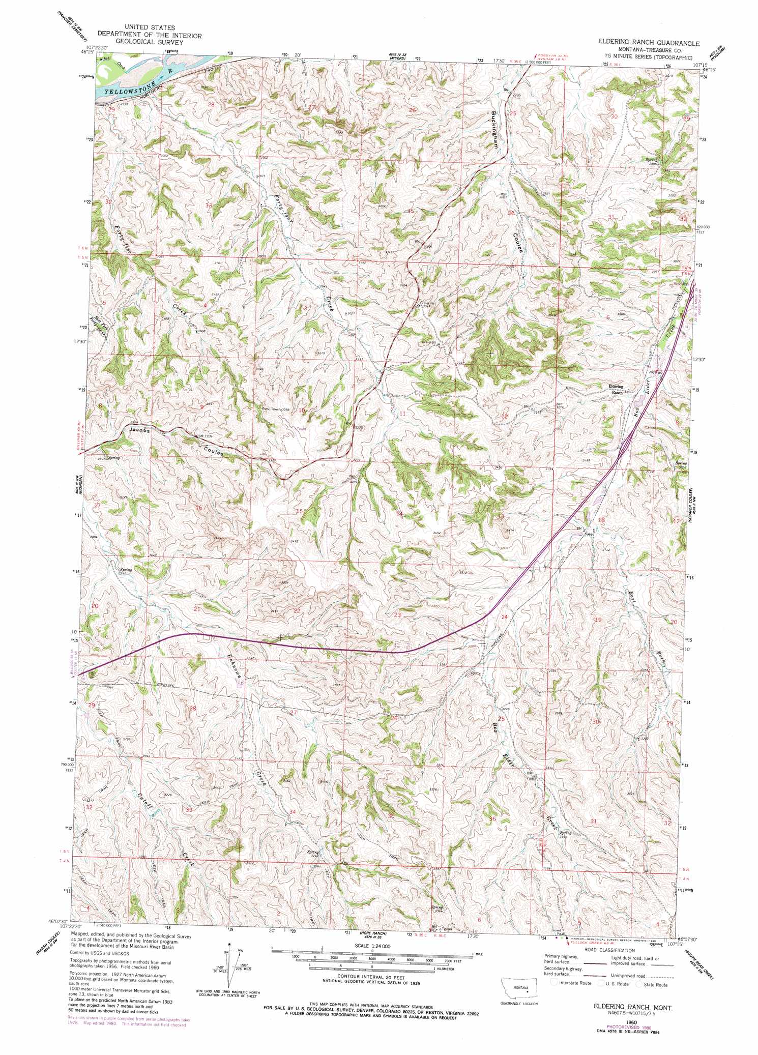
USGS Topo Quad 46107b3 - 1:24,000 scale
| Topo Map Name: | Eldering Ranch |
| USGS Topo Quad ID: | 46107b3 |
| Print Size: | ca. 21 1/4" wide x 27" high |
| Southeast Coordinates: | 46.125° N latitude / 107.25° W longitude |
| Map Center Coordinates: | 46.1875° N latitude / 107.3125° W longitude |
| U.S. State: | MT |
| Filename: | o46107b3.jpg |
| Download Map JPG Image: | Eldering Ranch topo map 1:24,000 scale |
| Map Type: | Topographic |
| Topo Series: | 7.5´ |
| Map Scale: | 1:24,000 |
| Source of Map Images: | United States Geological Survey (USGS) |
| Alternate Map Versions: |
Eldering Ranch MT 1960, updated 1962 Download PDF Buy paper map Eldering Ranch MT 1960, updated 1979 Download PDF Buy paper map Eldering Ranch MT 1960, updated 1980 Download PDF Buy paper map Eldering Ranch MT 2011 Download PDF Buy paper map Eldering Ranch MT 2014 Download PDF Buy paper map |
1:24,000 Topo Quads surrounding Eldering Ranch
Ruskosky Ridge |
Mckonkey Creek |
Steie Ranch |
Ahles |
Vananda |
Devils Kitchen |
Rancher Cemetery |
Myers |
Hysham |
Sanders |
Custer |
Bighorn |
Eldering Ranch |
Scraper Coulee |
Woods Water |
Mission Creek |
Marsh Coulee |
Hope Ranch |
South Bear Creek |
Minnehaha Creek North |
Foster |
Dudley Spring |
Hammond Ranch |
Iron Spring |
Minnehaha Creek South |
> Back to 46107a1 at 1:100,000 scale
> Back to 46106a1 at 1:250,000 scale
> Back to U.S. Topo Maps home
Eldering Ranch topo map: Gazetteer
Eldering Ranch: Crossings
Interchange 63 elevation 909m 2982′Eldering Ranch: Islands
Howery Island elevation 812m 2664′Eldering Ranch: Streams
Alkali Creek elevation 809m 2654′East Fork Box Elder Creek elevation 931m 3054′
Forty-five Creek elevation 809m 2654′
Forty-four Creek elevation 816m 2677′
Eldering Ranch: Wells
05N35E04A___01 Well elevation 940m 3083′05N35E15AADA01 Well elevation 977m 3205′
05N36E07ABDC01 Well elevation 907m 2975′
Eldering Ranch digital topo map on disk
Buy this Eldering Ranch topo map showing relief, roads, GPS coordinates and other geographical features, as a high-resolution digital map file on DVD:
Eastern Montana & Western North Dakota
Buy digital topo maps: Eastern Montana & Western North Dakota