Weed Creek West Topo Map Montana
To zoom in, hover over the map of Weed Creek West
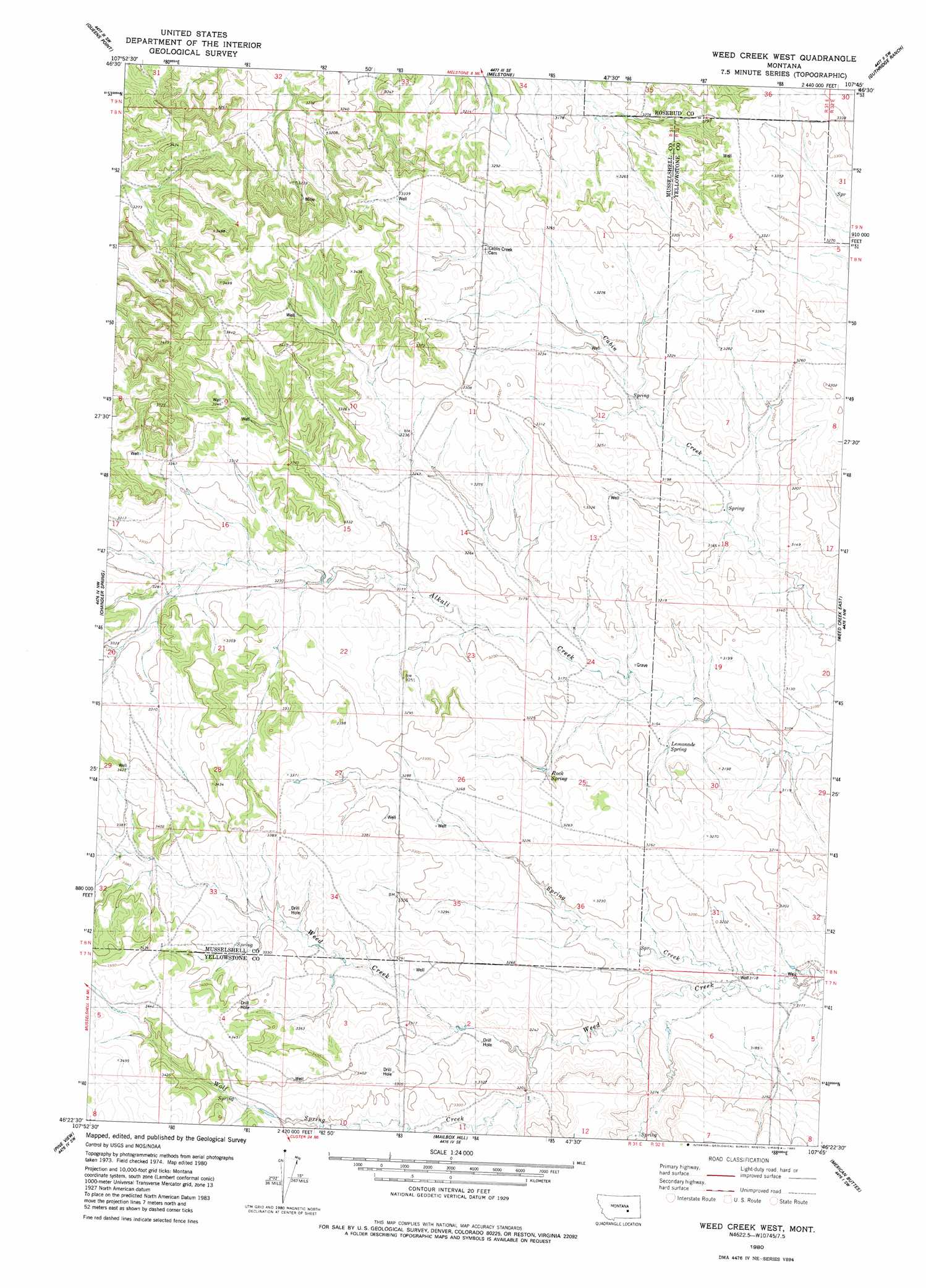
USGS Topo Quad 46107d7 - 1:24,000 scale
| Topo Map Name: | Weed Creek West |
| USGS Topo Quad ID: | 46107d7 |
| Print Size: | ca. 21 1/4" wide x 27" high |
| Southeast Coordinates: | 46.375° N latitude / 107.75° W longitude |
| Map Center Coordinates: | 46.4375° N latitude / 107.8125° W longitude |
| U.S. State: | MT |
| Filename: | o46107d7.jpg |
| Download Map JPG Image: | Weed Creek West topo map 1:24,000 scale |
| Map Type: | Topographic |
| Topo Series: | 7.5´ |
| Map Scale: | 1:24,000 |
| Source of Map Images: | United States Geological Survey (USGS) |
| Alternate Map Versions: |
Weed Creek West MT 1980, updated 1980 Download PDF Buy paper map Weed Creek West MT 2011 Download PDF Buy paper map Weed Creek West MT 2014 Download PDF Buy paper map |
1:24,000 Topo Quads surrounding Weed Creek West
Akers Ranch |
Melstone Nw |
Melstone Ne |
Grebe Ranch |
Hecker Ranch |
Musselshell |
Queens Point |
Melstone |
Guthridge Ranch |
Sumatra |
Corey Flat |
Chandler Spring |
Weed Creek West |
Weed Creek East |
Ruskosky Ridge |
Steamboat Butte |
Pine View |
Mailbox Hill |
Mexican Buttes |
Devils Kitchen |
P K Ranch Ne |
Bull Mountain Nw |
Mud Butte |
Coal Bank Creek |
Custer |
> Back to 46107a1 at 1:100,000 scale
> Back to 46106a1 at 1:250,000 scale
> Back to U.S. Topo Maps home
Weed Creek West topo map: Gazetteer
Weed Creek West: Springs
Lemonade Spring elevation 954m 3129′Rock Spring elevation 972m 3188′
Weed Creek West: Streams
Spring Creek elevation 946m 3103′Wolf Spring Creek elevation 970m 3182′
Weed Creek West: Wells
07N31E02BBBB01 Well elevation 1003m 3290′08N31E02CDDD01 Well elevation 1004m 3293′
08N31E29DBC_01 Well elevation 1044m 3425′
08N31E36DDDD01 Well elevation 969m 3179′
08N31E36DDDD02 Well elevation 969m 3179′
08N31E36DDDD03 Well elevation 969m 3179′
Weed Creek West digital topo map on disk
Buy this Weed Creek West topo map showing relief, roads, GPS coordinates and other geographical features, as a high-resolution digital map file on DVD:
Eastern Montana & Western North Dakota
Buy digital topo maps: Eastern Montana & Western North Dakota