Melstone Ne Topo Map Montana
To zoom in, hover over the map of Melstone Ne
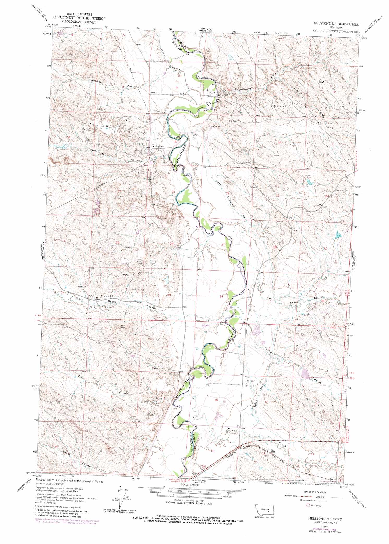
USGS Topo Quad 46107f7 - 1:24,000 scale
| Topo Map Name: | Melstone Ne |
| USGS Topo Quad ID: | 46107f7 |
| Print Size: | ca. 21 1/4" wide x 27" high |
| Southeast Coordinates: | 46.625° N latitude / 107.75° W longitude |
| Map Center Coordinates: | 46.6875° N latitude / 107.8125° W longitude |
| U.S. State: | MT |
| Filename: | o46107f7.jpg |
| Download Map JPG Image: | Melstone Ne topo map 1:24,000 scale |
| Map Type: | Topographic |
| Topo Series: | 7.5´ |
| Map Scale: | 1:24,000 |
| Source of Map Images: | United States Geological Survey (USGS) |
| Alternate Map Versions: |
Melstone NE MT 1962, updated 1965 Download PDF Buy paper map Melstone NE MT 1962, updated 1980 Download PDF Buy paper map Melstone NE MT 2011 Download PDF Buy paper map Melstone NE MT 2014 Download PDF Buy paper map |
1:24,000 Topo Quads surrounding Melstone Ne
Breed Spring |
Mosby |
Hill Ranch |
Dutton Ranch |
Mcwilliams Springs |
Mud Spring |
Maxwell Ranch |
Mosby Se |
Kincheloe Ranch |
Regnal Coulee |
Akers Ranch |
Melstone Nw |
Melstone Ne |
Grebe Ranch |
Hecker Ranch |
Musselshell |
Queens Point |
Melstone |
Guthridge Ranch |
Sumatra |
Corey Flat |
Chandler Spring |
Weed Creek West |
Weed Creek East |
Ruskosky Ridge |
> Back to 46107e1 at 1:100,000 scale
> Back to 46106a1 at 1:250,000 scale
> Back to U.S. Topo Maps home
Melstone Ne topo map: Gazetteer
Melstone Ne: Canals
Delphia Melstone Ditch elevation 846m 2775′Melstone Ne: Dams
BS Kincheloe Number 6 Dam elevation 869m 2851′Melstone Ne: Oilfields
Bascom Oil Field elevation 864m 2834′Ivanhoe Dome Oil Field elevation 899m 2949′
Stensvad Oil Field elevation 892m 2926′
Melstone Ne: Populated Places
Bascom elevation 885m 2903′Melstone Ne: Post Offices
Bascom Post Office (historical) elevation 888m 2913′Melstone Ne: Streams
Home Creek elevation 862m 2828′Melstone Ne: Valleys
Butts Coulee elevation 859m 2818′East Keggy Coulee elevation 848m 2782′
Getchell Coulee elevation 862m 2828′
Gremmert Coulee elevation 840m 2755′
Orchard Coulee elevation 849m 2785′
Rattlesnake Coulee elevation 846m 2775′
Seventynine Coulee elevation 849m 2785′
West Keggy Coulee elevation 868m 2847′
Melstone Ne: Wells
11N31E11DA__01 Well elevation 883m 2896′11N31E11DBD_01 Well elevation 889m 2916′
11N31E34DAC_01 Well elevation 848m 2782′
11N31E36AADD01 Well elevation 875m 2870′
Melstone Ne digital topo map on disk
Buy this Melstone Ne topo map showing relief, roads, GPS coordinates and other geographical features, as a high-resolution digital map file on DVD:
Eastern Montana & Western North Dakota
Buy digital topo maps: Eastern Montana & Western North Dakota