North Fork Crooked Creek West Topo Map Montana
To zoom in, hover over the map of North Fork Crooked Creek West
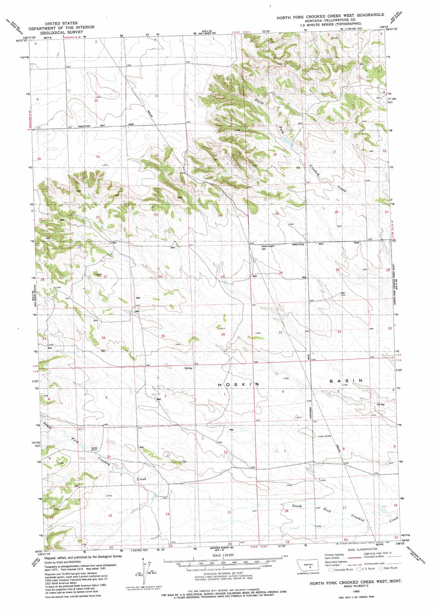
USGS Topo Quad 46108a5 - 1:24,000 scale
| Topo Map Name: | North Fork Crooked Creek West |
| USGS Topo Quad ID: | 46108a5 |
| Print Size: | ca. 21 1/4" wide x 27" high |
| Southeast Coordinates: | 46° N latitude / 108.5° W longitude |
| Map Center Coordinates: | 46.0625° N latitude / 108.5625° W longitude |
| U.S. State: | MT |
| Filename: | o46108a5.jpg |
| Download Map JPG Image: | North Fork Crooked Creek West topo map 1:24,000 scale |
| Map Type: | Topographic |
| Topo Series: | 7.5´ |
| Map Scale: | 1:24,000 |
| Source of Map Images: | United States Geological Survey (USGS) |
| Alternate Map Versions: |
North Fork Crooked Creek West MT 1980, updated 1980 Download PDF Buy paper map North Fork Crooked Creek West MT 2011 Download PDF Buy paper map North Fork Crooked Creek West MT 2014 Download PDF Buy paper map |
1:24,000 Topo Quads surrounding North Fork Crooked Creek West
Bundy |
Elso |
Harper Coulee |
Signal Mountain |
Dunn Mountain North |
Broadview Ne |
Hay Basin North |
Hay Basin Ne |
Park Coulee |
Dunn Mountain South |
Broadview East |
Hay Basin South |
North Fork Crooked Creek West |
North Fork Crooked Creek East |
Cotton Creek |
Comanche |
Acton |
Hickson Ranch |
Rattlesnake Butte |
Huntley |
Two Pine School |
Rimrock |
Billings West |
Billings East |
Cottonwood Creek |
> Back to 46108a1 at 1:100,000 scale
> Back to 46108a1 at 1:250,000 scale
> Back to U.S. Topo Maps home
North Fork Crooked Creek West topo map: Gazetteer
North Fork Crooked Creek West: Basins
Hoskin Basin elevation 1013m 3323′North Fork Crooked Creek West: Dams
Conservation Reservoir Dam elevation 1104m 3622′North Fork Crooked Creek West: Wells
03N25E04ABBC01 Well elevation 1094m 3589′03N25E10BCDB01 Well elevation 1042m 3418′
03N26E07D___01 Well elevation 1009m 3310′
03N26E08B___01 Well elevation 1026m 3366′
04N25E14D___01 Well elevation 1182m 3877′
04N25E28BD__01 Well elevation 1093m 3585′
04N25E35BBCB01 Well elevation 1065m 3494′
North Fork Crooked Creek West digital topo map on disk
Buy this North Fork Crooked Creek West topo map showing relief, roads, GPS coordinates and other geographical features, as a high-resolution digital map file on DVD: