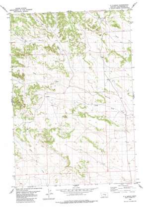
P K Ranch Topo Map Montana
To zoom in, hover over the map of P K Ranch
USGS Topo Quad 46108b2 - 1:24,000 scale
| Topo Map Name: | P K Ranch |
| USGS Topo Quad ID: | 46108b2 |
| Print Size: | ca. 21 1/4" wide x 27" high |
| Southeast Coordinates: | 46.125° N latitude / 108.125° W longitude |
| Map Center Coordinates: | 46.1875° N latitude / 108.1875° W longitude |
| U.S. State: | MT |
| Filename: | o46108b2.jpg |
| Download Map JPG Image: | P K Ranch topo map 1:24,000 scale |
| Map Type: | Topographic |
| Topo Series: | 7.5´ |
| Map Scale: | 1:24,000 |
| Source of Map Images: | United States Geological Survey (USGS) |
| Alternate Map Versions: |
P K Ranch MT 1980, updated 1980 Download PDF Buy paper map P K Ranch MT 2011 Download PDF Buy paper map P K Ranch MT 2014 Download PDF Buy paper map |
1:24,000 Topo Quads surrounding P K Ranch
> Back to 46108a1 at 1:100,000 scale
> Back to 46108a1 at 1:250,000 scale
> Back to U.S. Topo Maps home
P K Ranch topo map: Gazetteer
P K Ranch: Springs
06N28E25ACA_01 Spring elevation 1068m 3503′C A Spring elevation 1076m 3530′
P K Ranch: Streams
Bullhead Creek elevation 1095m 3592′Dutch Oven Creek elevation 1070m 3510′
South Fork Railroad Creek elevation 1012m 3320′
P K Ranch: Wells
05N28E04CBAA01 Well elevation 1097m 3599′05N28E09BCDC01 Well elevation 1087m 3566′
05N28E12D___01 Well elevation 1037m 3402′
05N28E16C___01 Well elevation 1095m 3592′
05N28E26DCAC01 Well elevation 1087m 3566′
06N28E32ADCD01 Well elevation 1116m 3661′
06N28E32BAD_01 Well elevation 1117m 3664′
06N28E32BDD_01 Well elevation 1144m 3753′
06N28E33ABB_01 Well elevation 1095m 3592′
06N28E33BCBB01 Well elevation 1107m 3631′
06N28E33BCDA01 Well elevation 1101m 3612′
P K Ranch digital topo map on disk
Buy this P K Ranch topo map showing relief, roads, GPS coordinates and other geographical features, as a high-resolution digital map file on DVD:


