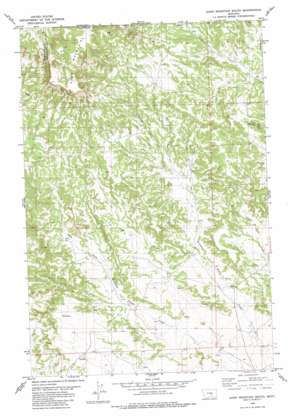
Dunn Mountain South Topo Map Montana
To zoom in, hover over the map of Dunn Mountain South
USGS Topo Quad 46108b3 - 1:24,000 scale
| Topo Map Name: | Dunn Mountain South |
| USGS Topo Quad ID: | 46108b3 |
| Print Size: | ca. 21 1/4" wide x 27" high |
| Southeast Coordinates: | 46.125° N latitude / 108.25° W longitude |
| Map Center Coordinates: | 46.1875° N latitude / 108.3125° W longitude |
| U.S. State: | MT |
| Filename: | o46108b3.jpg |
| Download Map JPG Image: | Dunn Mountain South topo map 1:24,000 scale |
| Map Type: | Topographic |
| Topo Series: | 7.5´ |
| Map Scale: | 1:24,000 |
| Source of Map Images: | United States Geological Survey (USGS) |
| Alternate Map Versions: |
Dunn Mountain South MT 1980, updated 1980 Download PDF Buy paper map Dunn Mountain South MT 2011 Download PDF Buy paper map Dunn Mountain South MT 2014 Download PDF Buy paper map |
1:24,000 Topo Quads surrounding Dunn Mountain South
> Back to 46108a1 at 1:100,000 scale
> Back to 46108a1 at 1:250,000 scale
> Back to U.S. Topo Maps home
Dunn Mountain South topo map: Gazetteer
Dunn Mountain South: Cliffs
Red Bluff elevation 1379m 4524′Dunn Mountain South: Mines
Holland Mine elevation 1227m 4025′Dunn Mountain South: Springs
05N27E01BCB_01 Spring elevation 1158m 3799′05N27E02CAA_01 Spring elevation 1156m 3792′
05N27E03DCD_01 Spring elevation 1174m 3851′
05N27E12BAD_01 Spring elevation 1122m 3681′
05N27E13BAA_01 Spring elevation 1098m 3602′
06N27E24CDD_01 Spring elevation 1177m 3861′
06N27E27BAC_01 Spring elevation 1343m 4406′
06N27E27BDD_01 Spring elevation 1318m 4324′
06N27E28CBD_01 Spring elevation 1331m 4366′
06N27E28CDD_01 Spring elevation 1379m 4524′
06N27E29AAA_01 Spring elevation 1311m 4301′
06N27E34ADD_01 Spring elevation 1218m 3996′
Dunn Mountain South: Wells
04N27E01CCBB01 Well elevation 1093m 3585′05N27E01BCC_01 Well elevation 1157m 3795′
05N27E08ADAA01 Well elevation 1173m 3848′
05N27E09CABD01 Well elevation 1182m 3877′
05N27E10BACB01 Well elevation 1177m 3861′
05N27E11DAB_01 Well elevation 1118m 3667′
05N27E12ABCC01 Well elevation 1132m 3713′
05N27E12BADC01 Well elevation 1126m 3694′
05N27E14ADAB01 Well elevation 1114m 3654′
05N27E14CCDA01 Well elevation 1132m 3713′
05N27E15DBAB01 Well elevation 1113m 3651′
05N27E21BACA01 Well elevation 1118m 3667′
05N27E21BADD01 Well elevation 1126m 3694′
05N27E21DBCD01 Well elevation 1117m 3664′
05N27E22DADA01 Well elevation 1101m 3612′
05N27E34DDCC01 Well elevation 1095m 3592′
05N28E06AADD01 Well elevation 1152m 3779′
05N28E06DBCC01 Well elevation 1184m 3884′
05N28E30B___01 Well elevation 1074m 3523′
06N27E25ABDC01 Well elevation 1172m 3845′
06N27E34BDAC01 Well elevation 1254m 4114′
06N27E34DBCC01 Well elevation 1213m 3979′
06N27E35ACD_01 Well elevation 1209m 3966′
06N27E35BBAC01 Well elevation 1243m 4078′
06N27E36CACB01 Well elevation 1183m 3881′
06N28E30CBD_01 Well elevation 1155m 3789′
06N28E30DCDB01 Well elevation 1142m 3746′
06N28E31CBDC01 Well elevation 1151m 3776′
06N28E32BCAC01 Well elevation 1122m 3681′
Dunn Mountain South digital topo map on disk
Buy this Dunn Mountain South topo map showing relief, roads, GPS coordinates and other geographical features, as a high-resolution digital map file on DVD:


