Mud Spring Topo Map Montana
To zoom in, hover over the map of Mud Spring
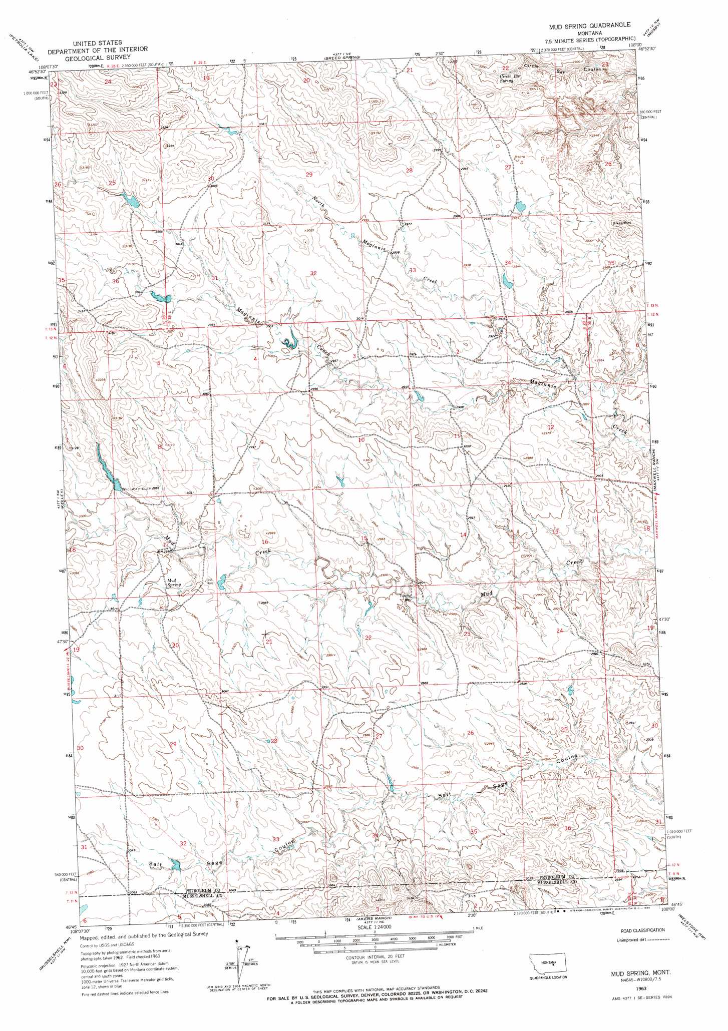
USGS Topo Quad 46108g1 - 1:24,000 scale
| Topo Map Name: | Mud Spring |
| USGS Topo Quad ID: | 46108g1 |
| Print Size: | ca. 21 1/4" wide x 27" high |
| Southeast Coordinates: | 46.75° N latitude / 108° W longitude |
| Map Center Coordinates: | 46.8125° N latitude / 108.0625° W longitude |
| U.S. State: | MT |
| Filename: | o46108g1.jpg |
| Download Map JPG Image: | Mud Spring topo map 1:24,000 scale |
| Map Type: | Topographic |
| Topo Series: | 7.5´ |
| Map Scale: | 1:24,000 |
| Source of Map Images: | United States Geological Survey (USGS) |
| Alternate Map Versions: |
Mud Spring MT 1963, updated 1966 Download PDF Buy paper map Mud Spring MT 2011 Download PDF Buy paper map Mud Spring MT 2014 Download PDF Buy paper map |
1:24,000 Topo Quads surrounding Mud Spring
Winnett North |
Ingals Dam |
Cat Creek |
Fail Ranch |
Barney Pinnacle |
Winnett South |
Petrolia Lake |
Breed Spring |
Mosby |
Hill Ranch |
Crowley Dam |
Kelley |
Mud Spring |
Maxwell Ranch |
Mosby Se |
Jim Coulee |
Musselshell Nw |
Akers Ranch |
Melstone Nw |
Melstone Ne |
Big Wall East |
Delphia |
Musselshell |
Queens Point |
Melstone |
> Back to 46108e1 at 1:100,000 scale
> Back to 46108a1 at 1:250,000 scale
> Back to U.S. Topo Maps home
Mud Spring topo map: Gazetteer
Mud Spring: Dams
Bethel Number 1 Dam elevation 939m 3080′Bethel Number 7 Dam elevation 933m 3061′
Frazer Number 1 Dam elevation 911m 2988′
Goffena Number 2 Dam elevation 910m 2985′
Mud Spring: Springs
Circle Bar Spring elevation 902m 2959′Mud Spring elevation 909m 2982′
Mud Spring: Streams
North Maginnis Creek elevation 872m 2860′Mud Spring digital topo map on disk
Buy this Mud Spring topo map showing relief, roads, GPS coordinates and other geographical features, as a high-resolution digital map file on DVD: