Tyler Topo Map Montana
To zoom in, hover over the map of Tyler
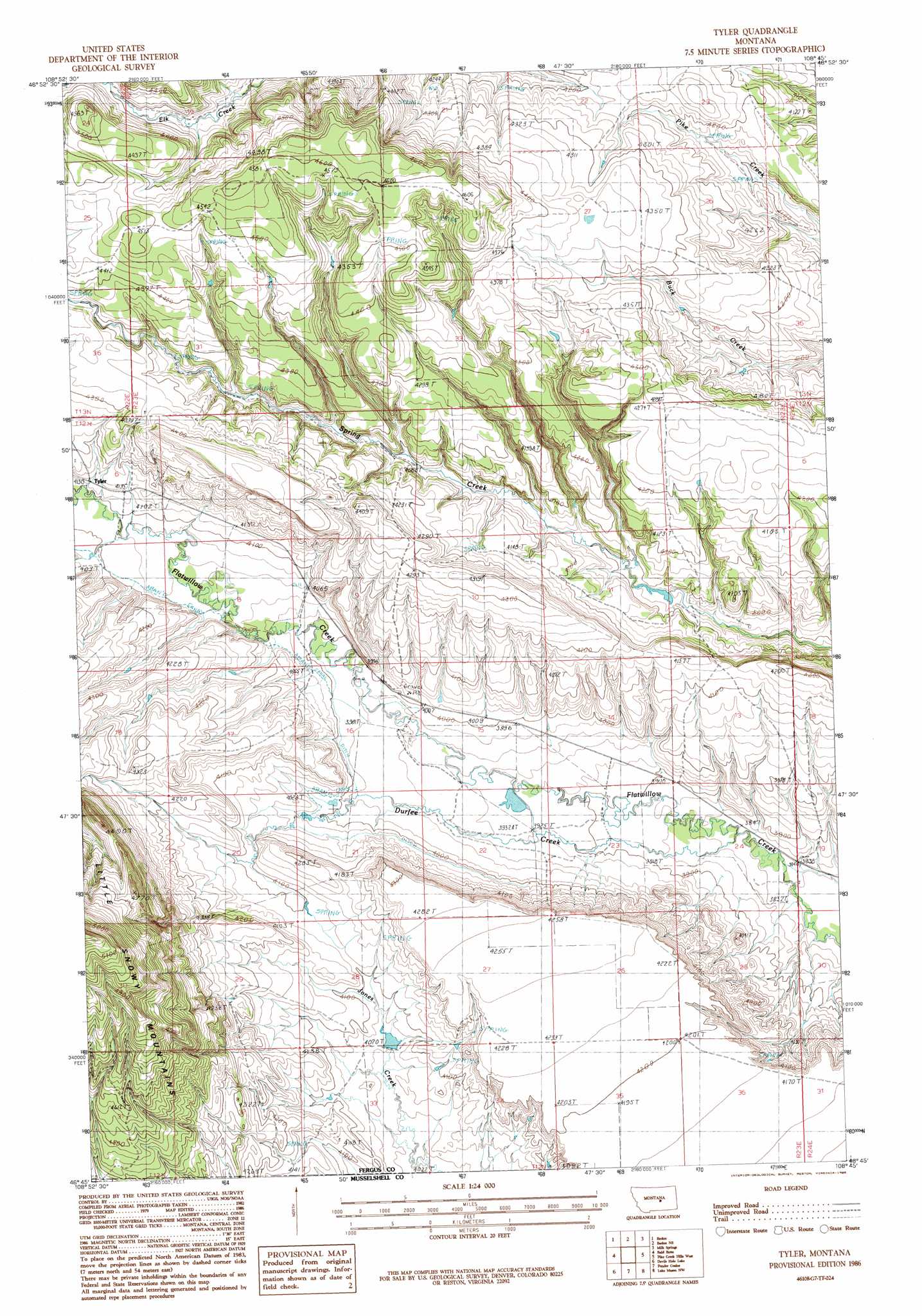
USGS Topo Quad 46108g7 - 1:24,000 scale
| Topo Map Name: | Tyler |
| USGS Topo Quad ID: | 46108g7 |
| Print Size: | ca. 21 1/4" wide x 27" high |
| Southeast Coordinates: | 46.75° N latitude / 108.75° W longitude |
| Map Center Coordinates: | 46.8125° N latitude / 108.8125° W longitude |
| U.S. State: | MT |
| Filename: | o46108g7.jpg |
| Download Map JPG Image: | Tyler topo map 1:24,000 scale |
| Map Type: | Topographic |
| Topo Series: | 7.5´ |
| Map Scale: | 1:24,000 |
| Source of Map Images: | United States Geological Survey (USGS) |
| Alternate Map Versions: |
Tyler MT 1986, updated 1986 Download PDF Buy paper map Tyler MT 2011 Download PDF Buy paper map Tyler MT 2014 Download PDF Buy paper map |
1:24,000 Topo Quads surrounding Tyler
Horsethief Coulee E. |
Fish Dam |
Grass Range |
Briggs Coulee |
Teigen |
Forestgrove |
Becket |
Becket Ne |
Milk Springs |
Snoose Creek |
South Bench |
Bald Butte |
Tyler |
Pike Creek Hills W. |
Pike Creek Hills E. |
Sahara Hill |
Devils Hole Lake |
Pender Coulee |
Lake Mason Nw |
Lake Mason Ne |
Sahara Hill Se |
Emory School |
Timber Buttes North |
Lake Mason |
Lake Mason Se |
> Back to 46108e1 at 1:100,000 scale
> Back to 46108a1 at 1:250,000 scale
> Back to U.S. Topo Maps home
Tyler topo map: Gazetteer
Tyler: Dams
Muppet Dam elevation 1196m 3923′Tyler: Populated Places
Warr (historical) elevation 1255m 4117′Tyler: Post Offices
Tyler Post Office (historical) elevation 1268m 4160′Tyler: Streams
Durfee Creek elevation 1176m 3858′Tyler digital topo map on disk
Buy this Tyler topo map showing relief, roads, GPS coordinates and other geographical features, as a high-resolution digital map file on DVD: