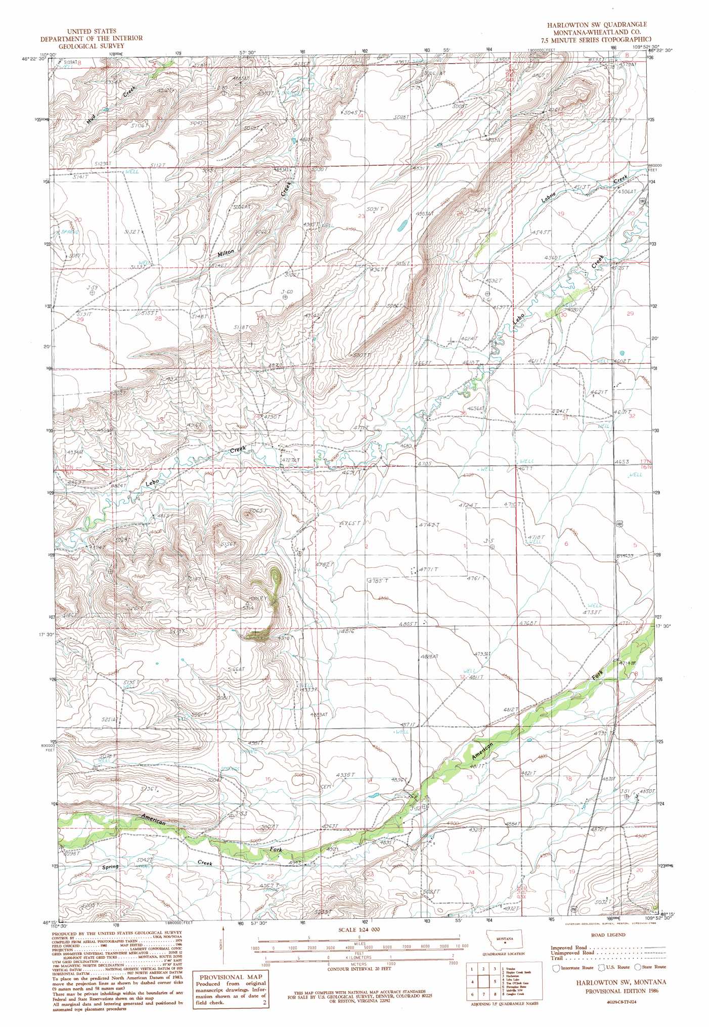
Harlowton Sw Topo Map Montana
To zoom in, hover over the map of Harlowton Sw
USGS Topo Quad 46109c8 - 1:24,000 scale
| Topo Map Name: | Harlowton Sw |
| USGS Topo Quad ID: | 46109c8 |
| Print Size: | ca. 21 1/4" wide x 27" high |
| Southeast Coordinates: | 46.25° N latitude / 109.875° W longitude |
| Map Center Coordinates: | 46.3125° N latitude / 109.9375° W longitude |
| U.S. State: | MT |
| Filename: | o46109c8.jpg |
| Download Map JPG Image: | Harlowton Sw topo map 1:24,000 scale |
| Map Type: | Topographic |
| Topo Series: | 7.5´ |
| Map Scale: | 1:24,000 |
| Source of Map Images: | United States Geological Survey (USGS) |
| Alternate Map Versions: |
Harlowton SW MT 1986, updated 1986 Download PDF Buy paper map Harlowton SW MT 2011 Download PDF Buy paper map Harlowton SW MT 2014 Download PDF Buy paper map |
1:24,000 Topo Quads surrounding Harlowton Sw
Haymaker Ranch Sw |
Haymaker Ranch |
Hopley Creek North |
Oka |
Oxford |
Twodot Nw |
Twodot |
Hopley Creek South |
Harlowton |
Ethels Coulee |
Cinnamon Spring |
Lebo Lake |
Harlowton Sw |
Ten O'Clock Gate |
Devils Pocket |
Rein Lake |
Porcupine Butte |
Melville Nw |
Gougley Creek |
Jim Creek |
Amelong Creek |
Battleship Butte |
Melville |
Upper Glaston Lake |
Gibson Sw |
> Back to 46109a1 at 1:100,000 scale
> Back to 46108a1 at 1:250,000 scale
> Back to U.S. Topo Maps home
Harlowton Sw topo map: Gazetteer
Harlowton Sw: Streams
Spring Creek elevation 1512m 4960′Harlowton Sw: Wells
06N14E01B___01 Well elevation 1452m 4763′06N14E01C___01 Well elevation 1462m 4796′
06N14E02D___01 Well elevation 1466m 4809′
06N14E04DCAA01 Well elevation 1599m 5246′
06N14E09DDCD01 Well elevation 1564m 5131′
06N15E07C___01 Well elevation 1458m 4783′
06N15E19____01 Well elevation 1504m 4934′
07N14E21CCC_01 Well elevation 1568m 5144′
07N15E30____01 Well elevation 1391m 4563′
Harlowton Sw digital topo map on disk
Buy this Harlowton Sw topo map showing relief, roads, GPS coordinates and other geographical features, as a high-resolution digital map file on DVD: