Sahara Hill Sw Topo Map Montana
To zoom in, hover over the map of Sahara Hill Sw
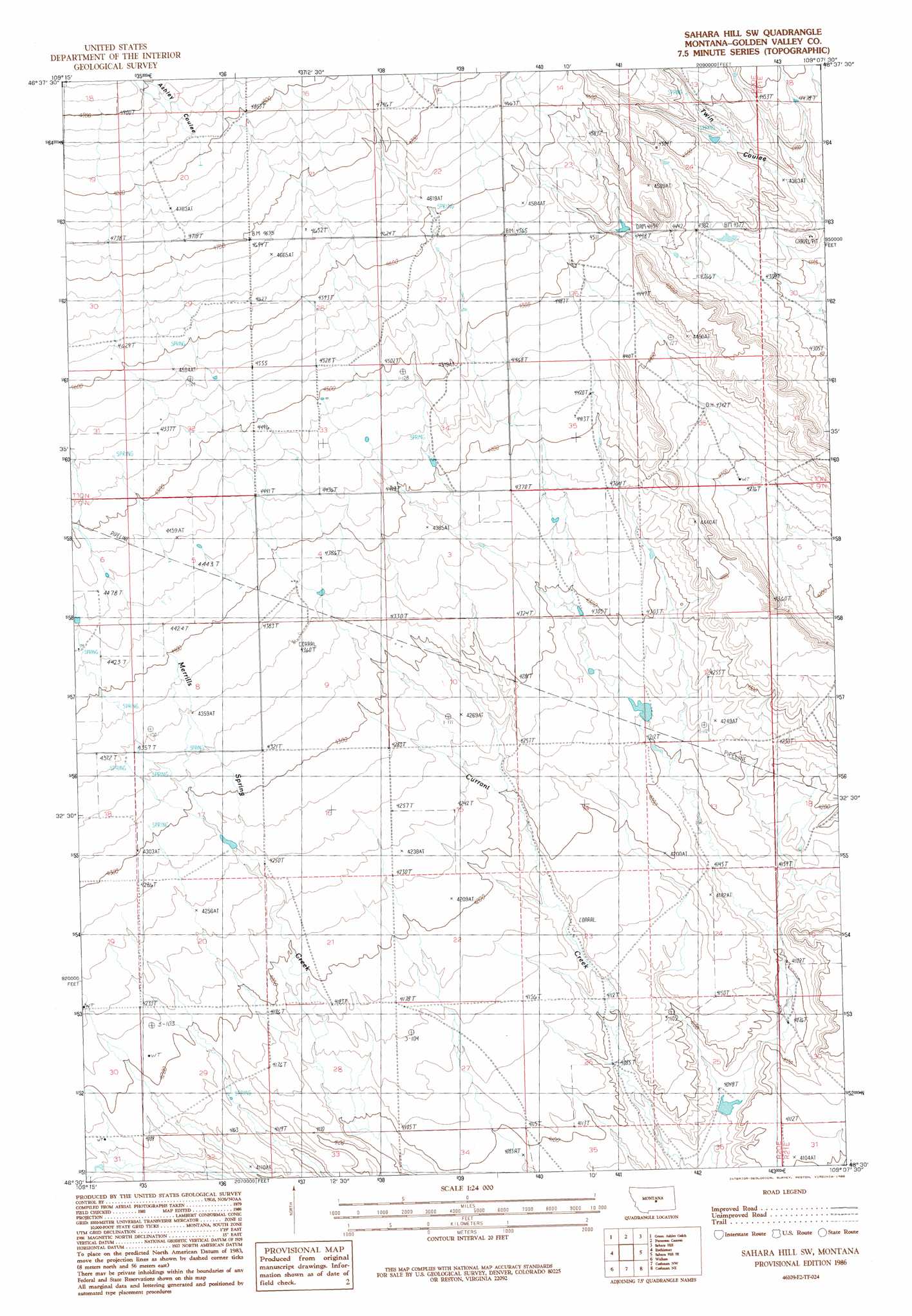
USGS Topo Quad 46109e2 - 1:24,000 scale
| Topo Map Name: | Sahara Hill Sw |
| USGS Topo Quad ID: | 46109e2 |
| Print Size: | ca. 21 1/4" wide x 27" high |
| Southeast Coordinates: | 46.5° N latitude / 109.125° W longitude |
| Map Center Coordinates: | 46.5625° N latitude / 109.1875° W longitude |
| U.S. State: | MT |
| Filename: | o46109e2.jpg |
| Download Map JPG Image: | Sahara Hill Sw topo map 1:24,000 scale |
| Map Type: | Topographic |
| Topo Series: | 7.5´ |
| Map Scale: | 1:24,000 |
| Source of Map Images: | United States Geological Survey (USGS) |
| Alternate Map Versions: |
Sahara Hill SW MT 1986, updated 1986 Download PDF Buy paper map Sahara Hill SW MT 2011 Download PDF Buy paper map Sahara Hill SW MT 2014 Download PDF Buy paper map |
1:24,000 Topo Quads surrounding Sahara Hill Sw
Jump Off Peak |
Half Moon Canyon |
Alaska Bench |
South Bench |
Bald Butte |
Snow Saucer Coulee |
Green Ashly Gulch |
Patterson Canyon |
Sahara Hill |
Devils Hole Lake |
Halbert Creek North |
Rothiemay |
Sahara Hill Sw |
Sahara Hill Se |
Emory School |
Halbert Creek South |
Vallum |
Cushman Nw |
Cushman Ne |
Lavina Nw |
Deadman Basin Res. |
Ryegate West |
Ryegate East |
Cushman |
Lavina |
> Back to 46109e1 at 1:100,000 scale
> Back to 46108a1 at 1:250,000 scale
> Back to U.S. Topo Maps home
Sahara Hill Sw topo map: Gazetteer
Sahara Hill Sw: Dams
Paint Rock Number 1 Dam elevation 1252m 4107′Sahara Hill Sw: Valleys
Ashley Coulee elevation 1452m 4763′Sahara Hill Sw digital topo map on disk
Buy this Sahara Hill Sw topo map showing relief, roads, GPS coordinates and other geographical features, as a high-resolution digital map file on DVD: