Jump Off Peak Topo Map Montana
To zoom in, hover over the map of Jump Off Peak
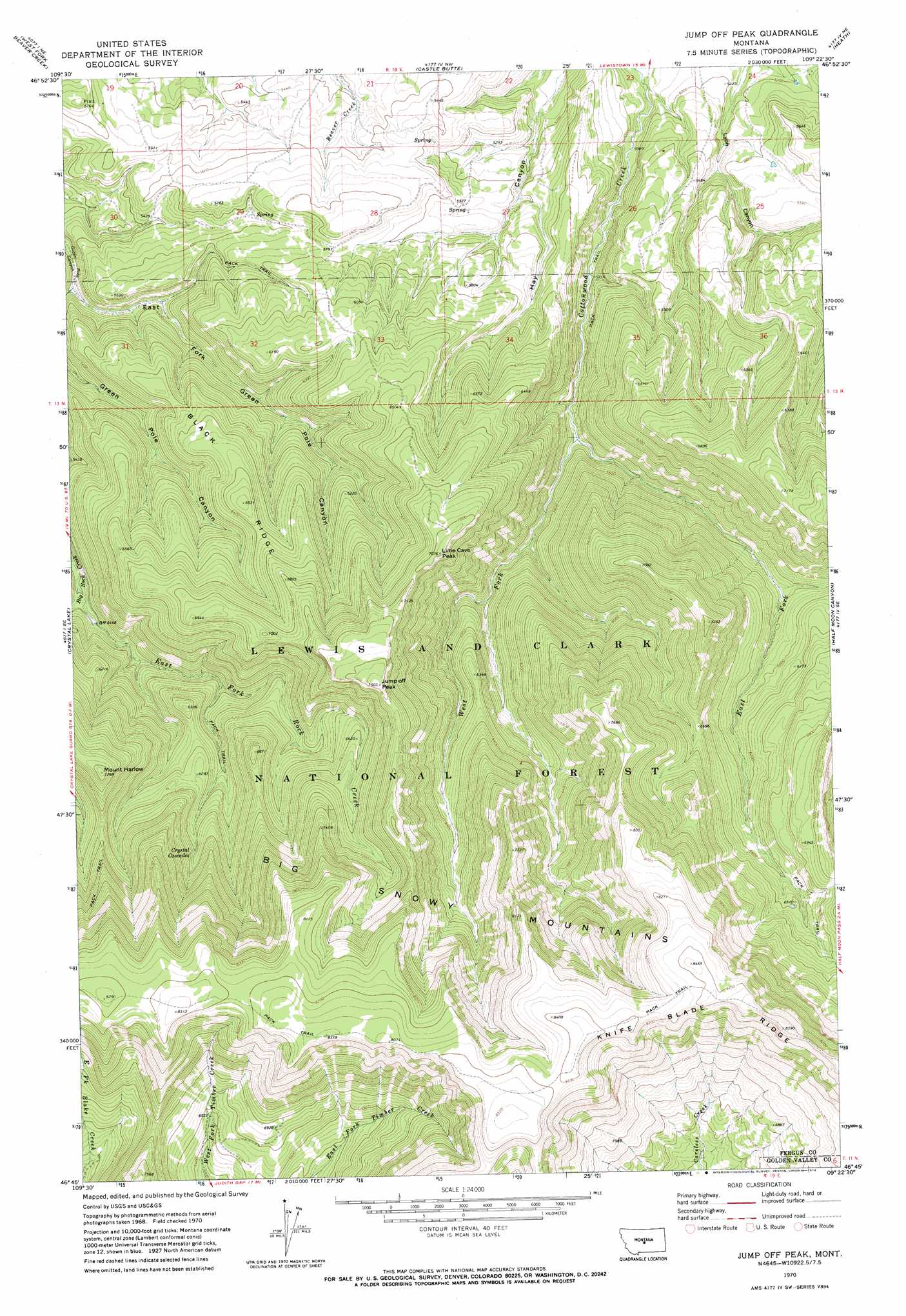
USGS Topo Quad 46109g4 - 1:24,000 scale
| Topo Map Name: | Jump Off Peak |
| USGS Topo Quad ID: | 46109g4 |
| Print Size: | ca. 21 1/4" wide x 27" high |
| Southeast Coordinates: | 46.75° N latitude / 109.375° W longitude |
| Map Center Coordinates: | 46.8125° N latitude / 109.4375° W longitude |
| U.S. State: | MT |
| Filename: | o46109g4.jpg |
| Download Map JPG Image: | Jump Off Peak topo map 1:24,000 scale |
| Map Type: | Topographic |
| Topo Series: | 7.5´ |
| Map Scale: | 1:24,000 |
| Source of Map Images: | United States Geological Survey (USGS) |
| Alternate Map Versions: |
Jump Off Peak MT 1970, updated 1974 Download PDF Buy paper map Jump Off Peak MT 1995, updated 1997 Download PDF Buy paper map Jump Off Peak MT 2011 Download PDF Buy paper map Jump Off Peak MT 2014 Download PDF Buy paper map |
| FStopo: | US Forest Service topo Jump Off Peak is available: Download FStopo PDF Download FStopo TIF |
1:24,000 Topo Quads surrounding Jump Off Peak
Ross Fork |
Glengarry |
Lewistown |
Pike Creek |
Horsethief Coulee W. |
Moore |
West Fork Beaver Creek |
Castle Butte |
Heath |
Loco Ridge |
Moore Sw |
Crystal Lake |
Jump Off Peak |
Half Moon Canyon |
Alaska Bench |
Elephant Rocks |
Yaple Bench |
Snow Saucer Coulee |
Green Ashly Gulch |
Patterson Canyon |
Oxford |
Nihill |
Halbert Creek North |
Rothiemay |
Sahara Hill Sw |
> Back to 46109e1 at 1:100,000 scale
> Back to 46108a1 at 1:250,000 scale
> Back to U.S. Topo Maps home
Jump Off Peak topo map: Gazetteer
Jump Off Peak: Ridges
Black Ridge elevation 1962m 6437′Knife Blade Ridge elevation 2599m 8526′
Jump Off Peak: Springs
Crystal Cascades elevation 1968m 6456′Jump Off Peak: Streams
East Fork Cottonwood Creek elevation 1621m 5318′East Fork Rock Creek elevation 1647m 5403′
West Fork Cottonwood Creek elevation 1621m 5318′
Jump Off Peak: Summits
Jump Off Peak elevation 2289m 7509′Lime Cave Peak elevation 2139m 7017′
Mount Harlow elevation 2166m 7106′
Jump Off Peak: Valleys
East Fork Green Pole Canyon elevation 1596m 5236′Jump Off Peak digital topo map on disk
Buy this Jump Off Peak topo map showing relief, roads, GPS coordinates and other geographical features, as a high-resolution digital map file on DVD: