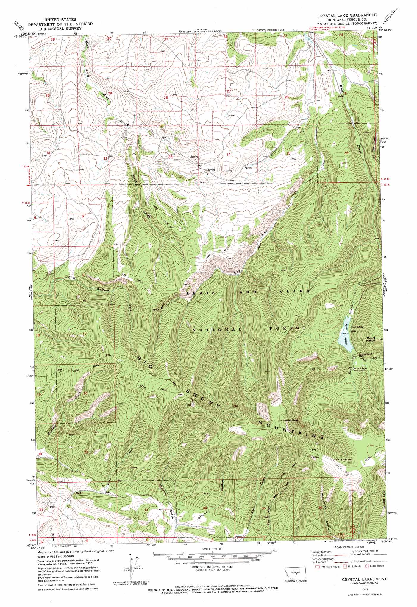
Crystal Lake Topo Map Montana
To zoom in, hover over the map of Crystal Lake
USGS Topo Quad 46109g5 - 1:24,000 scale
| Topo Map Name: | Crystal Lake |
| USGS Topo Quad ID: | 46109g5 |
| Print Size: | ca. 21 1/4" wide x 27" high |
| Southeast Coordinates: | 46.75° N latitude / 109.5° W longitude |
| Map Center Coordinates: | 46.8125° N latitude / 109.5625° W longitude |
| U.S. State: | MT |
| Filename: | o46109g5.jpg |
| Download Map JPG Image: | Crystal Lake topo map 1:24,000 scale |
| Map Type: | Topographic |
| Topo Series: | 7.5´ |
| Map Scale: | 1:24,000 |
| Source of Map Images: | United States Geological Survey (USGS) |
| Alternate Map Versions: |
Crystal Lake MT 1970, updated 1973 Download PDF Buy paper map Crystal Lake MT 1995, updated 1997 Download PDF Buy paper map Crystal Lake MT 2011 Download PDF Buy paper map Crystal Lake MT 2014 Download PDF Buy paper map |
| FStopo: | US Forest Service topo Crystal Lake is available: Download FStopo PDF Download FStopo TIF |
1:24,000 Topo Quads surrounding Crystal Lake
Kolin |
Ross Fork |
Glengarry |
Lewistown |
Pike Creek |
Sipple |
Moore |
West Fork Beaver Creek |
Castle Butte |
Heath |
Buffalo |
Moore Sw |
Crystal Lake |
Jump Off Peak |
Half Moon Canyon |
Judith Gap |
Elephant Rocks |
Yaple Bench |
Snow Saucer Coulee |
Green Ashly Gulch |
Oka |
Oxford |
Nihill |
Halbert Creek North |
Rothiemay |
> Back to 46109e1 at 1:100,000 scale
> Back to 46108a1 at 1:250,000 scale
> Back to U.S. Topo Maps home
Crystal Lake topo map: Gazetteer
Crystal Lake: Lakes
Crystal Lake elevation 1833m 6013′Crystal Lake: Streams
Dry Pole Creek elevation 1523m 4996′Crystal Lake: Summits
West Peak elevation 2495m 8185′Crystal Lake: Trails
Crystal Lake National Recreation Trail elevation 1898m 6227′Crystal Lake: Valleys
Brooks Coulee elevation 1753m 5751′Green Pole Canyon elevation 1538m 5045′
West Gulch elevation 1559m 5114′
Crystal Lake digital topo map on disk
Buy this Crystal Lake topo map showing relief, roads, GPS coordinates and other geographical features, as a high-resolution digital map file on DVD: