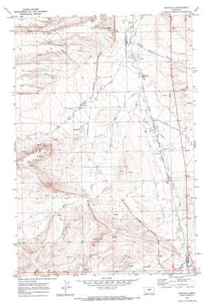
Buffalo Topo Map Montana
To zoom in, hover over the map of Buffalo
USGS Topo Quad 46109g7 - 1:24,000 scale
| Topo Map Name: | Buffalo |
| USGS Topo Quad ID: | 46109g7 |
| Print Size: | ca. 21 1/4" wide x 27" high |
| Southeast Coordinates: | 46.75° N latitude / 109.75° W longitude |
| Map Center Coordinates: | 46.8125° N latitude / 109.8125° W longitude |
| U.S. State: | MT |
| Filename: | o46109g7.jpg |
| Download Map JPG Image: | Buffalo topo map 1:24,000 scale |
| Map Type: | Topographic |
| Topo Series: | 7.5´ |
| Map Scale: | 1:24,000 |
| Source of Map Images: | United States Geological Survey (USGS) |
| Alternate Map Versions: |
Buffalo MT 1970, updated 1973 Download PDF Buy paper map Buffalo MT 2011 Download PDF Buy paper map Buffalo MT 2014 Download PDF Buy paper map |
1:24,000 Topo Quads surrounding Buffalo
> Back to 46109e1 at 1:100,000 scale
> Back to 46108a1 at 1:250,000 scale
> Back to U.S. Topo Maps home
Buffalo topo map: Gazetteer
Buffalo: Dams
Bye-Bye Dam elevation 1346m 4416′Buffalo: Populated Places
Buffalo elevation 1317m 4320′Garneill elevation 1347m 4419′
McClave elevation 1303m 4274′
Straw elevation 1281m 4202′
Buffalo: Post Offices
Buffalo Post Office elevation 1317m 4320′Garneill Post Office (historical) elevation 1347m 4419′
Straw Post Office (historical) elevation 1281m 4202′
Buffalo: Springs
11N15E05AA__01 Spring elevation 1440m 4724′12N15E20AC__01 Spring elevation 1366m 4481′
12N15E20BC__03 Spring elevation 1380m 4527′
12N15E29AD__01 Spring elevation 1401m 4596′
13N15E22DC__01 Spring elevation 1272m 4173′
13N15E31BD__01 Spring elevation 1369m 4491′
Buffalo: Streams
Barrows Creek elevation 1339m 4393′Buffalo Creek elevation 1272m 4173′
Dry Creek elevation 1291m 4235′
East Fork Mud Creek elevation 1357m 4452′
Meadow Creek elevation 1339m 4393′
Mud Creek elevation 1284m 4212′
Red Bluff Creek elevation 1342m 4402′
West Buffalo Creek elevation 1274m 4179′
West Fork Mud Creek elevation 1344m 4409′
Buffalo: Valleys
Monk Coulee elevation 1339m 4393′Buffalo: Wells
11N16E06BB__01 Well elevation 1362m 4468′11N16E06BB__02 Well elevation 1362m 4468′
12N15E01BC__01 Well elevation 1288m 4225′
12N15E01BC__02 Well elevation 1288m 4225′
12N15E04CD__01 Well elevation 1324m 4343′
12N15E04CD__02 Well elevation 1324m 4343′
12N15E04DC__01 Well elevation 1321m 4333′
12N15E04DD__01 Well elevation 1317m 4320′
12N15E04DD__02 Well elevation 1317m 4320′
12N15E04DD__03 Well elevation 1317m 4320′
12N15E04DD__04 Well elevation 1317m 4320′
12N15E04DD__05 Well elevation 1317m 4320′
12N15E05CD__01 Well elevation 1347m 4419′
12N15E08AA__01 Well elevation 1334m 4376′
12N15E08AA__02 Well elevation 1334m 4376′
12N15E08AD__01 Well elevation 1332m 4370′
12N15E08AD__02 Well elevation 1332m 4370′
12N15E09AA__01 Well elevation 1318m 4324′
12N15E09AA__02 Well elevation 1318m 4324′
12N15E10AA__01 Well elevation 1304m 4278′
12N15E10AA__02 Well elevation 1304m 4278′
12N15E10AA__03 Well elevation 1304m 4278′
12N15E10BB__01 Well elevation 1315m 4314′
12N15E10BB__02 Well elevation 1315m 4314′
12N15E10BB__03 Well elevation 1315m 4314′
12N15E10BC__01 Well elevation 1315m 4314′
12N15E10BC__02 Well elevation 1315m 4314′
12N15E11AA__01 Well elevation 1299m 4261′
12N15E11AA__02 Well elevation 1299m 4261′
12N15E12DD__01 Well elevation 1309m 4294′
12N15E12DD__02 Well elevation 1309m 4294′
12N15E13BB__01 Well elevation 1310m 4297′
12N15E20BC__01 Well elevation 1380m 4527′
12N15E20BC__02 Well elevation 1380m 4527′
12N15E21AC__01 Well elevation 1350m 4429′
12N15E21AC__02 Well elevation 1350m 4429′
12N15E22BC__01 Well elevation 1340m 4396′
12N15E22BC__02 Well elevation 1340m 4396′
12N15E22BCDC01 Well elevation 1342m 4402′
12N15E22BD__02 Well elevation 1338m 4389′
12N15E22BD__03 Well elevation 1338m 4389′
12N15E22CB__01 Well elevation 1343m 4406′
12N15E25AA__01 Well elevation 1324m 4343′
12N15E28DA__01 Well elevation 1379m 4524′
12N15E29AA__01 Well elevation 1372m 4501′
12N15E29DD__01 Well elevation 1403m 4603′
12N15E33AA__01 Well elevation 1379m 4524′
12N15E33AA__02 Well elevation 1379m 4524′
12N15E33BB__01 Well elevation 1409m 4622′
12N15E34AA__01 Well elevation 1389m 4557′
12N15E34BD__01 Well elevation 1403m 4603′
12N15E35DC__01 Well elevation 1369m 4491′
12N16E07BB__01 Well elevation 1307m 4288′
12N16E19CD__01 Well elevation 1328m 4356′
12N16E19CD__02 Well elevation 1328m 4356′
12N16E30AB__01 Well elevation 1340m 4396′
12N16E30BB__01 Well elevation 1324m 4343′
12N16E30BB__02 Well elevation 1324m 4343′
12N16E30BB__03 Well elevation 1324m 4343′
12N16E30DCC_01 Well elevation 1339m 4393′
12N16E31AC__01 Well elevation 1343m 4406′
12N16E31CC__01 Well elevation 1348m 4422′
12N16E31CC__02 Well elevation 1348m 4422′
12N16E31CD__01 Well elevation 1344m 4409′
12N16E31DC__01 Well elevation 1347m 4419′
13N15E23CC__01 Well elevation 1266m 4153′
13N15E23DB__01 Well elevation 1269m 4163′
13N15E25CC__01 Well elevation 1300m 4265′
13N15E26AB__01 Well elevation 1281m 4202′
13N15E26CC__01 Well elevation 1275m 4183′
13N15E26CD__01 Well elevation 1283m 4209′
13N15E26CD__02 Well elevation 1283m 4209′
13N15E26CD__03 Well elevation 1283m 4209′
13N15E26CD__04 Well elevation 1283m 4209′
13N15E26CD__05 Well elevation 1283m 4209′
13N15E32AD__01 Well elevation 1314m 4311′
13N15E34AA__01 Well elevation 1280m 4199′
13N15E34AA__02 Well elevation 1280m 4199′
13N15E34AA__03 Well elevation 1280m 4199′
13N15E35BB__01 Well elevation 1278m 4192′
13N15E35BB__02 Well elevation 1278m 4192′
13N15E36BB__01 Well elevation 1302m 4271′
13N15E36BB__02 Well elevation 1302m 4271′
Buffalo digital topo map on disk
Buy this Buffalo topo map showing relief, roads, GPS coordinates and other geographical features, as a high-resolution digital map file on DVD:


