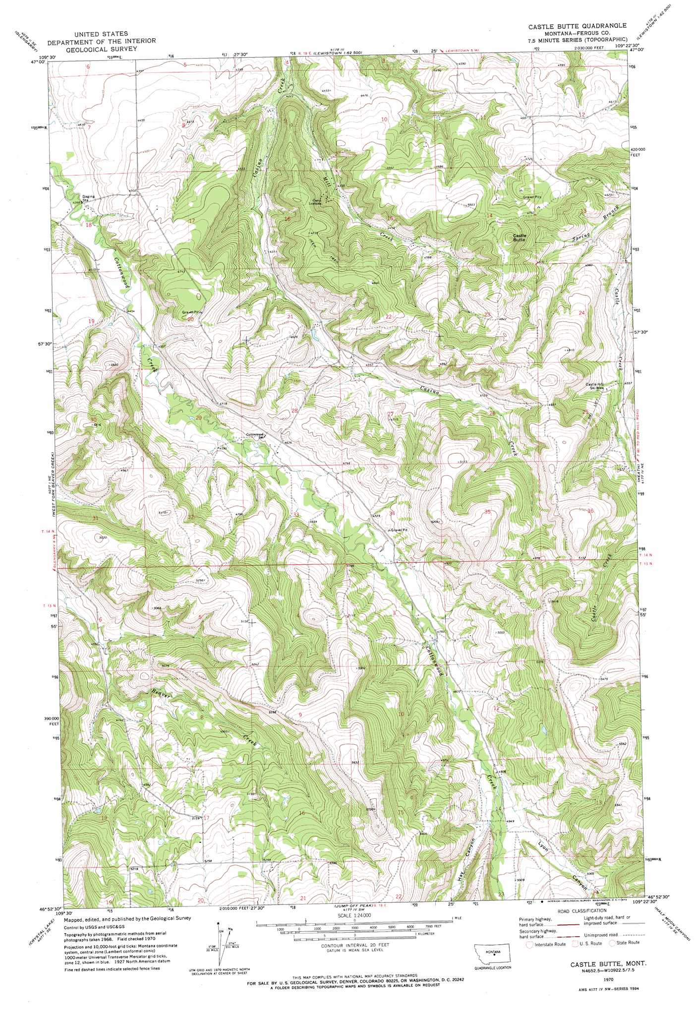
Castle Butte Topo Map Montana
To zoom in, hover over the map of Castle Butte
USGS Topo Quad 46109h4 - 1:24,000 scale
| Topo Map Name: | Castle Butte |
| USGS Topo Quad ID: | 46109h4 |
| Print Size: | ca. 21 1/4" wide x 27" high |
| Southeast Coordinates: | 46.875° N latitude / 109.375° W longitude |
| Map Center Coordinates: | 46.9375° N latitude / 109.4375° W longitude |
| U.S. State: | MT |
| Filename: | o46109h4.jpg |
| Download Map JPG Image: | Castle Butte topo map 1:24,000 scale |
| Map Type: | Topographic |
| Topo Series: | 7.5´ |
| Map Scale: | 1:24,000 |
| Source of Map Images: | United States Geological Survey (USGS) |
| Alternate Map Versions: |
Castle Butte MT 1970, updated 1973 Download PDF Buy paper map Castle Butte MT 1995, updated 1997 Download PDF Buy paper map Castle Butte MT 2011 Download PDF Buy paper map Castle Butte MT 2014 Download PDF Buy paper map |
| FStopo: | US Forest Service topo Castle Butte is available: Download FStopo PDF Download FStopo TIF |
1:24,000 Topo Quads surrounding Castle Butte
Danvers |
Spring Creek Junction |
Brooks |
New Year |
Judith Peak |
Ross Fork |
Glengarry |
Lewistown |
Pike Creek |
Horsethief Coulee W. |
Moore |
West Fork Beaver Creek |
Castle Butte |
Heath |
Loco Ridge |
Moore Sw |
Crystal Lake |
Jump Off Peak |
Half Moon Canyon |
Alaska Bench |
Elephant Rocks |
Yaple Bench |
Snow Saucer Coulee |
Green Ashly Gulch |
Patterson Canyon |
> Back to 46109e1 at 1:100,000 scale
> Back to 46108a1 at 1:250,000 scale
> Back to U.S. Topo Maps home
Castle Butte topo map: Gazetteer
Castle Butte: Post Offices
Jones Post Office (historical) elevation 1550m 5085′Natal Post Office (historical) elevation 1525m 5003′
Castle Butte: Streams
Mill Creek elevation 1281m 4202′Castle Butte: Summits
Castle Butte elevation 1508m 4947′Castle Butte: Valleys
Hay Canyon elevation 1492m 4895′Lyon Canyon elevation 1515m 4970′
Castle Butte: Wells
14N18E04DCBB01 Well elevation 1280m 4199′14N18E04DCBB02 Well elevation 1280m 4199′
14N18E09ADA_01 Well elevation 1305m 4281′
14N18E09DDC_01 Well elevation 1318m 4324′
14N18E10DDB_01 Well elevation 1408m 4619′
14N18E11ACBA01 Well elevation 1409m 4622′
14N18E12CCD_01 Well elevation 1451m 4760′
14N18E15DDBB01 Well elevation 1371m 4498′
14N18E16AADD01 Well elevation 1324m 4343′
14N18E16CDB_01 Well elevation 1334m 4376′
14N18E17BCA_01 Well elevation 1397m 4583′
14N18E18BDB_01 Well elevation 1332m 4370′
Castle Butte digital topo map on disk
Buy this Castle Butte topo map showing relief, roads, GPS coordinates and other geographical features, as a high-resolution digital map file on DVD: