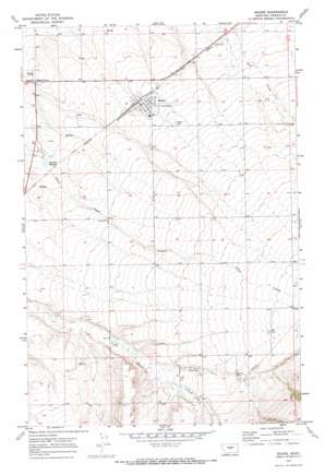
Moore Topo Map Montana
To zoom in, hover over the map of Moore
USGS Topo Quad 46109h6 - 1:24,000 scale
| Topo Map Name: | Moore |
| USGS Topo Quad ID: | 46109h6 |
| Print Size: | ca. 21 1/4" wide x 27" high |
| Southeast Coordinates: | 46.875° N latitude / 109.625° W longitude |
| Map Center Coordinates: | 46.9375° N latitude / 109.6875° W longitude |
| U.S. State: | MT |
| Filename: | o46109h6.jpg |
| Download Map JPG Image: | Moore topo map 1:24,000 scale |
| Map Type: | Topographic |
| Topo Series: | 7.5´ |
| Map Scale: | 1:24,000 |
| Source of Map Images: | United States Geological Survey (USGS) |
| Alternate Map Versions: |
Moore MT 1970, updated 1973 Download PDF Buy paper map Moore MT 2011 Download PDF Buy paper map Moore MT 2014 Download PDF Buy paper map |
1:24,000 Topo Quads surrounding Moore
> Back to 46109e1 at 1:100,000 scale
> Back to 46108a1 at 1:250,000 scale
> Back to U.S. Topo Maps home
Moore topo map: Gazetteer
Moore: Parks
Moore City Park elevation 1270m 4166′Moore: Populated Places
Eddies Corner elevation 1222m 4009′Moore elevation 1268m 4160′
Seright (historical) elevation 1309m 4294′
Moore: Post Offices
Moore Post Office elevation 1269m 4163′Trout Creek Post Office (historical) elevation 1316m 4317′
Moore: Springs
Dawkins Springs elevation 1239m 4064′Moore: Wells
13N16E01BA__01 Well elevation 1364m 4475′13N16E02BC__01 Well elevation 1340m 4396′
13N16E04AA__01 Well elevation 1311m 4301′
13N16E07AA__01 Well elevation 1263m 4143′
13N16E08AA__01 Well elevation 1291m 4235′
13N16E11CB__01 Well elevation 1339m 4393′
13N16E11CB__02 Well elevation 1339m 4393′
13N16E12AB__01 Well elevation 1375m 4511′
13N16E12BD__01 Well elevation 1369m 4491′
13N16E13BCBC01 Well elevation 1355m 4445′
13N16E15AA__01 Well elevation 1330m 4363′
13N16E15CA__01 Well elevation 1312m 4304′
13N16E15DD__01 Well elevation 1329m 4360′
13N16E17AA__01 Well elevation 1297m 4255′
13N16E18DD__01 Well elevation 1306m 4284′
13N16E20AB__01 Well elevation 1294m 4245′
13N16E20BB__01 Well elevation 1313m 4307′
13N16E23BB__01 Well elevation 1341m 4399′
13N17E06BB__01 Well elevation 1378m 4520′
13N17E18BB__01 Well elevation 1399m 4589′
14N16E09DD__01 Well elevation 1261m 4137′
14N16E11DD__01 Well elevation 1282m 4206′
14N16E13DC__01 Well elevation 1306m 4284′
14N16E13DD__01 Well elevation 1309m 4294′
14N16E14DD__01 Well elevation 1305m 4281′
14N16E15AB__01 Well elevation 1273m 4176′
14N16E15AB__02 Well elevation 1273m 4176′
14N16E15BB__01 Well elevation 1267m 4156′
14N16E15BBCB01 Well elevation 1266m 4153′
14N16E15BBCB02 Well elevation 1266m 4153′
14N16E15CB__01 Well elevation 1276m 4186′
14N16E15DC__01 Well elevation 1287m 4222′
14N16E18ABBC01 Well elevation 1223m 4012′
14N16E19AC__01 Well elevation 1239m 4064′
14N16E19DB__01 Well elevation 1235m 4051′
14N16E21AD__01 Well elevation 1280m 4199′
14N16E22BA__01 Well elevation 1288m 4225′
14N16E23BA__01 Well elevation 1302m 4271′
14N16E24CB__01 Well elevation 1322m 4337′
14N16E25DC__01 Well elevation 1350m 4429′
14N16E26AA__01 Well elevation 1327m 4353′
14N16E27BB__01 Well elevation 1296m 4251′
14N16E28DA__01 Well elevation 1294m 4245′
14N16E28DA__02 Well elevation 1294m 4245′
14N16E32BB__01 Well elevation 1264m 4146′
14N16E32CD__01 Well elevation 1278m 4192′
14N16E32DA__01 Well elevation 1284m 4212′
14N16E33DA__01 Well elevation 1303m 4274′
14N16E34DD__01 Well elevation 1330m 4363′
14N16E35BA__01 Well elevation 1332m 4370′
14N16E35BA__02 Well elevation 1332m 4370′
14N16E36CC__01 Well elevation 1356m 4448′
Moore digital topo map on disk
Buy this Moore topo map showing relief, roads, GPS coordinates and other geographical features, as a high-resolution digital map file on DVD:


