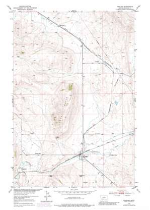
Ringling Topo Map Montana
To zoom in, hover over the map of Ringling
USGS Topo Quad 46110c7 - 1:24,000 scale
| Topo Map Name: | Ringling |
| USGS Topo Quad ID: | 46110c7 |
| Print Size: | ca. 21 1/4" wide x 27" high |
| Southeast Coordinates: | 46.25° N latitude / 110.75° W longitude |
| Map Center Coordinates: | 46.3125° N latitude / 110.8125° W longitude |
| U.S. State: | MT |
| Filename: | o46110c7.jpg |
| Download Map JPG Image: | Ringling topo map 1:24,000 scale |
| Map Type: | Topographic |
| Topo Series: | 7.5´ |
| Map Scale: | 1:24,000 |
| Source of Map Images: | United States Geological Survey (USGS) |
| Alternate Map Versions: |
Ringling MT 1951, updated 1953 Download PDF Buy paper map Ringling MT 1951, updated 1976 Download PDF Buy paper map Ringling MT 1951, updated 1981 Download PDF Buy paper map Ringling MT 2011 Download PDF Buy paper map Ringling MT 2014 Download PDF Buy paper map |
1:24,000 Topo Quads surrounding Ringling
> Back to 46110a1 at 1:100,000 scale
> Back to 46110a1 at 1:250,000 scale
> Back to U.S. Topo Maps home
Ringling topo map: Gazetteer
Ringling: Airports
Higgins Brothers Airport elevation 1624m 5328′Ringling: Dams
Turkey Straw Dam elevation 1634m 5360′Ringling: Mines
NW NE Section 15 Mine elevation 1687m 5534′Ringling: Populated Places
Bruce Place elevation 1639m 5377′Ford Place elevation 1654m 5426′
Moss Agate elevation 1598m 5242′
Ringling elevation 1616m 5301′
Ringling: Post Offices
Ringling Post Office elevation 1616m 5301′Ringling: Streams
Agate Creek elevation 1592m 5223′Lost Creek elevation 1615m 5298′
Meadow Creek elevation 1586m 5203′
Ringling: Summits
Horse Butte elevation 1861m 6105′Ringling: Wells
06N07E02DD__01 Well elevation 1645m 5396′06N07E09BC__01 Well elevation 1681m 5515′
06N07E09C___01 Well elevation 1656m 5433′
06N07E13DD__01 Well elevation 1621m 5318′
06N07E13DD__02 Well elevation 1621m 5318′
06N07E16DC__01 Well elevation 1619m 5311′
06N07E26A___01 Well elevation 1704m 5590′
06N07E27BB__01 Well elevation 1651m 5416′
06N08E07CC__01 Well elevation 1637m 5370′
06N08E08CB__01 Well elevation 1649m 5410′
07N07E25ADCA01 Well elevation 1636m 5367′
07N07E36BB__01 Well elevation 1654m 5426′
Ringling digital topo map on disk
Buy this Ringling topo map showing relief, roads, GPS coordinates and other geographical features, as a high-resolution digital map file on DVD:


