Hoover Spring Topo Map Montana
To zoom in, hover over the map of Hoover Spring
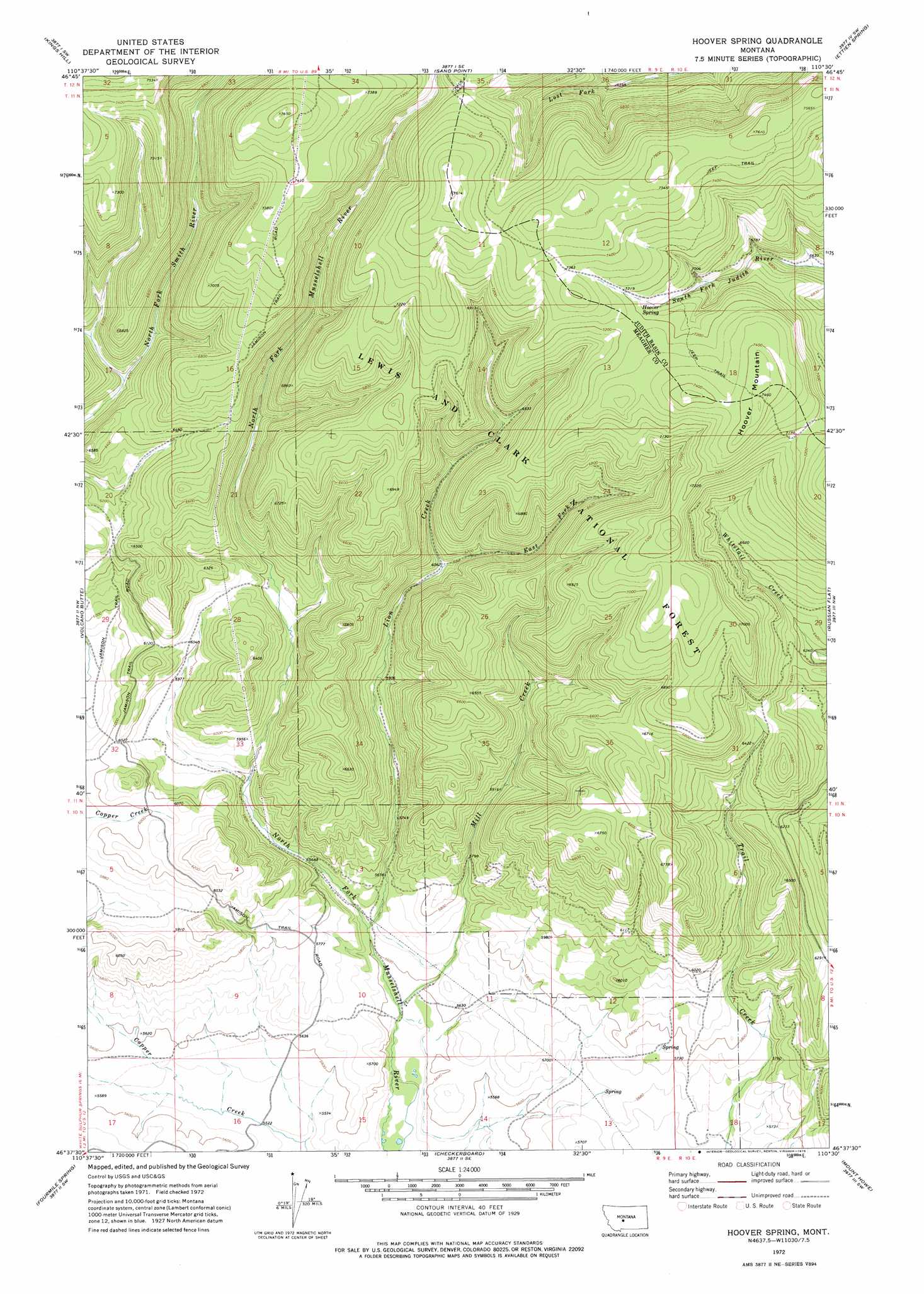
USGS Topo Quad 46110f5 - 1:24,000 scale
| Topo Map Name: | Hoover Spring |
| USGS Topo Quad ID: | 46110f5 |
| Print Size: | ca. 21 1/4" wide x 27" high |
| Southeast Coordinates: | 46.625° N latitude / 110.5° W longitude |
| Map Center Coordinates: | 46.6875° N latitude / 110.5625° W longitude |
| U.S. State: | MT |
| Filename: | o46110f5.jpg |
| Download Map JPG Image: | Hoover Spring topo map 1:24,000 scale |
| Map Type: | Topographic |
| Topo Series: | 7.5´ |
| Map Scale: | 1:24,000 |
| Source of Map Images: | United States Geological Survey (USGS) |
| Alternate Map Versions: |
Hoover Spring MT 1972, updated 1976 Download PDF Buy paper map Hoover Spring MT 1995, updated 1997 Download PDF Buy paper map Hoover Spring MT 1995, updated 1997 Download PDF Buy paper map Hoover Spring MT 2011 Download PDF Buy paper map Hoover Spring MT 2014 Download PDF Buy paper map |
| FStopo: | US Forest Service topo Hoover Spring is available: Download FStopo PDF Download FStopo TIF |
1:24,000 Topo Quads surrounding Hoover Spring
Belt Park Butte |
Neihart |
Yogo Peak |
Band Box Mountain |
Woodhurst Mountain |
Moose Mountain |
Kings Hill |
Sand Point |
Ettien Spring |
Indian Hill |
Charcoal Gulch |
Volcano Butte |
Hoover Spring |
Russian Flat |
Daisy Peak |
Pinchout Creek |
Fourmile Spring |
Checkerboard |
Mount Howe |
Mud Creek |
Manger Park |
Castle Town |
Lennep |
Groveland |
Martinsdale |
> Back to 46110e1 at 1:100,000 scale
> Back to 46110a1 at 1:250,000 scale
> Back to U.S. Topo Maps home
Hoover Spring topo map: Gazetteer
Hoover Spring: Ridges
Burnt Ridge elevation 2312m 7585′Hoover Spring: Springs
Hoover Spring elevation 2156m 7073′Hoover Spring: Streams
East Fork Lion Creek elevation 1848m 6062′Lion Creek elevation 1714m 5623′
Mill Creek elevation 1698m 5570′
Hoover Spring: Summits
Hoover Mountain elevation 2281m 7483′Hoover Spring digital topo map on disk
Buy this Hoover Spring topo map showing relief, roads, GPS coordinates and other geographical features, as a high-resolution digital map file on DVD: