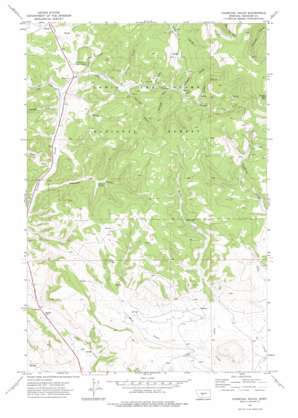
Charcoal Gulch Topo Map Montana
To zoom in, hover over the map of Charcoal Gulch
USGS Topo Quad 46110f7 - 1:24,000 scale
| Topo Map Name: | Charcoal Gulch |
| USGS Topo Quad ID: | 46110f7 |
| Print Size: | ca. 21 1/4" wide x 27" high |
| Southeast Coordinates: | 46.625° N latitude / 110.75° W longitude |
| Map Center Coordinates: | 46.6875° N latitude / 110.8125° W longitude |
| U.S. State: | MT |
| Filename: | o46110f7.jpg |
| Download Map JPG Image: | Charcoal Gulch topo map 1:24,000 scale |
| Map Type: | Topographic |
| Topo Series: | 7.5´ |
| Map Scale: | 1:24,000 |
| Source of Map Images: | United States Geological Survey (USGS) |
| Alternate Map Versions: |
Charcoal Gulch MT 1971, updated 1974 Download PDF Buy paper map Charcoal Gulch MT 1995, updated 1997 Download PDF Buy paper map Charcoal Gulch MT 2011 Download PDF Buy paper map Charcoal Gulch MT 2014 Download PDF Buy paper map |
| FStopo: | US Forest Service topo Charcoal Gulch is available: Download FStopo PDF Download FStopo TIF |
1:24,000 Topo Quads surrounding Charcoal Gulch
> Back to 46110e1 at 1:100,000 scale
> Back to 46110a1 at 1:250,000 scale
> Back to U.S. Topo Maps home
Charcoal Gulch topo map: Gazetteer
Charcoal Gulch: Lakes
Crater Lake elevation 1793m 5882′Charcoal Gulch: Mines
Newland Creek Quarry elevation 1717m 5633′NW NE Section 18 Mine elevation 1930m 6332′
SW NE Section 10 Mine elevation 1787m 5862′
Charcoal Gulch: Springs
Charcoal Spring elevation 1737m 5698′Charcoal Gulch: Streams
Ice Creek elevation 1653m 5423′Pistol Creek elevation 1735m 5692′
Reese Creek elevation 1670m 5479′
Charcoal Gulch: Summits
Butler Hill elevation 1755m 5757′Smoky Mountain elevation 2340m 7677′
Charcoal Gulch: Valleys
Abbott Gulch elevation 1672m 5485′Albright Gulch elevation 1744m 5721′
Bills Gulch elevation 1782m 5846′
Charcoal Gulch elevation 1665m 5462′
Chinaman Gulch elevation 1777m 5830′
Miller Gulch elevation 1696m 5564′
Post Gulch elevation 1812m 5944′
Snaggy Gulch elevation 1802m 5912′
Spruce Gulch elevation 1719m 5639′
Thornquist Gulch elevation 1690m 5544′
Timber Gulch elevation 1824m 5984′
Charcoal Gulch digital topo map on disk
Buy this Charcoal Gulch topo map showing relief, roads, GPS coordinates and other geographical features, as a high-resolution digital map file on DVD:


