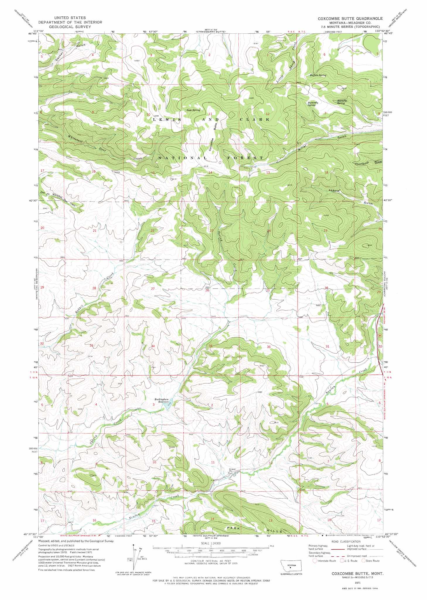
Coxcombe Butte Topo Map Montana
To zoom in, hover over the map of Coxcombe Butte
USGS Topo Quad 46110f8 - 1:24,000 scale
| Topo Map Name: | Coxcombe Butte |
| USGS Topo Quad ID: | 46110f8 |
| Print Size: | ca. 21 1/4" wide x 27" high |
| Southeast Coordinates: | 46.625° N latitude / 110.875° W longitude |
| Map Center Coordinates: | 46.6875° N latitude / 110.9375° W longitude |
| U.S. State: | MT |
| Filename: | o46110f8.jpg |
| Download Map JPG Image: | Coxcombe Butte topo map 1:24,000 scale |
| Map Type: | Topographic |
| Topo Series: | 7.5´ |
| Map Scale: | 1:24,000 |
| Source of Map Images: | United States Geological Survey (USGS) |
| Alternate Map Versions: |
Coxcombe Butte MT 1971, updated 1975 Download PDF Buy paper map Coxcombe Butte MT 1995, updated 1997 Download PDF Buy paper map Coxcombe Butte MT 2011 Download PDF Buy paper map Coxcombe Butte MT 2014 Download PDF Buy paper map |
| FStopo: | US Forest Service topo Coxcombe Butte is available: Download FStopo PDF Download FStopo TIF |
1:24,000 Topo Quads surrounding Coxcombe Butte
Bald Hills |
Monument Peak |
Bubbling Springs |
Belt Park Butte |
Neihart |
Devils Footstool |
Sheep Mountain |
Strawberry Butte |
Moose Mountain |
Kings Hill |
Fort Logan |
Whitetail Reservoir |
Coxcombe Butte |
Charcoal Gulch |
Volcano Butte |
Gipsy Lake |
Hanson Reservoir |
White Sulphur Springs |
Pinchout Creek |
Fourmile Spring |
Mount Edith |
Alkali Lake |
Catlin Spring |
Manger Park |
Castle Town |
> Back to 46110e1 at 1:100,000 scale
> Back to 46110a1 at 1:250,000 scale
> Back to U.S. Topo Maps home
Coxcombe Butte topo map: Gazetteer
Coxcombe Butte: Dams
Newlan Creek Dam elevation 1613m 5291′Spring Creek Dam elevation 1614m 5295′
Coxcombe Butte: Reservoirs
Buckingham Reservoir elevation 1609m 5278′Newlan Creek Reservoir elevation 1613m 5291′
Coxcombe Butte: Springs
Buffalo Spring elevation 1848m 6062′Butterfly Spring elevation 1856m 6089′
Horsefly Spring elevation 1825m 5987′
Sage Spring elevation 1974m 6476′
Coxcombe Butte: Summits
Coxcombe Butte elevation 2056m 6745′Coxcombe Butte digital topo map on disk
Buy this Coxcombe Butte topo map showing relief, roads, GPS coordinates and other geographical features, as a high-resolution digital map file on DVD: