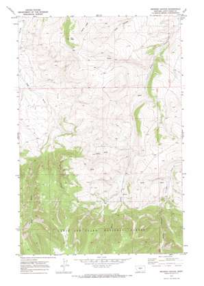
Browns Canyon Topo Map Montana
To zoom in, hover over the map of Browns Canyon
USGS Topo Quad 46110g2 - 1:24,000 scale
| Topo Map Name: | Browns Canyon |
| USGS Topo Quad ID: | 46110g2 |
| Print Size: | ca. 21 1/4" wide x 27" high |
| Southeast Coordinates: | 46.75° N latitude / 110.125° W longitude |
| Map Center Coordinates: | 46.8125° N latitude / 110.1875° W longitude |
| U.S. State: | MT |
| Filename: | o46110g2.jpg |
| Download Map JPG Image: | Browns Canyon topo map 1:24,000 scale |
| Map Type: | Topographic |
| Topo Series: | 7.5´ |
| Map Scale: | 1:24,000 |
| Source of Map Images: | United States Geological Survey (USGS) |
| Alternate Map Versions: |
Browns Canyon MT 1970, updated 1973 Download PDF Buy paper map Browns Canyon MT 1995, updated 1997 Download PDF Buy paper map Browns Canyon MT 2011 Download PDF Buy paper map Browns Canyon MT 2014 Download PDF Buy paper map |
| FStopo: | US Forest Service topo Browns Canyon is available: Download FStopo PDF Download FStopo TIF |
1:24,000 Topo Quads surrounding Browns Canyon
> Back to 46110e1 at 1:100,000 scale
> Back to 46110a1 at 1:250,000 scale
> Back to U.S. Topo Maps home
Browns Canyon topo map: Gazetteer
Browns Canyon: Springs
12N12E01BD__01 Spring elevation 1653m 5423′12N12E02DA__01 Spring elevation 1680m 5511′
12N12E02DD__01 Spring elevation 1656m 5433′
12N12E02DD__02 Spring elevation 1656m 5433′
12N12E03AA__01 Spring elevation 1712m 5616′
12N12E03AC__01 Spring elevation 1658m 5439′
12N12E03BB__01 Spring elevation 1642m 5387′
12N12E03BC__01 Spring elevation 1653m 5423′
12N12E05AD__01 Spring elevation 1569m 5147′
12N12E09CC__01 Spring elevation 1635m 5364′
12N12E09CD__01 Spring elevation 1673m 5488′
12N12E09DB__01 Spring elevation 1703m 5587′
12N12E10AD__01 Spring elevation 1751m 5744′
12N12E10BD__01 Spring elevation 1694m 5557′
12N12E11AD__01 Spring elevation 1738m 5702′
12N12E11BB__01 Spring elevation 1802m 5912′
12N12E12BB__01 Spring elevation 1661m 5449′
12N12E12BC__01 Spring elevation 1669m 5475′
12N12E12CC__01 Spring elevation 1709m 5606′
12N12E13AA__01 Spring elevation 1760m 5774′
12N12E13DD__01 Spring elevation 1803m 5915′
12N12E14DC__01 Spring elevation 1782m 5846′
12N12E15AD__01 Spring elevation 1821m 5974′
12N12E15CD__01 Spring elevation 1938m 6358′
12N12E23AA__01 Spring elevation 1756m 5761′
12N12E23BB__01 Spring elevation 1855m 6085′
12N12E23BC__01 Spring elevation 1884m 6181′
12N12E23DB__01 Spring elevation 1749m 5738′
12N12E24AA__01 Spring elevation 1734m 5688′
12N12E24BD__01 Spring elevation 1862m 6108′
12N12E24CA__01 Spring elevation 1896m 6220′
12N12E24CB__01 Spring elevation 1895m 6217′
12N12E24DB__01 Spring elevation 1840m 6036′
12N12E25AA__01 Spring elevation 1771m 5810′
12N13E06BC__01 Spring elevation 1698m 5570′
12N13E06CB__01 Spring elevation 1678m 5505′
12N13E07AA__01 Spring elevation 1751m 5744′
12N13E18DA__01 Spring elevation 1661m 5449′
12N13E19BC__01 Spring elevation 1738m 5702′
13N12E20DD__01 Spring elevation 1724m 5656′
13N12E27DD__01 Spring elevation 1700m 5577′
13N12E32AD__01 Spring elevation 1606m 5269′
13N12E34AA__01 Spring elevation 1699m 5574′
13N12E34AC__01 Spring elevation 1731m 5679′
13N12E35AA__01 Spring elevation 1622m 5321′
13N12E35BB__01 Spring elevation 1707m 5600′
13N12E35DD__01 Spring elevation 1613m 5291′
13N12E36BC__01 Spring elevation 1588m 5209′
Browns Canyon: Summits
Pine Knob elevation 1919m 6295′Browns Canyon: Valleys
Antelope Gorge elevation 1682m 5518′Browns Canyon elevation 1601m 5252′
Browns Canyon: Wells
12N12E08DC__01 Well elevation 1657m 5436′12N12E08DC__02 Well elevation 1657m 5436′
13N12E19AC__01 Well elevation 1484m 4868′
13N12E20CCDC01 Well elevation 1608m 5275′
13N12E23DB__01 Well elevation 1650m 5413′
Browns Canyon digital topo map on disk
Buy this Browns Canyon topo map showing relief, roads, GPS coordinates and other geographical features, as a high-resolution digital map file on DVD:


