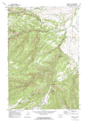
Indian Hill Topo Map Montana
To zoom in, hover over the map of Indian Hill
USGS Topo Quad 46110g3 - 1:24,000 scale
| Topo Map Name: | Indian Hill |
| USGS Topo Quad ID: | 46110g3 |
| Print Size: | ca. 21 1/4" wide x 27" high |
| Southeast Coordinates: | 46.75° N latitude / 110.25° W longitude |
| Map Center Coordinates: | 46.8125° N latitude / 110.3125° W longitude |
| U.S. State: | MT |
| Filename: | o46110g3.jpg |
| Download Map JPG Image: | Indian Hill topo map 1:24,000 scale |
| Map Type: | Topographic |
| Topo Series: | 7.5´ |
| Map Scale: | 1:24,000 |
| Source of Map Images: | United States Geological Survey (USGS) |
| Alternate Map Versions: |
Indian Hill MT 1970, updated 1973 Download PDF Buy paper map Indian Hill MT 1995, updated 1997 Download PDF Buy paper map Indian Hill MT 2011 Download PDF Buy paper map Indian Hill MT 2014 Download PDF Buy paper map |
| FStopo: | US Forest Service topo Indian Hill is available: Download FStopo PDF Download FStopo TIF |
1:24,000 Topo Quads surrounding Indian Hill
> Back to 46110e1 at 1:100,000 scale
> Back to 46110a1 at 1:250,000 scale
> Back to U.S. Topo Maps home
Indian Hill topo map: Gazetteer
Indian Hill: Capes
Russell Point elevation 1835m 6020′Indian Hill: Mines
American Mine elevation 1630m 5347′NW SE Section 20 Mine elevation 1655m 5429′
Vortex Mine elevation 1603m 5259′
Indian Hill: Populated Places
Yogo Crossing elevation 1558m 5111′Indian Hill: Post Offices
Sapphire Post Office (historical) elevation 1614m 5295′Indian Hill: Springs
High Spring elevation 2050m 6725′Indian Hill: Streams
Burley Creek elevation 1632m 5354′High Spring Creek elevation 1625m 5331′
Middle Fork Judith River elevation 1501m 4924′
South Fork Judith River elevation 1501m 4924′
Yogo Creek elevation 1531m 5022′
Indian Hill: Summits
Indian Hill elevation 1883m 6177′Indian Hill: Valleys
Arch Coulee elevation 1574m 5164′Bower Canyon elevation 1543m 5062′
Dry Pole Canyon elevation 1615m 5298′
Ettien Gulch elevation 1541m 5055′
Hay Canyon elevation 1576m 5170′
Kelly Coulee elevation 1608m 5275′
Pagil Gulch elevation 1500m 4921′
Rocky Gulch elevation 1535m 5036′
Trask Gulch elevation 1659m 5442′
Indian Hill: Wells
13N11E25DA__01 Well elevation 1496m 4908′13N11E25DA__02 Well elevation 1496m 4908′
13N11E25DA__03 Well elevation 1496m 4908′
13N11E26BD__01 Well elevation 1583m 5193′
13N11E26BD__02 Well elevation 1583m 5193′
13N11E35AB__01 Well elevation 1545m 5068′
13N11E36DA__01 Well elevation 1527m 5009′
13N12E19BD__01 Well elevation 1481m 4858′
13N12E19CA__01 Well elevation 1484m 4868′
13N12E30BA__01 Well elevation 1496m 4908′
Indian Hill digital topo map on disk
Buy this Indian Hill topo map showing relief, roads, GPS coordinates and other geographical features, as a high-resolution digital map file on DVD:


