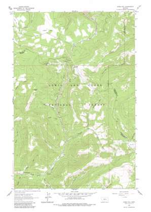
Kings Hill Topo Map Montana
To zoom in, hover over the map of Kings Hill
USGS Topo Quad 46110g6 - 1:24,000 scale
| Topo Map Name: | Kings Hill |
| USGS Topo Quad ID: | 46110g6 |
| Print Size: | ca. 21 1/4" wide x 27" high |
| Southeast Coordinates: | 46.75° N latitude / 110.625° W longitude |
| Map Center Coordinates: | 46.8125° N latitude / 110.6875° W longitude |
| U.S. State: | MT |
| Filename: | o46110g6.jpg |
| Download Map JPG Image: | Kings Hill topo map 1:24,000 scale |
| Map Type: | Topographic |
| Topo Series: | 7.5´ |
| Map Scale: | 1:24,000 |
| Source of Map Images: | United States Geological Survey (USGS) |
| Alternate Map Versions: |
Kings Hill MT 1961, updated 1964 Download PDF Buy paper map Kings Hill MT 1961, updated 1982 Download PDF Buy paper map Kings Hill MT 1995, updated 1997 Download PDF Buy paper map Kings Hill MT 1995, updated 1997 Download PDF Buy paper map Kings Hill MT 2011 Download PDF Buy paper map Kings Hill MT 2014 Download PDF Buy paper map |
| FStopo: | US Forest Service topo Kings Hill is available: Download FStopo PDF Download FStopo TIF |
1:24,000 Topo Quads surrounding Kings Hill
> Back to 46110e1 at 1:100,000 scale
> Back to 46110a1 at 1:250,000 scale
> Back to U.S. Topo Maps home
Kings Hill topo map: Gazetteer
Kings Hill: Flats
O'Brien Park elevation 2211m 7253′Kings Hill: Gaps
Kings Hill Pass elevation 2251m 7385′Kings Hill: Mines
Kings Hill Quarry elevation 2261m 7417′Kings Hill: Populated Places
Forest Green elevation 1854m 6082′Kings Hill: Post Offices
Galen Post Office (historical) elevation 2209m 7247′Thale Post Office (historical) elevation 1854m 6082′
Kings Hill: Ranges
Little Belt Mountains elevation 2498m 8195′Kings Hill: Streams
Barnaboo Creek elevation 1960m 6430′Bonine Creek elevation 1841m 6040′
Canyon Creek elevation 1892m 6207′
Cascade Creek elevation 1840m 6036′
Deadman Creek elevation 1914m 6279′
Lamb Creek elevation 1862m 6108′
Lishen Creek elevation 2052m 6732′
Mizpah Creek elevation 1981m 6499′
North Fork Deadman Creek elevation 2008m 6587′
Nugget Creek elevation 1894m 6213′
Petty Creek elevation 2088m 6850′
South Fork Deadman Creek elevation 1966m 6450′
Kings Hill: Summits
Kings Hill elevation 2441m 8008′Mizpah Peak elevation 2361m 7746′
Porphyry Peak elevation 2498m 8195′
Kings Hill: Trails
Arkansas Traveller Ski Trail elevation 2323m 7621′Big Seven Ski Trail elevation 2323m 7621′
Black Diamond Ski Trail elevation 2323m 7621′
Brown-eyed Queen Ski Trail elevation 2323m 7621′
Compromise Pass Ski Trail elevation 2323m 7621′
Cumberland Ski Trail elevation 2323m 7621′
Dynamite Ski Trail elevation 2323m 7621′
Frisco Ski Trail elevation 2323m 7621′
Geronimo Ski Trail elevation 2323m 7621′
Glory Hole Ski Trail elevation 2323m 7621′
Golden Goose Ski Trail elevation 2323m 7621′
Good Luck Ski Trail elevation 2323m 7621′
Gun Barrel Ski Trail elevation 2323m 7621′
James Bond Ski Trail elevation 2323m 7621′
Last Chance Gulch Ski Trail elevation 2323m 7621′
Mizpah Race Hill Ski Trail elevation 2323m 7621′
Mizpah Ski Trail elevation 2323m 7621′
Moly Ski Trail elevation 2323m 7621′
Muley Ski Trail elevation 2323m 7621′
Pan Handle Ski Trail elevation 2323m 7621′
Pay Dirt Ski Trail elevation 2323m 7621′
Prentice Ski Trail elevation 2323m 7621′
Quicksilver Lower Ski Trail elevation 2323m 7621′
Quicksilver Upper Ski Trail elevation 2323m 7621′
Ripley Lower Ski Trail elevation 2323m 7621′
Ripley Upper Ski Trail elevation 2323m 7621′
Ruby Gulch Ski Trail elevation 2323m 7621′
Ruby Ski Trail elevation 2323m 7621′
Second Thought Ski Trail elevation 2323m 7621′
Silverhorn Ski Trail elevation 2323m 7621′
Sluice Box Ski Trail elevation 2323m 7621′
Sour Dough Hill Ski Trail elevation 2323m 7621′
Speculation Ski Trail elevation 2323m 7621′
Yogo Ski Trail elevation 2323m 7621′
Kings Hill digital topo map on disk
Buy this Kings Hill topo map showing relief, roads, GPS coordinates and other geographical features, as a high-resolution digital map file on DVD:


