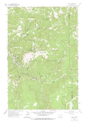
Neihart Topo Map Montana
To zoom in, hover over the map of Neihart
USGS Topo Quad 46110h6 - 1:24,000 scale
| Topo Map Name: | Neihart |
| USGS Topo Quad ID: | 46110h6 |
| Print Size: | ca. 21 1/4" wide x 27" high |
| Southeast Coordinates: | 46.875° N latitude / 110.625° W longitude |
| Map Center Coordinates: | 46.9375° N latitude / 110.6875° W longitude |
| U.S. State: | MT |
| Filename: | o46110h6.jpg |
| Download Map JPG Image: | Neihart topo map 1:24,000 scale |
| Map Type: | Topographic |
| Topo Series: | 7.5´ |
| Map Scale: | 1:24,000 |
| Source of Map Images: | United States Geological Survey (USGS) |
| Alternate Map Versions: |
Neihart MT 1961, updated 1964 Download PDF Buy paper map Neihart MT 1961, updated 1978 Download PDF Buy paper map Neihart MT 1995, updated 1997 Download PDF Buy paper map Neihart MT 2011 Download PDF Buy paper map Neihart MT 2014 Download PDF Buy paper map |
| FStopo: | US Forest Service topo Neihart is available: Download FStopo PDF Download FStopo TIF |
1:24,000 Topo Quads surrounding Neihart
> Back to 46110e1 at 1:100,000 scale
> Back to 46110a1 at 1:250,000 scale
> Back to U.S. Topo Maps home
Neihart topo map: Gazetteer
Neihart: Falls
Memorial Falls elevation 1886m 6187′Neihart: Flats
Lucy Park elevation 2064m 6771′Neihart: Forests
Lewis and Clark National Forest elevation 2026m 6646′Lewis and Clark National Forest - Jefferson Division elevation 2026m 6646′
Neihart: Mines
Atlantus Mine elevation 1867m 6125′Baker Mine elevation 1907m 6256′
Big Seven Mine elevation 2143m 7030′
Big Seven Mine elevation 2151m 7057′
Big Snowy Number 4 Mine elevation 2383m 7818′
Black Diamond Jay Mine elevation 2125m 6971′
Blotter Mine elevation 2023m 6637′
Broadwater Mines elevation 1826m 5990′
Bull of the Woods Mine elevation 2150m 7053′
Carpenter Creek Tailing elevation 1828m 5997′
Compromise Mine elevation 1809m 5935′
Concentrated Mine elevation 1704m 5590′
Cornucopia Mine elevation 2236m 7335′
Cornucopia Mine elevation 2259m 7411′
Cowboy Mine elevation 1920m 6299′
Cumberland Mine elevation 1834m 6017′
Dacotah Mine elevation 2047m 6715′
Dickens Mine elevation 2160m 7086′
Emma Mine elevation 1957m 6420′
Empire Mine elevation 1845m 6053′
Evening Star Mine elevation 1695m 5561′
Fairplay Mine elevation 2143m 7030′
Florence Mine elevation 1817m 5961′
Florence Mine elevation 1738m 5702′
Frisco Number 2 Mine elevation 1736m 5695′
Graham and Hollowbush Mine elevation 1734m 5688′
Hartley Mine elevation 1892m 6207′
Haystack Creek Mine elevation 1944m 6377′
Hidden Treasure Mine elevation 1871m 6138′
Huchinson Mine elevation 2000m 6561′
Hunter Mine elevation 1936m 6351′
Jennie Whipple Mine elevation 2298m 7539′
Jennie Whipple Number 2 Mine elevation 2324m 7624′
Jennie Whipple Number 3 Mine elevation 2391m 7844′
Keegan Mine elevation 1720m 5643′
Last Chance Mine elevation 1717m 5633′
Lexington Number 1 Mine elevation 2335m 7660′
Lexington Number 2 Mine elevation 2297m 7536′
Lexington Number 3 Mine elevation 2266m 7434′
Lexington Number 4 Mine elevation 2242m 7355′
Lizze Mine elevation 2009m 6591′
Lower Big Snowy Mine elevation 2281m 7483′
Lower Black Diamond Mine elevation 2071m 6794′
Lower Champion Mine elevation 2011m 6597′
Lower I X L Mine elevation 2081m 6827′
Lower Rebellion Mine elevation 2132m 6994′
Lower West Eureka Mine elevation 2034m 6673′
Lucky Strike Mine elevation 2106m 6909′
Mattie Mine elevation 1995m 6545′
Maud S Mine elevation 2141m 7024′
Middle Lexington Number 2 Mine elevation 2025m 6643′
Molton Mine elevation 1789m 5869′
Molton Mine elevation 1789m 5869′
Monarch Mine elevation 1810m 5938′
MS 3489 Mine elevation 1807m 5928′
Neihart Tailings elevation 1687m 5534′
Nellie L Mine elevation 1741m 5711′
NW NE Section 10 Mine elevation 1828m 5997′
NW SW Section 29 Mine elevation 2017m 6617′
Old Crow Mine elevation 1883m 6177′
Ontario Mine elevation 2329m 7641′
Queen of the Hills Mine elevation 1722m 5649′
Queen of the Hills Mine elevation 1714m 5623′
Ripple Mine elevation 2310m 7578′
Ripple Number 2 Mine elevation 2338m 7670′
Ripple Number 3 Mine elevation 2386m 7828′
Ripple Number 4 Mine elevation 2443m 8015′
Rochester Mine elevation 1876m 6154′
Savage Mine elevation 1998m 6555′
Sherman Number 2 Mine elevation 1905m 6250′
Sherman Number 2 Mine elevation 1918m 6292′
Silver Belt Mine elevation 2105m 6906′
Silver Dyke Adit Mine elevation 2089m 6853′
Silver Dyke Millsite elevation 2022m 6633′
Silver Dyke Mine elevation 2130m 6988′
Silver Dyke Tailings elevation 1938m 6358′
Silver King Mine elevation 1708m 5603′
Silver Safe Mine elevation 1723m 5652′
Speculation Mine elevation 1723m 5652′
Spokane Mine elevation 2258m 7408′
Spotted Mine elevation 2155m 7070′
Stallabrass Mine elevation 1758m 5767′
Star Mine elevation 1702m 5583′
Turkey Mountain Mine elevation 1769m 5803′
Upper Big Snowy Mine elevation 2314m 7591′
Upper Blue Cloud Mine elevation 2275m 7463′
Upper Champion Mine elevation 2094m 6870′
Upper Lexington Number 2 Mine elevation 2024m 6640′
Upper Rebellion Mine elevation 2184m 7165′
Upper Snow Creek Mine elevation 2137m 7011′
Upper West Eureka Mine elevation 2058m 6751′
Vilipa Mine elevation 1894m 6213′
White Elephant Number 1 Mine elevation 1949m 6394′
Neihart: Populated Places
Neihart elevation 1715m 5626′Neihart: Post Offices
Neihart Post Office elevation 1717m 5633′Neihart: Reservoirs
Neihart Reservoir elevation 1802m 5912′Neihart: Ridges
Pioneer Ridge elevation 2191m 7188′Poverty Ridge elevation 2156m 7073′
Neihart: Streams
Burg Creek elevation 1891m 6204′Chamberlain Creek elevation 1848m 6062′
Haystack Creek elevation 1836m 6023′
Jefferson Creek elevation 1810m 5938′
Johnston Creek elevation 1712m 5616′
Lucy Creek elevation 1809m 5935′
Mackay Creek elevation 1836m 6023′
Memorial Creek elevation 1804m 5918′
O'Brien Creek elevation 1731m 5679′
Palisade Creek elevation 1814m 5951′
Rock Creek elevation 1697m 5567′
Shorty Creek elevation 1802m 5912′
Sih-mem Creek elevation 1890m 6200′
Snow Creek elevation 1795m 5889′
Neihart: Summits
Long Mountain elevation 2625m 8612′Neihart Baldy elevation 2525m 8284′
Neihart: Valleys
Compromise Gulch elevation 1708m 5603′Hidden Canyon elevation 1803m 5915′
Narrow Gauge Gulch elevation 1756m 5761′
Spring Gulch elevation 1689m 5541′
Neihart: Wells
14N48E29ADCA01 Well elevation 2320m 7611′Neihart digital topo map on disk
Buy this Neihart topo map showing relief, roads, GPS coordinates and other geographical features, as a high-resolution digital map file on DVD:


