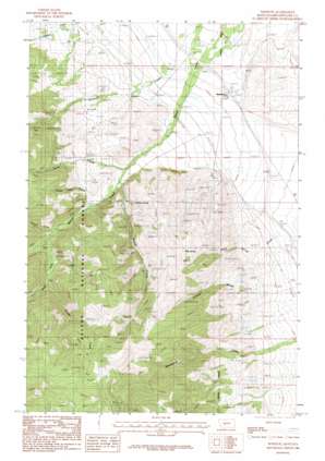
Winston Topo Map Montana
To zoom in, hover over the map of Winston
USGS Topo Quad 46111d6 - 1:24,000 scale
| Topo Map Name: | Winston |
| USGS Topo Quad ID: | 46111d6 |
| Print Size: | ca. 21 1/4" wide x 27" high |
| Southeast Coordinates: | 46.375° N latitude / 111.625° W longitude |
| Map Center Coordinates: | 46.4375° N latitude / 111.6875° W longitude |
| U.S. State: | MT |
| Filename: | o46111d6.jpg |
| Download Map JPG Image: | Winston topo map 1:24,000 scale |
| Map Type: | Topographic |
| Topo Series: | 7.5´ |
| Map Scale: | 1:24,000 |
| Source of Map Images: | United States Geological Survey (USGS) |
| Alternate Map Versions: |
Winston MT 1986, updated 1986 Download PDF Buy paper map Winston MT 2001, updated 2004 Download PDF Buy paper map Winston MT 2011 Download PDF Buy paper map Winston MT 2014 Download PDF Buy paper map |
| FStopo: | US Forest Service topo Winston is available: Download FStopo PDF Download FStopo TIF |
1:24,000 Topo Quads surrounding Winston
> Back to 46111a1 at 1:100,000 scale
> Back to 46110a1 at 1:250,000 scale
> Back to U.S. Topo Maps home
Winston topo map: Gazetteer
Winston: Mines
Big Chief Mine elevation 2220m 7283′East Pacific Mine elevation 1768m 5800′
January Mine elevation 1880m 6167′
Kleinschmidt Mine elevation 2239m 7345′
Kleinschmidt Mine elevation 2253m 7391′
Little Bonanza Mine elevation 1900m 6233′
Maine Mine elevation 1565m 5134′
Monte Cristo Mine elevation 2033m 6669′
NE NW Section 3 Mine elevation 2268m 7440′
North Pole Creek Mine elevation 1756m 5761′
NW NW Section 26 Mine elevation 1672m 5485′
NW SE Section 28 Mine elevation 1958m 6423′
Stray Horse Mine elevation 2083m 6833′
Sunrise Mine elevation 1823m 5980′
Sunshine Mine elevation 1712m 5616′
SW NE Section 16 Mine elevation 1774m 5820′
SW NW Section 3 Mine elevation 2250m 7381′
SW SW Section 27 Mine elevation 2151m 7057′
Vosburg Mine elevation 2155m 7070′
Vosburg Mine elevation 2195m 7201′
Winston: Populated Places
Winston elevation 1329m 4360′Winston: Post Offices
Winston Post Office (historical) elevation 1329m 4360′Winston: Springs
Graham Spring elevation 1594m 5229′Kelley Spring elevation 1693m 5554′
Winston: Streams
Badger Creek elevation 1724m 5656′North Pole Creek elevation 1465m 4806′
Sawmill Creek elevation 1592m 5223′
South Fork Beaver Creek elevation 1633m 5357′
South Pole Creek elevation 1562m 5124′
Weasel Creek elevation 1488m 4881′
Winston: Valleys
Kelly Spring Gulch elevation 1280m 4199′Kimber Gulch elevation 1334m 4376′
Winston: Wells
08N01E06BC__01 Well elevation 1318m 4324′08N01E06BC__02 Well elevation 1318m 4324′
08N01E06BC__03 Well elevation 1318m 4324′
08N01E06CB__01 Well elevation 1327m 4353′
08N01E06CB__02 Well elevation 1327m 4353′
08N01E06CB__03 Well elevation 1327m 4353′
08N01E06CB__04 Well elevation 1327m 4353′
08N01E06CB__05 Well elevation 1327m 4353′
08N01E06CB__06 Well elevation 1327m 4353′
08N01E06CB__07 Well elevation 1327m 4353′
08N01E06CB__08 Well elevation 1327m 4353′
08N01E06CB__09 Well elevation 1327m 4353′
08N01E06CB__10 Well elevation 1327m 4353′
08N01E06CC__01 Well elevation 1337m 4386′
08N01E06CC__02 Well elevation 1337m 4386′
08N01E18CA__01 Well elevation 1334m 4376′
08N01W02AA__01 Well elevation 1332m 4370′
09N01E31BC__01 Well elevation 1279m 4196′
09N01E31DB__01 Well elevation 1275m 4183′
09N01E31DB__02 Well elevation 1275m 4183′
09N01W35DD__01 Well elevation 1319m 4327′
09N01W35DD__02 Well elevation 1319m 4327′
09N01W36CA__01 Well elevation 1305m 4281′
09N01W36DD__01 Well elevation 1302m 4271′
Winston digital topo map on disk
Buy this Winston topo map showing relief, roads, GPS coordinates and other geographical features, as a high-resolution digital map file on DVD:


