Canyon Ferry Sw Topo Map Montana
To zoom in, hover over the map of Canyon Ferry Sw
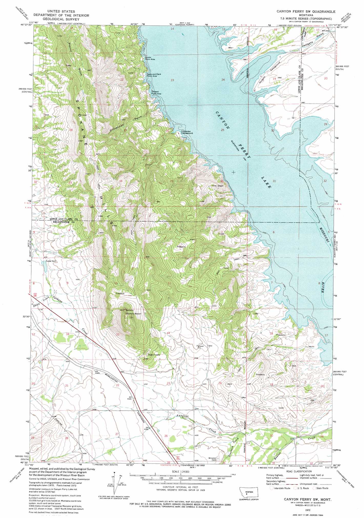
USGS Topo Quad 46111e6 - 1:24,000 scale
| Topo Map Name: | Canyon Ferry Sw |
| USGS Topo Quad ID: | 46111e6 |
| Print Size: | ca. 21 1/4" wide x 27" high |
| Southeast Coordinates: | 46.5° N latitude / 111.625° W longitude |
| Map Center Coordinates: | 46.5625° N latitude / 111.6875° W longitude |
| U.S. State: | MT |
| Filename: | o46111e6.jpg |
| Download Map JPG Image: | Canyon Ferry Sw topo map 1:24,000 scale |
| Map Type: | Topographic |
| Topo Series: | 7.5´ |
| Map Scale: | 1:24,000 |
| Source of Map Images: | United States Geological Survey (USGS) |
| Alternate Map Versions: |
Canyon Ferry SW MT 1972, updated 1975 Download PDF Buy paper map Canyon Ferry SW MT 2011 Download PDF Buy paper map Canyon Ferry SW MT 2014 Download PDF Buy paper map |
1:24,000 Topo Quads surrounding Canyon Ferry Sw
Upper Holter Lake |
Nelson |
Hogback Mountain |
Snedaker Basin |
Lingshire |
Lake Helena |
Hauser Lake |
Canyon Ferry |
Hellgate Gulch |
Whites City |
East Helena |
Louisville |
Canyon Ferry Sw |
Canyon Ferry Se |
Diamond City |
Clancy |
Casey Peak |
Winston |
Townsend Ne |
Gurnett Creek West |
Elkhorn |
Crow Creek Falls |
Giant Hill |
Townsend |
Holker |
> Back to 46111e1 at 1:100,000 scale
> Back to 46110a1 at 1:250,000 scale
> Back to U.S. Topo Maps home
Canyon Ferry Sw topo map: Gazetteer
Canyon Ferry Sw: Dams
Potter Dam elevation 1254m 4114′Potter Irrigation Dam elevation 1371m 4498′
Canyon Ferry Sw: Post Offices
Spokane Post Office (historical) elevation 1300m 4265′Canyon Ferry Sw: Streams
Antelope Creek elevation 1219m 3999′Avalanche Creek elevation 1158m 3799′
Miller Creek elevation 1245m 4084′
Sheep Creek elevation 1261m 4137′
Staubach Creek elevation 1254m 4114′
Canyon Ferry Sw: Valleys
Crittenden Gulch elevation 1172m 3845′Hellgate Gulch elevation 1162m 3812′
Little Hellgate Gulch elevation 1173m 3848′
Canyon Ferry Sw: Wells
09N01W22AD__01 Well elevation 1322m 4337′09N01W22CD__01 Well elevation 1333m 4373′
09N01W26AD__03 Well elevation 1285m 4215′
09N01W26DD__01 Well elevation 1297m 4255′
09N01W26DD__02 Well elevation 1297m 4255′
10N01W23CCAD01 Well elevation 1167m 3828′
Canyon Ferry Sw digital topo map on disk
Buy this Canyon Ferry Sw topo map showing relief, roads, GPS coordinates and other geographical features, as a high-resolution digital map file on DVD: