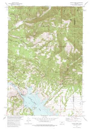
Canyon Ferry Topo Map Montana
To zoom in, hover over the map of Canyon Ferry
USGS Topo Quad 46111f6 - 1:24,000 scale
| Topo Map Name: | Canyon Ferry |
| USGS Topo Quad ID: | 46111f6 |
| Print Size: | ca. 21 1/4" wide x 27" high |
| Southeast Coordinates: | 46.625° N latitude / 111.625° W longitude |
| Map Center Coordinates: | 46.6875° N latitude / 111.6875° W longitude |
| U.S. State: | MT |
| Filename: | o46111f6.jpg |
| Download Map JPG Image: | Canyon Ferry topo map 1:24,000 scale |
| Map Type: | Topographic |
| Topo Series: | 7.5´ |
| Map Scale: | 1:24,000 |
| Source of Map Images: | United States Geological Survey (USGS) |
| Alternate Map Versions: |
Canyon Ferry MT 1972, updated 1976 Download PDF Buy paper map Canyon Ferry MT 1972, updated 1976 Download PDF Buy paper map Canyon Ferry MT 2001, updated 2004 Download PDF Buy paper map Canyon Ferry MT 2011 Download PDF Buy paper map Canyon Ferry MT 2014 Download PDF Buy paper map |
| FStopo: | US Forest Service topo Canyon Ferry is available: Download FStopo PDF Download FStopo TIF |
1:24,000 Topo Quads surrounding Canyon Ferry
> Back to 46111e1 at 1:100,000 scale
> Back to 46110a1 at 1:250,000 scale
> Back to U.S. Topo Maps home
Canyon Ferry topo map: Gazetteer
Canyon Ferry: Bars
French Bar elevation 1114m 3654′Gruells Bar elevation 1153m 3782′
Canyon Ferry: Bays
Cave Bay elevation 1158m 3799′Chinaman Cove elevation 1160m 3805′
Canyon Ferry: Dams
Canyon Ferry Dam elevation 1158m 3799′Canyon Ferry: Mines
Coxcy Gulch Mine elevation 1374m 4507′Golden Messenger Mine elevation 1396m 4580′
Golden Messenger Mine elevation 1378m 4520′
Gruells Bar Mine elevation 1159m 3802′
Korizek Mine elevation 1220m 4002′
Little Dandy Mine elevation 1418m 4652′
NE SE Section 16/Gennian Gulch Mine elevation 1347m 4419′
NW SE Section 30 Mine elevation 1324m 4343′
SE NE Section 14/Kingsberry Gulch Mine elevation 1763m 5784′
SE NW S11/Big Rattlesnake Gulch Mine elevation 1536m 5039′
SE SE Section 19 Mine elevation 1472m 4829′
SW NE S11/Big Rattlesnake Gulch Mine elevation 1630m 5347′
Canyon Ferry: Populated Places
Canyon Ferry elevation 1175m 3854′Cavetown elevation 1168m 3832′
Daytown (historical) elevation 1212m 3976′
Canyon Ferry: Post Offices
Canyon Ferry Post Office (historical) elevation 1175m 3854′Cavetown Post Office (historical) elevation 1168m 3832′
Canyon Ferry: Reservoirs
Canyon Ferry Lake elevation 1158m 3799′Canyon Ferry: Streams
Magpie Creek elevation 1158m 3799′Canyon Ferry: Summits
Cemetery Hill elevation 1162m 3812′French Bar Mountain elevation 1389m 4557′
Goon Hill elevation 1253m 4110′
Hedges Mountain elevation 2165m 7103′
Canyon Ferry: Valleys
Beards Gulch elevation 1286m 4219′Big Rattlesnake Gulch elevation 1531m 5022′
Blacksmith Gulch elevation 1314m 4311′
Browns Gulch elevation 1219m 3999′
Cave Gulch elevation 1158m 3799′
Clarks Gulch elevation 1172m 3845′
Collins Gulch elevation 1390m 4560′
Cooper Gulch elevation 1165m 3822′
Coxcy Gulch elevation 1348m 4422′
Fox Gulch elevation 1339m 4393′
Gennian Gulch elevation 1298m 4258′
Holiday Gulch elevation 1364m 4475′
Horse Gulch elevation 1132m 3713′
Johnnys Gulch elevation 1159m 3802′
Kelly Gulch elevation 1271m 4169′
Kingsberry Gulch elevation 1272m 4173′
Oregon Gulch elevation 1121m 3677′
Sheriff Gulch elevation 1158m 3799′
Washout Gulch elevation 1288m 4225′
York Gulch elevation 1274m 4179′
Canyon Ferry: Wells
10N01W02CABB01 Well elevation 1177m 3861′10N01W02CAC_01 Well elevation 1198m 3930′
Canyon Ferry digital topo map on disk
Buy this Canyon Ferry topo map showing relief, roads, GPS coordinates and other geographical features, as a high-resolution digital map file on DVD:


