Sheep Mountain Topo Map Montana
To zoom in, hover over the map of Sheep Mountain
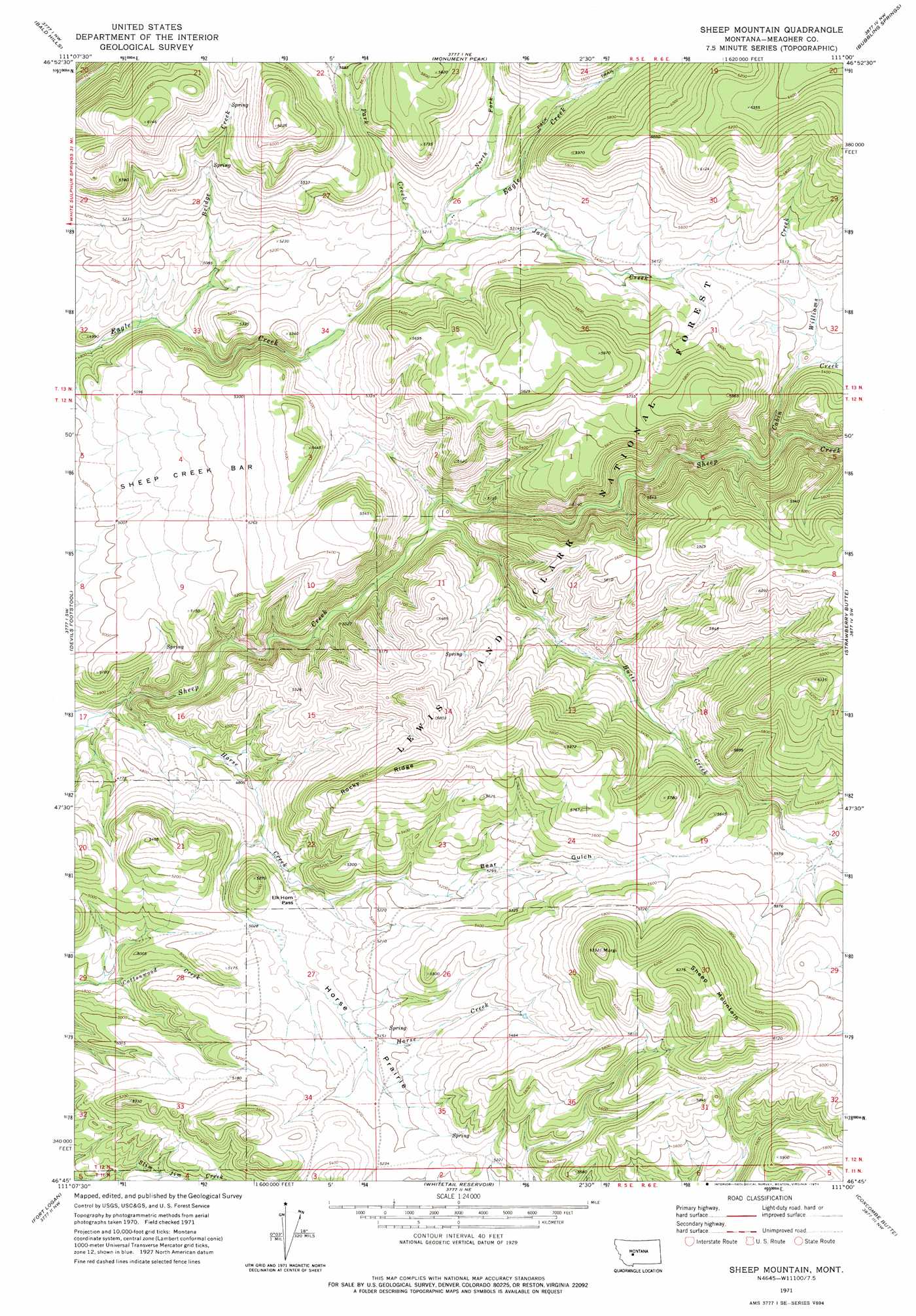
USGS Topo Quad 46111g1 - 1:24,000 scale
| Topo Map Name: | Sheep Mountain |
| USGS Topo Quad ID: | 46111g1 |
| Print Size: | ca. 21 1/4" wide x 27" high |
| Southeast Coordinates: | 46.75° N latitude / 111° W longitude |
| Map Center Coordinates: | 46.8125° N latitude / 111.0625° W longitude |
| U.S. State: | MT |
| Filename: | o46111g1.jpg |
| Download Map JPG Image: | Sheep Mountain topo map 1:24,000 scale |
| Map Type: | Topographic |
| Topo Series: | 7.5´ |
| Map Scale: | 1:24,000 |
| Source of Map Images: | United States Geological Survey (USGS) |
| Alternate Map Versions: |
Sheep Mountain MT 1971, updated 1974 Download PDF Buy paper map Sheep Mountain MT 1995, updated 1997 Download PDF Buy paper map Sheep Mountain MT 2011 Download PDF Buy paper map Sheep Mountain MT 2014 Download PDF Buy paper map |
| FStopo: | US Forest Service topo Sheep Mountain is available: Download FStopo PDF Download FStopo TIF |
1:24,000 Topo Quads surrounding Sheep Mountain
Millegan |
Deep Creek Park |
Blankenbaker Flats |
Thunder Mountain |
Monarch |
Lingshire Ne |
Bald Hills |
Monument Peak |
Bubbling Springs |
Belt Park Butte |
Ellis Canyon |
Devils Footstool |
Sheep Mountain |
Strawberry Butte |
Moose Mountain |
Watson |
Fort Logan |
Whitetail Reservoir |
Coxcombe Butte |
Charcoal Gulch |
Boulder Baldy |
Gipsy Lake |
Hanson Reservoir |
White Sulphur Springs |
Pinchout Creek |
> Back to 46111e1 at 1:100,000 scale
> Back to 46110a1 at 1:250,000 scale
> Back to U.S. Topo Maps home
Sheep Mountain topo map: Gazetteer
Sheep Mountain: Benches
Sheep Creek Bar elevation 1561m 5121′Sheep Mountain: Flats
Horse Prairie elevation 1563m 5127′Sheep Mountain: Gaps
Elk Horn Pass elevation 1540m 5052′Sheep Mountain: Post Offices
Shannon Post Office (historical) elevation 1541m 5055′Sheep Mountain: Ridges
Rocky Ridge elevation 1756m 5761′Sheep Mountain: Streams
Big Butte Creek elevation 1464m 4803′Bridge Creek elevation 1479m 4852′
Cabin Creek elevation 1560m 5118′
Horse Creek elevation 1394m 4573′
Jack Creek elevation 1587m 5206′
North Fork Eagle Creek elevation 1592m 5223′
Park Creek elevation 1578m 5177′
Pole Creek elevation 1569m 5147′
Williams Creek elevation 1610m 5282′
Sheep Mountain: Summits
Sheep Mountain elevation 1943m 6374′Sheep Mountain: Valleys
Bear Gulch elevation 1532m 5026′Sheep Mountain digital topo map on disk
Buy this Sheep Mountain topo map showing relief, roads, GPS coordinates and other geographical features, as a high-resolution digital map file on DVD: