B K Ranch Topo Map Montana
To zoom in, hover over the map of B K Ranch
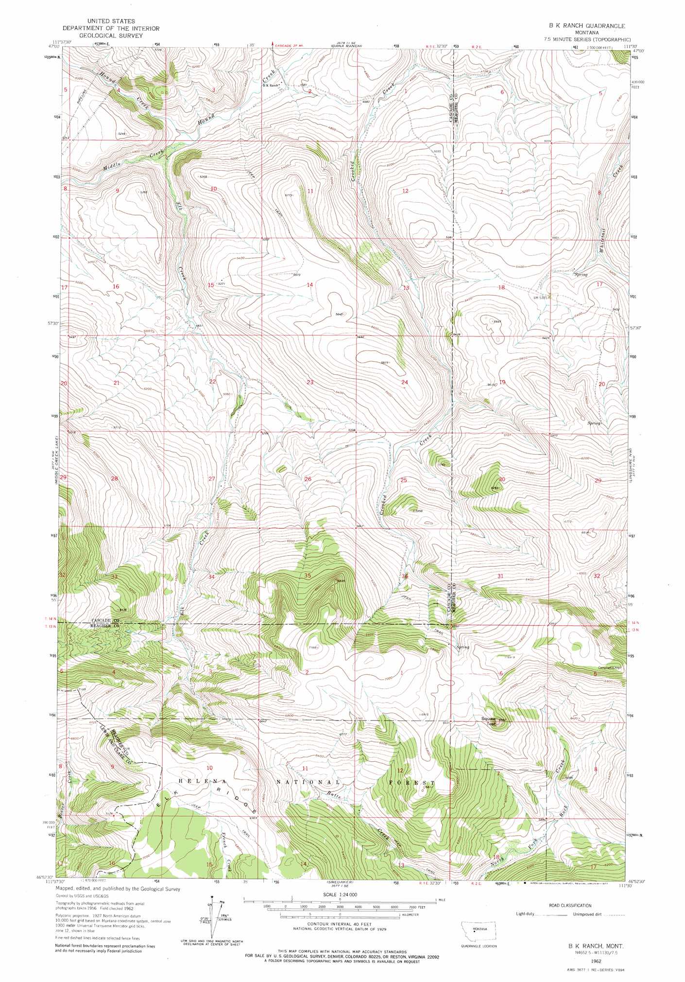
USGS Topo Quad 46111h5 - 1:24,000 scale
| Topo Map Name: | B K Ranch |
| USGS Topo Quad ID: | 46111h5 |
| Print Size: | ca. 21 1/4" wide x 27" high |
| Southeast Coordinates: | 46.875° N latitude / 111.5° W longitude |
| Map Center Coordinates: | 46.9375° N latitude / 111.5625° W longitude |
| U.S. State: | MT |
| Filename: | o46111h5.jpg |
| Download Map JPG Image: | B K Ranch topo map 1:24,000 scale |
| Map Type: | Topographic |
| Topo Series: | 7.5´ |
| Map Scale: | 1:24,000 |
| Source of Map Images: | United States Geological Survey (USGS) |
| Alternate Map Versions: |
B K Ranch MT 1962, updated 1964 Download PDF Buy paper map B K Ranch MT 1962, updated 1977 Download PDF Buy paper map B K Ranch MT 2011 Download PDF Buy paper map B K Ranch MT 2014 Download PDF Buy paper map |
| FStopo: | US Forest Service topo B K Ranch is available: Download FStopo PDF Download FStopo TIF |
1:24,000 Topo Quads surrounding B K Ranch
Hardy |
Rocky Reef |
Schrammeck Lake |
Spanish Coulee School |
Boston Coulee School |
The Sawteeth |
Hound Creek Reservoir |
Dana Ranch |
Conway Ridge |
Millegan |
Candle Mountain |
Middle Creek Lake |
B K Ranch |
Lingshire Nw |
Lingshire Ne |
Nelson |
Hogback Mountain |
Snedaker Basin |
Lingshire |
Ellis Canyon |
Hauser Lake |
Canyon Ferry |
Hellgate Gulch |
Whites City |
Watson |
> Back to 46111e1 at 1:100,000 scale
> Back to 46110a1 at 1:250,000 scale
> Back to U.S. Topo Maps home
B K Ranch topo map: Gazetteer
B K Ranch: Pillars
Mil-mil-teh Hill elevation 2079m 6820′B K Ranch: Post Offices
Wallace Post Office (historical) elevation 1373m 4504′B K Ranch: Ridges
Elk Ridge elevation 2117m 6945′B K Ranch: Streams
East Fork Hound Creek elevation 1395m 4576′Elk Creek elevation 1402m 4599′
Middle Creek elevation 1393m 4570′
B K Ranch digital topo map on disk
Buy this B K Ranch topo map showing relief, roads, GPS coordinates and other geographical features, as a high-resolution digital map file on DVD: