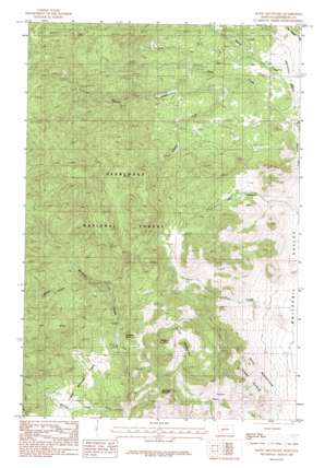
Ratio Mountain Topo Map Montana
To zoom in, hover over the map of Ratio Mountain
USGS Topo Quad 46112a2 - 1:24,000 scale
| Topo Map Name: | Ratio Mountain |
| USGS Topo Quad ID: | 46112a2 |
| Print Size: | ca. 21 1/4" wide x 27" high |
| Southeast Coordinates: | 46° N latitude / 112.125° W longitude |
| Map Center Coordinates: | 46.0625° N latitude / 112.1875° W longitude |
| U.S. State: | MT |
| Filename: | o46112a2.jpg |
| Download Map JPG Image: | Ratio Mountain topo map 1:24,000 scale |
| Map Type: | Topographic |
| Topo Series: | 7.5´ |
| Map Scale: | 1:24,000 |
| Source of Map Images: | United States Geological Survey (USGS) |
| Alternate Map Versions: |
Ratio Mountain MT 1985, updated 1986 Download PDF Buy paper map Ratio Mountain MT 1996, updated 1998 Download PDF Buy paper map Ratio Mountain MT 2011 Download PDF Buy paper map Ratio Mountain MT 2014 Download PDF Buy paper map |
| FStopo: | US Forest Service topo Ratio Mountain is available: Download FStopo PDF Download FStopo TIF |
1:24,000 Topo Quads surrounding Ratio Mountain
> Back to 46112a1 at 1:100,000 scale
> Back to 46112a1 at 1:250,000 scale
> Back to U.S. Topo Maps home
Ratio Mountain topo map: Gazetteer
Ratio Mountain: Flats
Lower Whitetail Park elevation 1715m 5626′Poison Flats elevation 1809m 5935′
Ratio Mountain: Mines
Ajax Mine elevation 1755m 5757′Attowa Mine elevation 1801m 5908′
Beaver Creek Mine elevation 1806m 5925′
Beaver Placer Mine elevation 1800m 5905′
Mountain Queen Mine elevation 1995m 6545′
Mountain Queen Mine elevation 2026m 6646′
NE SW Section 3 Mine elevation 1864m 6115′
NW NW Section 21 Mine elevation 2401m 7877′
Saint Anthony Mine elevation 1839m 6033′
State Mine elevation 2062m 6765′
State Mine elevation 2142m 7027′
Ratio Mountain: Populated Places
Big Foot (historical) elevation 1746m 5728′Ratio Mountain: Springs
Roadside Spring elevation 1794m 5885′Wildhorse Spring elevation 2120m 6955′
Ratio Mountain: Streams
Beaver Creek elevation 1667m 5469′Bigfoot Creek elevation 1556m 5104′
Grouse Creek elevation 1623m 5324′
Shedhorn Creek elevation 1633m 5357′
South Fork State Creek elevation 1652m 5419′
Spring Creek elevation 1883m 6177′
State Creek elevation 1561m 5121′
Ratio Mountain: Summits
Goodwin Mountain elevation 2115m 6938′Ratio Mountain elevation 2187m 7175′
Ratio Mountain: Trails
Upper Whitetail Park Trail elevation 1961m 6433′Ratio Mountain: Valleys
Hay Canyon elevation 1531m 5022′Ratio Mountain digital topo map on disk
Buy this Ratio Mountain topo map showing relief, roads, GPS coordinates and other geographical features, as a high-resolution digital map file on DVD:


