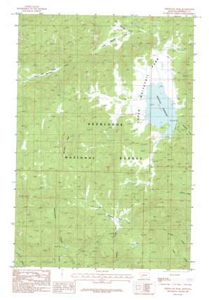
Whitetail Peak Topo Map Montana
To zoom in, hover over the map of Whitetail Peak
USGS Topo Quad 46112a3 - 1:24,000 scale
| Topo Map Name: | Whitetail Peak |
| USGS Topo Quad ID: | 46112a3 |
| Print Size: | ca. 21 1/4" wide x 27" high |
| Southeast Coordinates: | 46° N latitude / 112.25° W longitude |
| Map Center Coordinates: | 46.0625° N latitude / 112.3125° W longitude |
| U.S. State: | MT |
| Filename: | o46112a3.jpg |
| Download Map JPG Image: | Whitetail Peak topo map 1:24,000 scale |
| Map Type: | Topographic |
| Topo Series: | 7.5´ |
| Map Scale: | 1:24,000 |
| Source of Map Images: | United States Geological Survey (USGS) |
| Alternate Map Versions: |
Whitetail Peak MT 1985, updated 1986 Download PDF Buy paper map Whitetail Peak MT 1996, updated 1998 Download PDF Buy paper map Whitetail Peak MT 2011 Download PDF Buy paper map Whitetail Peak MT 2014 Download PDF Buy paper map |
| FStopo: | US Forest Service topo Whitetail Peak is available: Download FStopo PDF Download FStopo TIF |
1:24,000 Topo Quads surrounding Whitetail Peak
> Back to 46112a1 at 1:100,000 scale
> Back to 46112a1 at 1:250,000 scale
> Back to U.S. Topo Maps home
Whitetail Peak topo map: Gazetteer
Whitetail Peak: Dams
Whitetail Dam elevation 2218m 7276′Whitetail Peak: Flats
Bakers Meadows elevation 1988m 6522′Halfway Park elevation 2261m 7417′
Little Boulder Park elevation 2231m 7319′
Lost Park elevation 2305m 7562′
Upper Whitetail Park elevation 2213m 7260′
Whitetail Peak: Forests
Deerlodge National Forest elevation 2263m 7424′Whitetail Peak: Mines
NW NW Section 13 Mine elevation 2233m 7326′SE SE Section 15 Mine elevation 2057m 6748′
SW SW Section 14 Mine elevation 2057m 6748′
Whitetail Peak: Reservoirs
Whitetail Reservoir elevation 2213m 7260′Whitetail Peak: Summits
Whitetail Peak elevation 2546m 8353′Whitetail Peak digital topo map on disk
Buy this Whitetail Peak topo map showing relief, roads, GPS coordinates and other geographical features, as a high-resolution digital map file on DVD:


