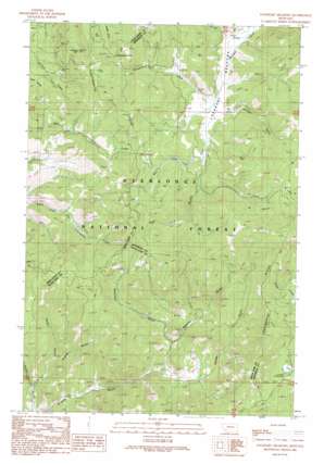
Lockhart Meadows Topo Map Montana
To zoom in, hover over the map of Lockhart Meadows
USGS Topo Quad 46112b5 - 1:24,000 scale
| Topo Map Name: | Lockhart Meadows |
| USGS Topo Quad ID: | 46112b5 |
| Print Size: | ca. 21 1/4" wide x 27" high |
| Southeast Coordinates: | 46.125° N latitude / 112.5° W longitude |
| Map Center Coordinates: | 46.1875° N latitude / 112.5625° W longitude |
| U.S. State: | MT |
| Filename: | o46112b5.jpg |
| Download Map JPG Image: | Lockhart Meadows topo map 1:24,000 scale |
| Map Type: | Topographic |
| Topo Series: | 7.5´ |
| Map Scale: | 1:24,000 |
| Source of Map Images: | United States Geological Survey (USGS) |
| Alternate Map Versions: |
Lockhart Meadows MT 1989, updated 1989 Download PDF Buy paper map Lockhart Meadows MT 1996, updated 1998 Download PDF Buy paper map Lockhart Meadows MT 2011 Download PDF Buy paper map Lockhart Meadows MT 2014 Download PDF Buy paper map |
| FStopo: | US Forest Service topo Lockhart Meadows is available: Download FStopo PDF Download FStopo TIF |
1:24,000 Topo Quads surrounding Lockhart Meadows
> Back to 46112a1 at 1:100,000 scale
> Back to 46112a1 at 1:250,000 scale
> Back to U.S. Topo Maps home
Lockhart Meadows topo map: Gazetteer
Lockhart Meadows: Flats
Lockhart Meadows elevation 1967m 6453′Lockhart Meadows: Gaps
Champion Pass elevation 2124m 6968′Lockhart Meadows: Mines
American Mine elevation 2119m 6952′Champion Mine elevation 1984m 6509′
Champion Mine elevation 1955m 6414′
NW NW Section 32 Mine elevation 2054m 6738′
Ruby Mine elevation 2041m 6696′
Lockhart Meadows: Populated Places
Champion (historical) elevation 1946m 6384′Lockhart Meadows: Post Offices
Champion Post Office (historical) elevation 1946m 6384′Lockhart Post Office (historical) elevation 1984m 6509′
Lockhart Meadows: Streams
Cabin Creek elevation 1957m 6420′Indian Creek elevation 1960m 6430′
Powderhorn Creek elevation 1969m 6459′
South Fork Boulder River elevation 2034m 6673′
West Fork Boulder River elevation 1994m 6541′
Lockhart Meadows: Summits
Gospel Hill elevation 2216m 7270′Lockhart Meadows: Valleys
Alaska Gulch elevation 1845m 6053′American Gulch elevation 1867m 6125′
Flume Gulch elevation 1770m 5807′
Northey Gulch elevation 1976m 6482′
Rocky Canyon elevation 1816m 5958′
Strozzy Gulch elevation 1816m 5958′
Lockhart Meadows digital topo map on disk
Buy this Lockhart Meadows topo map showing relief, roads, GPS coordinates and other geographical features, as a high-resolution digital map file on DVD:


