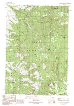
Sugarloaf Mountain Topo Map Montana
To zoom in, hover over the map of Sugarloaf Mountain
USGS Topo Quad 46112c5 - 1:24,000 scale
| Topo Map Name: | Sugarloaf Mountain |
| USGS Topo Quad ID: | 46112c5 |
| Print Size: | ca. 21 1/4" wide x 27" high |
| Southeast Coordinates: | 46.25° N latitude / 112.5° W longitude |
| Map Center Coordinates: | 46.3125° N latitude / 112.5625° W longitude |
| U.S. State: | MT |
| Filename: | o46112c5.jpg |
| Download Map JPG Image: | Sugarloaf Mountain topo map 1:24,000 scale |
| Map Type: | Topographic |
| Topo Series: | 7.5´ |
| Map Scale: | 1:24,000 |
| Source of Map Images: | United States Geological Survey (USGS) |
| Alternate Map Versions: |
Sugarloaf Mountain MT 1989, updated 1989 Download PDF Buy paper map Sugarloaf Mountain MT 1996, updated 1998 Download PDF Buy paper map Sugarloaf Mountain MT 2011 Download PDF Buy paper map Sugarloaf Mountain MT 2014 Download PDF Buy paper map |
| FStopo: | US Forest Service topo Sugarloaf Mountain is available: Download FStopo PDF Download FStopo TIF |
1:24,000 Topo Quads surrounding Sugarloaf Mountain
> Back to 46112a1 at 1:100,000 scale
> Back to 46112a1 at 1:250,000 scale
> Back to U.S. Topo Maps home
Sugarloaf Mountain topo map: Gazetteer
Sugarloaf Mountain: Mines
Jaslowski Mine elevation 2176m 7139′Leadville Mine elevation 2401m 7877′
Sugarloaf Mountain: Populated Places
Leadville elevation 2412m 7913′Sugarloaf Mountain: Springs
Cold Spring elevation 2285m 7496′Sugarloaf Mountain: Streams
Dieders Fork elevation 1844m 6049′Middle Fork Cottonwood Creek elevation 1725m 5659′
North Fork Cottonwood Creek elevation 1647m 5403′
Rock Creek elevation 1929m 6328′
South Fork Cottonwood Creek elevation 1650m 5413′
Spring Creek elevation 1838m 6030′
Spring Creek elevation 1814m 5951′
Sugarloaf Mountain: Summits
Black Mountain elevation 2432m 7979′Blizzard Hill elevation 2328m 7637′
Cliff Mountain elevation 2551m 8369′
Saratoga Mountain elevation 2119m 6952′
Sugarloaf Mountain elevation 2514m 8248′
Sugarloaf Mountain: Tunnels
Schurchs Tunnel elevation 2263m 7424′Sugarloaf Mountain: Valleys
Rocker Gulch elevation 1733m 5685′Sugarloaf Mountain: Wells
07N08W17DA__01 Well elevation 1723m 5652′07N08W21BA__01 Well elevation 1800m 5905′
Sugarloaf Mountain digital topo map on disk
Buy this Sugarloaf Mountain topo map showing relief, roads, GPS coordinates and other geographical features, as a high-resolution digital map file on DVD:


