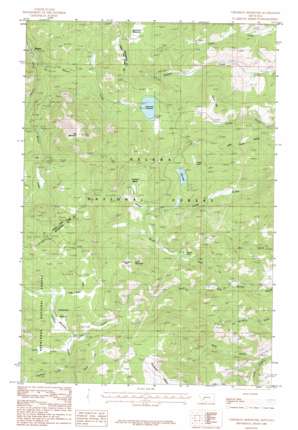
Chessman Reservoir Topo Map Montana
To zoom in, hover over the map of Chessman Reservoir
USGS Topo Quad 46112d2 - 1:24,000 scale
| Topo Map Name: | Chessman Reservoir |
| USGS Topo Quad ID: | 46112d2 |
| Print Size: | ca. 21 1/4" wide x 27" high |
| Southeast Coordinates: | 46.375° N latitude / 112.125° W longitude |
| Map Center Coordinates: | 46.4375° N latitude / 112.1875° W longitude |
| U.S. State: | MT |
| Filename: | o46112d2.jpg |
| Download Map JPG Image: | Chessman Reservoir topo map 1:24,000 scale |
| Map Type: | Topographic |
| Topo Series: | 7.5´ |
| Map Scale: | 1:24,000 |
| Source of Map Images: | United States Geological Survey (USGS) |
| Alternate Map Versions: |
Chessman Reservoir MT 1985, updated 1986 Download PDF Buy paper map Chessman Reservoir MT 2001, updated 2004 Download PDF Buy paper map Chessman Reservoir MT 2011 Download PDF Buy paper map Chessman Reservoir MT 2014 Download PDF Buy paper map |
| FStopo: | US Forest Service topo Chessman Reservoir is available: Download FStopo PDF Download FStopo TIF |
1:24,000 Topo Quads surrounding Chessman Reservoir
> Back to 46112a1 at 1:100,000 scale
> Back to 46112a1 at 1:250,000 scale
> Back to U.S. Topo Maps home
Chessman Reservoir topo map: Gazetteer
Chessman Reservoir: Areas
Gould Diggings elevation 2180m 7152′Chessman Reservoir: Basins
Cataract Basin elevation 2178m 7145′Frohner Basin elevation 2040m 6692′
Chessman Reservoir: Dams
Chessman Main Dam elevation 1897m 6223′Chessman Saddle Dam elevation 1897m 6223′
Chessman Reservoir: Flats
Black Hall Meadows elevation 1925m 6315′Frohner Meadows elevation 2027m 6650′
Horsethief Park elevation 2265m 7431′
Chessman Reservoir: Lakes
Forest Lake elevation 1907m 6256′Quartz Lake elevation 1934m 6345′
Chessman Reservoir: Mines
Alsace Mine elevation 2335m 7660′Argentine Mine elevation 2256m 7401′
Atlanta Mine elevation 2295m 7529′
Belle elevation 1892m 6207′
Black Hawk elevation 2291m 7516′
Bunker Hill elevation 1865m 6118′
Clontart/Carp elevation 1726m 5662′
Conflict elevation 1678m 5505′
Corbitt Mine elevation 2296m 7532′
Crescent Mine elevation 2366m 7762′
Crescent Mine elevation 2373m 7785′
Dalney elevation 1916m 6286′
Delanie Mine elevation 2272m 7454′
Eureka elevation 1893m 6210′
Evergreen - Lower Evergreen Mine elevation 1886m 6187′
Fairview elevation 1883m 6177′
Frohner Mine elevation 2140m 7020′
Frohner Mine elevation 2213m 7260′
Garfield elevation 2390m 7841′
General Grant Mine elevation 2167m 7109′
Green Tree elevation 2167m 7109′
H Grattan elevation 1834m 6017′
Helena elevation 1827m 5994′
Ida May Mine elevation 2299m 7542′
Ida May Mine elevation 2296m 7532′
Jumbo elevation 1776m 5826′
Knight Gwinne elevation 1654m 5426′
Lexington elevation 1922m 6305′
Little Sampson Mine elevation 1809m 5935′
Lone Eagle Mine elevation 1804m 5918′
Lulu elevation 2128m 6981′
Mary Aloys elevation 2310m 7578′
Micawber elevation 1944m 6377′
Morgan Gulch Mine elevation 2017m 6617′
National Extension 79 Mine elevation 2310m 7578′
NE NE Section 28 Mine elevation 2371m 7778′
NE SE Section 4 elevation 2010m 6594′
NE SW Section 34 Mine elevation 1877m 6158′
NE Three Brothers Mine elevation 2365m 7759′
Nellie Grant Mine elevation 2159m 7083′
New Castle elevation 2268m 7440′
North Pacific elevation 1938m 6358′
NW NE Section 16 elevation 2092m 6863′
NW NW Section 34 elevation 1956m 6417′
NW NW Section 9 elevation 1952m 6404′
NW SE S33 elevation 1769m 5803′
NW SE Section 16 elevation 2237m 7339′
NW SW Section 27 Mine elevation 2241m 7352′
NW SW Section 3 Mine elevation 2009m 6591′
Ousley Mine elevation 2291m 7516′
Peerles Jenny elevation 2257m 7404′
Peerless King elevation 2230m 7316′
Peerless Mine elevation 2277m 7470′
Perseverance elevation 2136m 7007′
Pilgrim elevation 2229m 7312′
Queensbury elevation 2204m 7230′
Red Mountain elevation 2089m 6853′
Rob Roy elevation 1950m 6397′
S P Bassett elevation 2223m 7293′
Sallie Bell elevation 2249m 7378′
SE NE Section 28 Mine elevation 2196m 7204′
SE NE Section 33 elevation 1841m 6040′
SE NE Section 4 elevation 1838m 6030′
SE NW Section 30 Mine elevation 1850m 6069′
SE SE Section 10 elevation 2210m 7250′
SE SE Section 21 Mine elevation 2297m 7536′
SE SE Section 3 elevation 1859m 6099′
SE SW Section 2 Mine elevation 2303m 7555′
SE SW Section 9 Mine elevation 2013m 6604′
South Pacific elevation 1913m 6276′
SW SW Section 23 Mine elevation 2087m 6847′
Treasury Number 1 elevation 2297m 7536′
Vandalia Mine elevation 2295m 7529′
W A Alley elevation 1818m 5964′
Chessman Reservoir: Plains
Occidental Plateau elevation 2276m 7467′Chessman Reservoir: Populated Places
Rimini elevation 1611m 5285′Chessman Reservoir: Post Offices
Crescent Post Office (historical) elevation 2016m 6614′Rimini Post Office (historical) elevation 1611m 5285′
Vaughn Post Office (historical) elevation 2392m 7847′
Chessman Reservoir: Reservoirs
Chessman Reservoir elevation 1889m 6197′Chessman Reservoir elevation 1897m 6223′
Park Lake elevation 1942m 6371′
Chessman Reservoir: Streams
Beaver Creek elevation 1602m 5255′Branch Creek elevation 2099m 6886′
Deep Creek elevation 2150m 7053′
Nellie Grant Creek elevation 2183m 7162′
North Fork Quartz Creek elevation 1702m 5583′
Overland Creek elevation 2141m 7024′
South Fork Quartz Creek elevation 1703m 5587′
Trail Creek elevation 2158m 7080′
Chessman Reservoir: Summits
Lava Mountain elevation 2299m 7542′Red Mountain elevation 2482m 8143′
Spruce Hills elevation 1926m 6318′
Chessman Reservoir: Valleys
Kady Gulch elevation 1696m 5564′Chessman Reservoir: Wells
07N04W05CDCD01 Well elevation 1719m 5639′07N04W08BDBB01 Well elevation 1740m 5708′
Chessman Reservoir digital topo map on disk
Buy this Chessman Reservoir topo map showing relief, roads, GPS coordinates and other geographical features, as a high-resolution digital map file on DVD:


