Macdonald Pass Topo Map Montana
To zoom in, hover over the map of Macdonald Pass
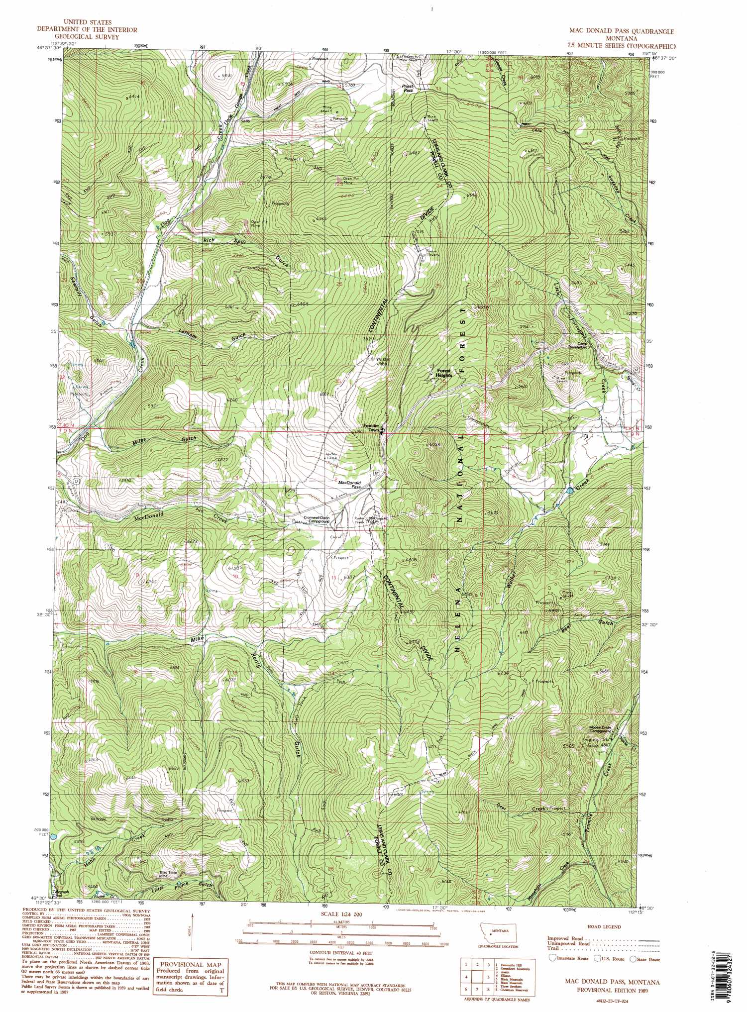
USGS Topo Quad 46112e3 - 1:24,000 scale
| Topo Map Name: | Macdonald Pass |
| USGS Topo Quad ID: | 46112e3 |
| Print Size: | ca. 21 1/4" wide x 27" high |
| Southeast Coordinates: | 46.5° N latitude / 112.25° W longitude |
| Map Center Coordinates: | 46.5625° N latitude / 112.3125° W longitude |
| U.S. State: | MT |
| Filename: | o46112e3.jpg |
| Download Map JPG Image: | Macdonald Pass topo map 1:24,000 scale |
| Map Type: | Topographic |
| Topo Series: | 7.5´ |
| Map Scale: | 1:24,000 |
| Source of Map Images: | United States Geological Survey (USGS) |
| Alternate Map Versions: |
Mac Donald Pass MT 1989, updated 1989 Download PDF Buy paper map Mac Donald Pass MT 1989, updated 1989 Download PDF Buy paper map Macdonald Pass MT 2001, updated 2004 Download PDF Buy paper map MacDonald Pass MT 2011 Download PDF Buy paper map MacDonald Pass MT 2014 Download PDF Buy paper map |
| FStopo: | US Forest Service topo MacDonald Pass is available: Download FStopo PDF Download FStopo TIF |
1:24,000 Topo Quads surrounding Macdonald Pass
Nevada Mountain |
Granite Butte |
Canyon Creek |
Silver City |
Rattlesnake Mountain |
Ophir Creek |
Esmeralda Hill |
Greenhorn Mountain |
Austin |
Scratchgravel Hill |
Avon |
Elliston |
Macdonald Pass |
Black Mountain |
Helena |
Baggs Creek |
Bison Mountain |
Three Brothers |
Chessman Reservoir |
Jefferson City |
Sugarloaf Mountain |
Thunderbolt Creek |
Basin |
Mount Thompson |
Wickes |
> Back to 46112e1 at 1:100,000 scale
> Back to 46112a1 at 1:250,000 scale
> Back to U.S. Topo Maps home
Macdonald Pass topo map: Gazetteer
Macdonald Pass: Gaps
MacDonald Pass elevation 1924m 6312′Priest Pass elevation 1830m 6003′
Macdonald Pass: Mines
Third Term Mine elevation 1802m 5912′Third Term Mine elevation 1759m 5770′
Macdonald Pass: Populated Places
Forest Heights elevation 1889m 6197′Frontier Town elevation 1921m 6302′
Macdonald Pass: Post Offices
Clarkston Post Office (historical) elevation 1529m 5016′Macdonald Pass: Ranges
Boulder Mountains elevation 1858m 6095′Macdonald Pass: Streams
Deer Creek elevation 1511m 4957′Hahn Creek elevation 1637m 5370′
Little Porcupine Creek elevation 1446m 4744′
Minnehaha Creek elevation 1543m 5062′
Moose Creek elevation 1476m 4842′
Uncle George Creek elevation 1644m 5393′
Macdonald Pass: Trails
Bear Gulch Trail elevation 2062m 6765′Macdonald Pass: Valleys
Latham Gulch elevation 1636m 5367′Little Flume Gulch elevation 1720m 5643′
Miles Gulch elevation 1617m 5305′
Rich Spur Gulch elevation 1654m 5426′
Sawmill Gulch elevation 1632m 5354′
Macdonald Pass digital topo map on disk
Buy this Macdonald Pass topo map showing relief, roads, GPS coordinates and other geographical features, as a high-resolution digital map file on DVD: