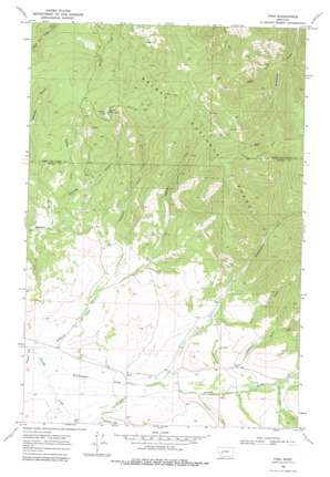
Finn Topo Map Montana
To zoom in, hover over the map of Finn
USGS Topo Quad 46112g6 - 1:24,000 scale
| Topo Map Name: | Finn |
| USGS Topo Quad ID: | 46112g6 |
| Print Size: | ca. 21 1/4" wide x 27" high |
| Southeast Coordinates: | 46.75° N latitude / 112.625° W longitude |
| Map Center Coordinates: | 46.8125° N latitude / 112.6875° W longitude |
| U.S. State: | MT |
| Filename: | o46112g6.jpg |
| Download Map JPG Image: | Finn topo map 1:24,000 scale |
| Map Type: | Topographic |
| Topo Series: | 7.5´ |
| Map Scale: | 1:24,000 |
| Source of Map Images: | United States Geological Survey (USGS) |
| Alternate Map Versions: |
Finn MT 1968, updated 1971 Download PDF Buy paper map Finn MT 1968, updated 1978 Download PDF Buy paper map Finn MT 1968, updated 1978 Download PDF Buy paper map Finn MT 2001, updated 2004 Download PDF Buy paper map Finn MT 2011 Download PDF Buy paper map Finn MT 2014 Download PDF Buy paper map |
| FStopo: | US Forest Service topo Finn is available: Download FStopo PDF Download FStopo TIF |
1:24,000 Topo Quads surrounding Finn
> Back to 46112e1 at 1:100,000 scale
> Back to 46112a1 at 1:250,000 scale
> Back to U.S. Topo Maps home
Finn topo map: Gazetteer
Finn: Airports
Keiley Ranch Strip elevation 1564m 5131′Finn: Dams
Mannix Dam elevation 1614m 5295′Finn: Mines
NE SE Section 30 Mine elevation 1854m 6082′NE SE Section 6 Mine elevation 1587m 5206′
NW SE Section 30 Mine elevation 1760m 5774′
NW SW Section 5 Mine elevation 1551m 5088′
SW NE Section 6 Mine elevation 1786m 5859′
Washington Creek Mine elevation 1883m 6177′
Wiggins Mine elevation 2064m 6771′
Finn: Populated Places
Finn elevation 1475m 4839′Keiley elevation 1490m 4888′
Finn: Post Offices
Finn Post Office (historical) elevation 1475m 4839′Washington Gulch Post Office (historical) elevation 1492m 4895′
Finn: Streams
East Fork Creek elevation 2000m 6561′Finn Creek elevation 1451m 4760′
Gallagher Creek elevation 1427m 4681′
Halfway Creek elevation 1452m 4763′
Jefferson Creek elevation 1427m 4681′
Mitchell Creek elevation 1498m 4914′
Sheldon Creek elevation 1572m 5157′
Shingle Mill Creek elevation 1534m 5032′
Washington Creek elevation 1437m 4714′
Finn: Summits
Dalton Mountain elevation 2063m 6768′Finn: Valleys
American Gulch elevation 1538m 5045′Avon Valley elevation 1426m 4678′
Bear Gulch elevation 1568m 5144′
California Gulch elevation 1496m 4908′
Cow Gulch elevation 1535m 5036′
Madison Gulch elevation 1498m 4914′
Finn: Wells
12N09W21CCBC01 Well elevation 1439m 4721′12N09W25CBCA01 Well elevation 1490m 4888′
12N09W34AAAA01 Well elevation 1464m 4803′
Finn digital topo map on disk
Buy this Finn topo map showing relief, roads, GPS coordinates and other geographical features, as a high-resolution digital map file on DVD:


