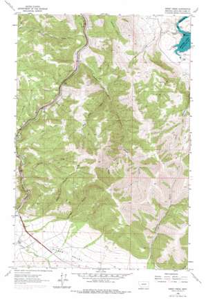
Sheep Creek Topo Map Montana
To zoom in, hover over the map of Sheep Creek
USGS Topo Quad 46112h1 - 1:24,000 scale
| Topo Map Name: | Sheep Creek |
| USGS Topo Quad ID: | 46112h1 |
| Print Size: | ca. 21 1/4" wide x 27" high |
| Southeast Coordinates: | 46.875° N latitude / 112° W longitude |
| Map Center Coordinates: | 46.9375° N latitude / 112.0625° W longitude |
| U.S. State: | MT |
| Filename: | o46112h1.jpg |
| Download Map JPG Image: | Sheep Creek topo map 1:24,000 scale |
| Map Type: | Topographic |
| Topo Series: | 7.5´ |
| Map Scale: | 1:24,000 |
| Source of Map Images: | United States Geological Survey (USGS) |
| Alternate Map Versions: |
Sheep Creek MT 1962, updated 1964 Download PDF Buy paper map Sheep Creek MT 1962, updated 1973 Download PDF Buy paper map Sheep Creek MT 1962, updated 1979 Download PDF Buy paper map Sheep Creek MT 2011 Download PDF Buy paper map Sheep Creek MT 2014 Download PDF Buy paper map |
1:24,000 Topo Quads surrounding Sheep Creek
> Back to 46112e1 at 1:100,000 scale
> Back to 46112a1 at 1:250,000 scale
> Back to U.S. Topo Maps home
Sheep Creek topo map: Gazetteer
Sheep Creek: Airports
Ox Bow Ranch Airport elevation 1108m 3635′Oxbow Landing Strip elevation 1106m 3628′
Sheep Creek: Bridges
Sheep Creek Bridge elevation 1107m 3631′Sheep Creek: Crossings
Interchange 216 elevation 1232m 4041′Interchange 219 elevation 1172m 3845′
Sheep Creek: Dams
Holter Dam elevation 1056m 3464′Sheep Creek: Mines
SE NE Section 10 Mine elevation 1243m 4078′SE SE Section 4 Mine elevation 1272m 4173′
Sheep Creek Mine elevation 1154m 3786′
SW NW Section 14 Mine elevation 1224m 4015′
Sheep Creek: Parks
Central Montana Railroad Historical Marker elevation 1130m 3707′Sheep Creek: Post Offices
Holter Post Office (historical) elevation 1070m 3510′Sheep Creek: Reservoirs
Holter Lake elevation 1070m 3510′Sheep Creek: Streams
Clark Creek elevation 1180m 3871′Little Creek elevation 1097m 3599′
Main Fork Little Creek elevation 1218m 3996′
Middle Fork Little Creek elevation 1231m 4038′
North Fork Little Creek elevation 1217m 3992′
Sheep Creek elevation 1108m 3635′
West Sheep Creek elevation 1187m 3894′
Sheep Creek: Valleys
Bear Gulch elevation 1189m 3900′Levings Gulch elevation 1206m 3956′
Rose Gulch elevation 1329m 4360′
Spring Gulch elevation 1160m 3805′
Sheep Creek digital topo map on disk
Buy this Sheep Creek topo map showing relief, roads, GPS coordinates and other geographical features, as a high-resolution digital map file on DVD:


